Uploads by JoshRRC
Jump to navigation
Jump to search
This special page shows all uploaded files.
| Date | Name | Thumbnail | Size | Description | Versions |
|---|---|---|---|---|---|
| 14:32, 7 July 2025 | Brecon weir aerial-4.jpg (file) |  |
465 KB | 1 | |
| 13:55, 7 July 2025 | Senni-bridge.jpeg (file) |  |
151 KB | 1 | |
| 14:50, 4 July 2025 | Examples-of-large-wood-in-river-tarell.png (file) |  |
2.58 MB | 1 | |
| 13:54, 4 July 2025 | Pont-pantyscallog-on-the-usk-april-2022.jpg (file) |  |
215 KB | 1 | |
| 12:41, 4 July 2025 | 20230920 143251.jpg (file) |  |
4.69 MB | 1 | |
| 10:49, 4 July 2025 | Chester-weir.jpg (file) |  |
71 KB | 1 | |
| 10:17, 4 July 2025 | Erbistock 1.jpg (file) |  |
628 KB | 1 | |
| 09:18, 4 July 2025 | Dee-project-image.jpg (file) |  |
75 KB | 1 | |
| 13:37, 27 July 2016 | Stapleford post.JPG (file) |  |
1.16 MB | Stapleford - post works | 1 |
| 13:36, 27 July 2016 | Burcombe post.JPG (file) |  |
1.26 MB | Burcombe - post works | 1 |
| 10:31, 15 July 2016 | 24-07-12 East Chisenbury - General Avon photo.jpg (file) |  |
320 KB | East Chisenbury | 1 |
| 10:19, 15 July 2016 | 20150319 Project Record WCSP West Amesbury 2013.pdf (file) | 366 KB | Project Summary | 1 | |
| 10:13, 15 July 2016 | 20150318 Project Record WCSP Fifield 2013.pdf (file) | 639 KB | Project Summary | 1 | |
| 09:59, 15 July 2016 | AVON13 A91a LongstreetPR after.jpg (file) |  |
38 KB | Impoundment - After | 1 |
| 09:59, 15 July 2016 | AVON13 A91a LongstreetPR before.jpg (file) |  |
33 KB | Impoundment - Before | 1 |
| 09:57, 15 July 2016 | AVON13 A91a LongstreetPR overview.jpg (file) |  |
39 KB | 1 | |
| 09:55, 15 July 2016 | AVON13 A91a Longstreet PR.pdf (file) | 419 KB | Project summary | 1 | |
| 12:12, 23 July 2015 | DunstonBeck1.JPG (file) |  |
219 KB | 1 | |
| 12:10, 23 July 2015 | Dunston Beck.JPG (file) | 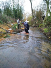 |
220 KB | 1 | |
| 09:24, 10 July 2015 | Photos Rother 1.jpg (file) |  |
74 KB | 1 | |
| 09:17, 10 July 2015 | Pensthorpe1.jpg (file) |  |
129 KB | A stretch of the river pre-restoration | 1 |
| 09:16, 10 July 2015 | Pensthorpe2.jpg (file) | 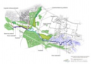 |
145 KB | 1 | |
| 09:11, 10 July 2015 | Dunn.jpg (file) | 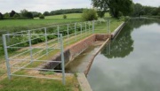 |
142 KB | 1 | |
| 09:04, 10 July 2015 | C GoatbridgeProjectDescription.jpg (file) | 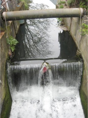 |
125 KB | 1 | |
| 08:56, 10 July 2015 | Kirklees.png (file) | 125 KB | 1 | ||
| 08:44, 10 July 2015 | Map of the Lower Lee Valley showing Diffuse Pollution Project sites.jpg (file) |  |
506 KB | Map of the Lower Lee Valley showing Diffuse Pollution Project Sites | 1 |
| 08:43, 10 July 2015 | Salmons brook.jpg (file) | 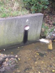 |
45 KB | One of the many points at which pollution was entering the channel | 1 |
| 08:31, 10 July 2015 | Town Mill fish migration phase two.jpg (file) |  |
335 KB | 1 | |
| 08:19, 10 July 2015 | Loweswater.jpg (file) | 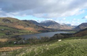 |
138 KB | 1 | |
| 15:13, 9 July 2015 | Chase Nature Reserve.jpg (file) | 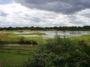 |
104 KB | 1 | |
| 16:12, 8 July 2015 | Tarff Creamery Weir BEFORE.JPG (file) | 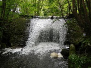 |
188 KB | 1 | |
| 15:00, 1 June 2015 | Landuseag.jpg (file) |  |
111 KB | Agriculture is the main land use in the sub basin | 1 |
| 14:58, 1 June 2015 | Landuseagricult.1.jpg (file) |  |
1.11 MB | Agriculture is the main landuse in the sub basin | 1 |
| 09:35, 14 May 2015 | Knepp0257.jpg (file) | 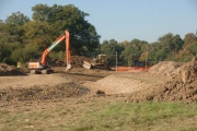 |
55 KB | River restoration in progress | 1 |
| 09:34, 14 May 2015 | Knepp0013.jpg (file) | 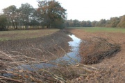 |
53 KB | Completed works with LWD | 1 |
| 09:34, 14 May 2015 | Knepp0132.jpg (file) | 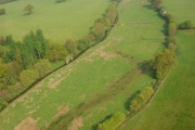 |
39 KB | Pre-works – canelised river with former meanders visible in floodplain | 1 |
| 09:33, 14 May 2015 | Knepp3707.jpg (file) | 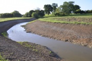 |
53 KB | Completed works | 1 |
| 10:05, 17 April 2015 | View from the tree platform.JPG (file) |  |
4.59 MB | 1 | |
| 10:06, 20 November 2014 | 2012-08-24 10.01.2811.png (file) |  |
4.04 MB | 1 | |
| 10:04, 20 November 2014 | 2012-08-24 10.01.281.jpg (file) |  |
838 KB | 1 | |
| 10:03, 20 November 2014 | 2012-08-24 10.01.28.jpg (file) |  |
596 KB | 1 | |
| 09:56, 20 November 2014 | Turiariver.1.png (file) |  |
1.03 MB | 1 | |
| 09:54, 20 November 2014 | Turiariver1.png (file) |  |
1.03 MB | 1 | |
| 09:53, 20 November 2014 | Turiariver.png (file) |  |
1.24 MB | 1 | |
| 09:31, 20 November 2014 | Harrowlodgepark.png (file) |  |
615 KB | 1 | |
| 15:44, 19 November 2014 | 820703 481555245234871 1655787606 o.jpg (file) |  |
149 KB | 1 | |
| 15:23, 19 November 2014 | Riverpark.2.png (file) | 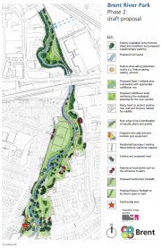 |
547 KB | 1 | |
| 15:21, 19 November 2014 | Riverpark.1.png (file) | 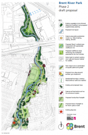 |
573 KB | 1 | |
| 15:21, 19 November 2014 | Brentriverpark4.png (file) | 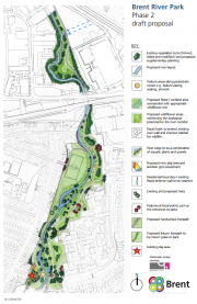 |
573 KB | 1 | |
| 15:19, 19 November 2014 | Brentriverpark2.png (file) |  |
573 KB | 1 |