Case study:Upper River Witham : Easton
This case study is pending approval by a RiverWiki administrator.
Project overview
| Status | Complete |
|---|---|
| Project web site | |
| Themes | Habitat and biodiversity |
| Country | England |
| Main contact forename | Matt |
| Main contact surname | Parr |
| Main contact user ID | |
| Contact organisation | Environment Agency |
| Contact organisation web site | http://www.gov.uk/government/organisations/environment-agency |
| Partner organisations | |
| Parent multi-site project | |
| This is a parent project encompassing the following projects |
No |
Project summary
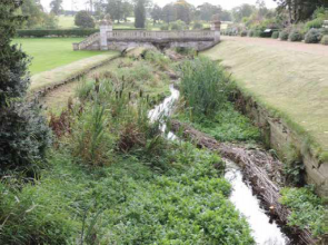
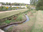
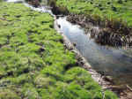
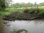
Weir removal to restore bed gradient; channel narrowing and flow deflection to create flow variation and beneficial bed scour using log flow deflectors (vanes), open and enclosed log/faggot and brushwood mattresses (silt-traps) and earth, turf and silt filled log- or faggot-fronted enclosures; creation of sections of 2-stage channel and enhancing marginal wetland habitat by reprofiling eroded banks; excavation of pools in the river bed; increasing in-stream woody habitat by securing existing deadwood and hinging and pinning (layering) live riverside trees; and fencing to prevent bank erosion by livestock.
Project Objectives The pre-project surveys and assessments led to the identification of the following objectives for the enhancement scheme:
Reduce the impact of sediment inputs as a result of erosion caused by livestock.
Repair eroded banks and protect them from erosion in the future.
Trap sediment already in the system.
Improve flows and natural cleansing of spawning gravels.
Improve light levels in over-shaded sections.
Improve habitat for trout, coarse fish and native white-clawed crayfish.
Ensure that historic features within the Grade II Listed Historic Park and Garden are protected.
Three separate schemes based on these objectives were prepared.
Monitoring surveys and results
In addition to the established annual fish monitoring programme downstream of Easton Walled Garden and invertebrate sampling at Easton Lane Bridge, visual inspections of the enhanced reach will be undertaken, and the fixed point photographic record will be updated to monitor the integrity and performance of the in-stream enhancements and record any changes they are making to river morphology. Post-works redd (trout spawning nest) surveys were undertaken upstream and downstream of Easton Lane. 6 redds were located in the upstream (Easton Park) section, but none were located downstream. These surveys provide a baseline for future monitoring.
Lessons learnt
1. The greatest detrimental impact upon river habitat is the legacy of past channel engineering. Straightening and widening of the channel and lowering of the river bed have disrupted/destroyed the natural pool-riffle sequence and disconnected the floodplain. The process of the river recovering these natural characteristics is very slow (centuries) because of the naturally low energy of the river and limited supply of coarse sediment.
2. Habitat improvement measures within the existing channel have generally been unsuccessful. Installed in-stream structures have not had the desired effect of creating scour and producing depth variation. This is because of the resistant nature of the predominantly clay substrate, loss of sediment (gravel) to historic channel engineering and lack of sediment (gravel) supply/retention within the present channel dimensions. Introduced brushwood and large woody material have improved cover and fish-holding habitat, but have not fundamentally changed the channel shape.
3. The weir removal at Easton has restored fish passage and better habitat to the formerly impounded reach upstream, although the above constraints (point 1) remain. Trout numbers observed in this reach indicate a recovery from past pollution incidents.
Image gallery
|
Catchment and subcatchmentSelect a catchment/subcatchment
Catchment
Subcatchment
Other case studies in this subcatchment: Aubourn Rock Ramp and Habitat Works, Belton Floodplain Reconnection and River Restoration, Dysart Park, Grantham Habitat Improvement, Grantham Blue Green - Urban Reach, Little Ponton, Manthorpe Floodplain Reconnection, Papermill Weir Section in-channel restoration, River Witham Great Ponton, Stainby Road, Colsterworth, Syston and Barkston Restoration... further results
Site
Project background
Cost for project phases
Reasons for river restoration
Measures
MonitoringHydromorphological quality elements
Biological quality elements
Physico-chemical quality elements
Any other monitoring, e.g. social, economic
Monitoring documents
Additional documents and videos
Additional links and references
Supplementary InformationEdit Supplementary Information
| ||||||||||||||||||||||||||||||||||||||||||||||||||||||||||||||||||||||||||||||||||||||||||||||||||||||||||||||||||||||||||||||||||||||||||||||||||||||||||||||||||||||||||||||||||||||||||||||||||||||||


