Case study:River Witham Great Ponton: Difference between revisions
Dhutchinson (talk | contribs) No edit summary |
Dhutchinson (talk | contribs) No edit summary |
||
| Line 51: | Line 51: | ||
{{Toggle content start}} | {{Toggle content start}} | ||
{{Case study subcatchment | {{Case study subcatchment | ||
|Subcatchment= | |Subcatchment=Upper Witham | ||
}} | }} | ||
{{Site | {{Site | ||
Revision as of 12:04, 27 February 2024
This case study is pending approval by a RiverWiki administrator.
Project overview
| Status | Complete |
|---|---|
| Project web site | |
| Themes | Habitat and biodiversity |
| Country | England |
| Main contact forename | Matt |
| Main contact surname | Parr |
| Main contact user ID | |
| Contact organisation | Environment Agency |
| Contact organisation web site | http://www.gov.uk/government/organisations/environment-agency |
| Partner organisations | Wild Trout Trust and Grantham Angling Association Fly Fishing Section |
| Parent multi-site project | |
| This is a parent project encompassing the following projects |
No |
Project summary
Channel narrowing and flow deflection to create flow variation and beneficial bed scour using a variety of techniques: log flow deflectors (vanes), open and enclosed log/faggot and brushwood mattresses (silt-traps); increasing in-stream woody habitat by securing existing deadwood and hinging and pinning (layering) live riverside trees; creation of sections of 2-stage channel and enhancing marginal wetland habitat by excavating of bays/berms; and the reduction of sediment inputs by ford refurbishment and riverside fencing. The final phase involved major works to restore a section of the river to a more natural planform.
Project Objectives The initial downstream phases were primarily designed to
Stabilise eroding river banks to reduce sediment inputs caused by fluvial processes and livestock.
Trap mobile fine sediments already in the river.
Improve conveyance during higher flows and reduce flood risk.
Improve in-stream habitats for fish and invertebrates, including white-clawed crayfish.
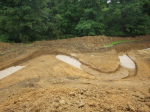
The final phase, at Grange Farm, set out to restore a degraded section of the river to its original course, such that the naturalised section of river would function in an ecologically and geomorphologically improved form.
Monitoring surveys and results
For all phases, visual inspections and regular fixed-point photographs are being undertaken to monitor the integrity and performance of the enhancement works and record any changes they are making to river morphology. Specific to Phase 2, modifications to the channel profile as a result of the woody material introduction upstream of Dunkirk Cottage can be determined by comparison with a baseline cross-section in this location and the effects on turbidity and invertebrate populations will also be monitored here. For phase 3, in addition to an annual redd (trout spawning “nest”) survey of the new riffles, the established annual fish monitoring downstream of Easton Walled Garden and invertebrate sampling at Easton Lane Bridge will be used to detect any changes as a result of the works.
Lessons learnt
The importance of gravel and floodplain connectivity to drive significant change. Need for wood in by-pass channel. Where the constraints have been addressed by realigning and re-naturalising the channel at Grange Farm, habitat improvement has been more successful, although further intervention is required. Introduced gravel has been displaced in high flows and needs to be replaced with larger calibre material which will remain stable and restore the designed pool-riffle sequence. The abrupt change in valley floor gradient at this site constrained the design of the new channel and caused this situation; this is unusual and should not be a deterrent to similar river restoration schemes elsewhere.
Image gallery
|
Catchment and subcatchmentSelect a catchment/subcatchment
Catchment
Subcatchment
Other case studies in this subcatchment: Aubourn Rock Ramp and Habitat Works, Belton Floodplain Reconnection and River Restoration, Dysart Park, Grantham Habitat Improvement, Grantham Blue Green - Urban Reach, Little Ponton, Manthorpe Floodplain Reconnection, Papermill Weir Section in-channel restoration, Stainby Road, Colsterworth, Syston and Barkston Restoration, Upper Cringle Floodplain Restoration Project... further results
Site
Project background
Cost for project phases
Reasons for river restoration
Measures
MonitoringHydromorphological quality elements
Biological quality elements
Physico-chemical quality elements
Any other monitoring, e.g. social, economic
Monitoring documents
Additional documents and videos
Additional links and references
Supplementary InformationEdit Supplementary Information
| ||||||||||||||||||||||||||||||||||||||||||||||||||||||||||||||||||||||||||||||||||||||||||||||||||||||||||||||||||||||||||||||||||||||||||||||||||||||||||||||||||||||||||||||||||||||||||||||||||||||||


