Case study:Cuckolds Haven Nature Area: Difference between revisions
Jump to navigation
Jump to search
No edit summary |
No edit summary |
||
| (9 intermediate revisions by 4 users not shown) | |||
| Line 1: | Line 1: | ||
{{Case study status | {{Case study status | ||
|Approval status= | |Approval status=Approved | ||
}} | }} | ||
{{Location | {{Location | ||
| Line 7: | Line 7: | ||
{{Project overview | {{Project overview | ||
|Status=Complete | |Status=Complete | ||
|Themes=Habitat and biodiversity, Social benefits | |Themes=Habitat and biodiversity, Social benefits, Urban | ||
|Country=England | |Country=England | ||
|Main contact forename=Toni | |Main contact forename=Toni | ||
| Line 20: | Line 20: | ||
|Project summary='''Previous site use/issues''' | |Project summary='''Previous site use/issues''' | ||
* Nature area owned by LB Newham (little known/used by local people) | |||
* No access for wheelchairs | |||
* Limited access points adding to ‘fear of crime’ | |||
* Ecologically and historically valuable site but no information for site users reed buting have been seen in the reeds adjacent to the site | |||
* Lack of seating areas within site for users/local school groups | |||
|Monitoring surveys and results='''Enhancements''' | |||
'''Enhancements''' | |||
* Enhanced planting within site including black poplars | |||
* Creation of riverside seating/viewing area | |||
* Provision of site wildlife and historical information boards | |||
* New wheelchair friendly site entrance and access route | |||
* Interpretation boards installed by just ecology | |||
}} | |||
{{Image gallery}} | |||
{{Case study image | |||
|File name=History final.pdf | |||
|Caption=History information panel | |||
}} | |||
{{Image gallery end}} | |||
{{Toggle button}} | |||
{{Toggle content start}} | |||
{{Case study subcatchment | |||
|Subcatchment=THAMES MIDDLE | |||
}} | }} | ||
{{Site | {{Site | ||
|Name=Cuckold's Haven | |Name=Cuckold's Haven | ||
|WFD water body code=GB530603911402 | |||
|WFD (national) typology=Intertidal, | |WFD (national) typology=Intertidal, | ||
|WFD water body name=THAMES MIDDLE | |||
|Heavily modified water body=Yes | |Heavily modified water body=Yes | ||
|Protected species present=No | |Protected species present=No | ||
| Line 65: | Line 69: | ||
}} | }} | ||
{{Measures | {{Measures | ||
|Floodplain / River corridor=Riparian | |Floodplain / River corridor=Riparian planting, | ||
|Social measures= | |Social measures=Viewing platform, Wheelchair access, Interpretation boards | ||
}} | }} | ||
{{Hydromorphological quality elements header}} | {{Hydromorphological quality elements header}} | ||
| Line 78: | Line 82: | ||
{{Monitoring documents}} | {{Monitoring documents}} | ||
{{Monitoring documents end}} | {{Monitoring documents end}} | ||
{{Additional Documents}} | {{Additional Documents}} | ||
{{Case study documents | {{Case study documents | ||
| Line 92: | Line 90: | ||
{{Additional links and references footer}} | {{Additional links and references footer}} | ||
{{Supplementary Information}} | {{Supplementary Information}} | ||
{{Toggle content end}} | |||
Latest revision as of 08:35, 6 June 2017
Location: 51° 31' 44.86" N, 0° 4' 34.14" E
Left click to look around in the map, and use the wheel of your mouse to zoom in and out.
Project overview
| Status | Complete |
|---|---|
| Project web site | |
| Themes | Habitat and biodiversity, Social benefits, Urban |
| Country | England |
| Main contact forename | Toni |
| Main contact surname | Scarr |
| Main contact user ID | User:Ascarr |
| Contact organisation | Environment Agency |
| Contact organisation web site | http://www.environment-agency.gov.uk |
| Partner organisations | |
| Parent multi-site project | |
| This is a parent project encompassing the following projects |
No |
Project summary
Edit project overview to modify the project summary.
Previous site use/issues
- Nature area owned by LB Newham (little known/used by local people)
- No access for wheelchairs
- Limited access points adding to ‘fear of crime’
- Ecologically and historically valuable site but no information for site users reed buting have been seen in the reeds adjacent to the site
- Lack of seating areas within site for users/local school groups
Monitoring surveys and results
Edit project overview to modify the Monitoring survey and results.
Enhancements
- Enhanced planting within site including black poplars
- Creation of riverside seating/viewing area
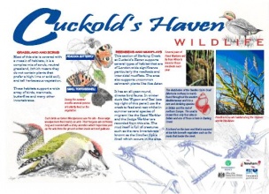
- Provision of site wildlife and historical information boards
- New wheelchair friendly site entrance and access route
- Interpretation boards installed by just ecology
Lessons learnt
This case study hasn’t got any lessons learnt, you can add some by editing the project overview.
Image gallery
|
Catchment and subcatchmentSelect a catchment/subcatchment
Catchment
Subcatchment
Other case studies in this subcatchment: Barking Creek near A13, Barking Creekmouth, Chambers Wharf, Greenwich Peninsula, Lower River Roding Regeneration Project, Mill Pool, Saving Chiswick Eyot, Wandsworth Riverside Quarter
Site
Project background
Cost for project phases
Reasons for river restoration
Measures
MonitoringHydromorphological quality elements
Biological quality elements
Physico-chemical quality elements
Any other monitoring, e.g. social, economic
Monitoring documents
Additional documents and videos
Additional links and references
Supplementary InformationEdit Supplementary Information
| ||||||||||||||||||||||||||||||||||||||||||||||||||||||||||||||||||||||||||||||||||||||||||||||||||||||||||||||||||||||||||||||||||||||||||||||||||||||||||||||||||||||||||||||||||||||||||||||||||||||||

