Case study:Barking Creek near A13: Difference between revisions
Jump to navigation
Jump to search
No edit summary |
|||
| (10 intermediate revisions by 5 users not shown) | |||
| Line 1: | Line 1: | ||
{{Project overview | {{Project overview | ||
|Status=Complete | |Status=Complete | ||
|Themes=Habitat and biodiversity, Social benefits | |Themes=Estuary, Flood risk management, Habitat and biodiversity, Hydromorphology, Social benefits, Urban | ||
|Country=England | |Country=England | ||
|Main contact forename=Toni | |Main contact forename=Toni | ||
| Line 20: | Line 14: | ||
|Project summary='''Previous site use/issues''' | |Project summary='''Previous site use/issues''' | ||
* Terrestrial habitat with rank grassland and species poor scrubland. | |||
* Plot of adjacent to Barking Creek, accessible by informal and underused riverside footpath. | |||
* Blind spots within site (formed by sections of redundant fencing) lead to a raised ‘fear of crime’. | |||
* Riverside footpath not suitable for wheelchairs. | |||
* Concrete flood defence in poor condition needing replacing. | |||
'''Enhancements''' | '''Enhancements''' | ||
* Retreat and renewal of flood defences adapting to climate change by creating increased flood storage capacity and improved riverside and intertidal habitat. Reed bunting and sand martins have been seen in this area. | |||
* Sand martin nesting tubes. | |||
* Improved footpath, suitable for wheelchairs. | |||
* Blind spots remove and the site opened up although reeds allowed establish to help protect the wildlife on the river. | |||
}} | |||
{{Case study status | |||
|Approval status=Approved | |||
}} | |||
{{Location | |||
|Location=51.52804712139871, 0.08050616862794868 | |||
}} | |||
{{Image gallery}} | |||
{{Case study image | |||
|File name=Barking - A3.png | |||
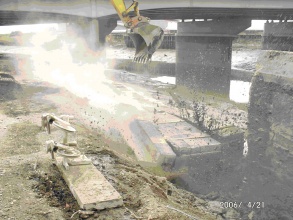
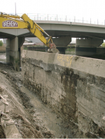
|Caption=During construction | |||
}} | |||
{{Case study image | |||
|File name=Barking - A3 post.png | |||
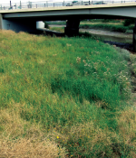
|Caption=Post project | |||
}} | |||
{{Image gallery end}} | |||
{{Toggle button}} | |||
{{Toggle content start}} | |||
{{Case study subcatchment | |||
|Subcatchment=THAMES MIDDLE | |||
}} | }} | ||
{{Site | {{Site | ||
|Name=Barking Creek near the A13 | |Name=Barking Creek near the A13 | ||
|WFD (national) typology=intertidal, | |WFD water body code=GB530603911402 | ||
|Pre-project morphology=Estuary (tidal), | |WFD (national) typology=intertidal, | ||
|WFD water body name=THAMES MIDDLE | |||
|Pre-project morphology=Estuary (tidal), | |||
|Heavily modified water body=Yes | |Heavily modified water body=Yes | ||
|Protected species present=No | |Protected species present=No | ||
|Invasive species present=No | |Invasive species present=No | ||
|Dominant hydrology=Tidal, | |Species=Japanese knotweed (Fallopia japonica), sea bass (Dicentrarchus labrax), European eel (Anguilla anguilla), flounder, teal, shelduck, wigeon, gadwell, shoveler, pintail, duck (Anas sp.), oyster catchers | ||
|Dominant hydrology=Tidal, | |||
|Dominant substrate=Estuarine mud, | |||
|River corridor land use=Urban, | |||
}} | }} | ||
{{Project background | {{Project background | ||
| Line 66: | Line 78: | ||
|Bank and bed modifications measure=retreat and renewal of folld defences, construction of new intertidal area | |Bank and bed modifications measure=retreat and renewal of folld defences, construction of new intertidal area | ||
|Floodplain / River corridor=New footpaths, sand martin nesting tubes | |Floodplain / River corridor=New footpaths, sand martin nesting tubes | ||
|Social measures= | |Social measures=Wheelchair access | ||
}} | }} | ||
{{Hydromorphological quality elements header}} | {{Hydromorphological quality elements header}} | ||
| Line 77: | Line 89: | ||
{{End table}} | {{End table}} | ||
{{Monitoring documents}} | {{Monitoring documents}} | ||
{{Case study monitoring documents | |||
|Monitoring document=BARKING CREEK- FINAL MSc PROJECT.pdf | |||
|Description=MSc project - Fish Utilisation of restored intertidal habitats in a tidal backwater of the Thames estuary | |||
}} | |||
{{Monitoring documents end}} | {{Monitoring documents end}} | ||
{{Additional Documents}} | {{Additional Documents}} | ||
{{Case study documents | {{Case study documents | ||
| Line 97: | Line 103: | ||
{{Additional links and references footer}} | {{Additional links and references footer}} | ||
{{Supplementary Information}} | {{Supplementary Information}} | ||
{{Toggle content end}} | |||
Latest revision as of 13:42, 16 September 2024
Project overview
| Status | Complete |
|---|---|
| Project web site | |
| Themes | Estuary, Flood risk management, Habitat and biodiversity, Hydromorphology, Social benefits, Urban |
| Country | England |
| Main contact forename | Toni |
| Main contact surname | Scarr |
| Main contact user ID | User:Ascarr |
| Contact organisation | Environment Agency |
| Contact organisation web site | http://www.environment-agency.gov.uk |
| Partner organisations | |
| Parent multi-site project | |
| This is a parent project encompassing the following projects |
No |
Project summary
Edit project overview to modify the project summary.
Previous site use/issues
- Terrestrial habitat with rank grassland and species poor scrubland.
- Plot of adjacent to Barking Creek, accessible by informal and underused riverside footpath.
- Blind spots within site (formed by sections of redundant fencing) lead to a raised ‘fear of crime’.
- Riverside footpath not suitable for wheelchairs.
- Concrete flood defence in poor condition needing replacing.
Enhancements
- Retreat and renewal of flood defences adapting to climate change by creating increased flood storage capacity and improved riverside and intertidal habitat. Reed bunting and sand martins have been seen in this area.
- Sand martin nesting tubes.
- Improved footpath, suitable for wheelchairs.
- Blind spots remove and the site opened up although reeds allowed establish to help protect the wildlife on the river.
Monitoring surveys and results
This case study hasn’t got any Monitoring survey and results, you can add some by editing the project overview.
Lessons learnt
This case study hasn’t got any lessons learnt, you can add some by editing the project overview.
Location: 51° 31' 40.97" N, 0° 4' 49.82" E
Left click to look around in the map, and use the wheel of your mouse to zoom in and out.
Image gallery
|
Catchment and subcatchmentSelect a catchment/subcatchment
Catchment
Subcatchment
Other case studies in this subcatchment: Barking Creekmouth, Chambers Wharf, Cuckolds Haven Nature Area, Greenwich Peninsula, Lower River Roding Regeneration Project, Mill Pool, Saving Chiswick Eyot, Wandsworth Riverside Quarter
Site
Project background
Cost for project phases
Reasons for river restoration
Measures
MonitoringHydromorphological quality elements
Biological quality elements
Physico-chemical quality elements
Any other monitoring, e.g. social, economic
Monitoring documents
Additional documents and videos
Additional links and references
Supplementary InformationEdit Supplementary Information
| ||||||||||||||||||||||||||||||||||||||||||||||||||||||||||||||||||||||||||||||||||||||||||||||||||||||||||||||||||||||||||||||||||||||||||||||||||||||||||||||||||||||||||||||||||||||||||||||


