Case study:Wensum River Restoration and Floodplain Enhancement: Difference between revisions
No edit summary |
No edit summary |
||
| (3 intermediate revisions by 2 users not shown) | |||
| Line 1: | Line 1: | ||
{{ | {{Case study status | ||
|Approval status= | |Approval status=Approved | ||
}} | }} | ||
{{Location | {{Location | ||
| Line 36: | Line 29: | ||
}} | }} | ||
{{Site | {{Site | ||
|WFD water body code=GB105034055881 | |||
|WFD water body name=Wensum US Norwich | |||
|Heavily modified water body=No | |||
|Protected species present=No | |||
|WFD water body code= | |Invasive species present=No | ||
|WFD water body name= | |||
|Heavily modified water body= | |||
|Protected species present= | |||
|Invasive species present= | |||
}} | }} | ||
{{Project background | {{Project background | ||
| Line 106: | Line 56: | ||
{{Measures | {{Measures | ||
|Bank and bed modifications measure=habitat improvements | |Bank and bed modifications measure=habitat improvements | ||
|Floodplain / River corridor=Floodplain reconnection | |Floodplain / River corridor=Floodplain reconnection, Reedbed creation, Creation of wetland, | ||
|Social measures=Community involvement | |Social measures=Community involvement | ||
}} | }} | ||
Latest revision as of 09:41, 1 June 2017
Project overview
| Status | In progress |
|---|---|
| Project web site | |
| Themes | Fisheries, Social benefits, Water quality |
| Country | England |
| Main contact forename | Tim |
| Main contact surname | Nevard |
| Main contact user ID | |
| Contact organisation | Pensthorpe Conservation Trust Ltd |
| Contact organisation web site | |
| Partner organisations | |
| Parent multi-site project | |
| This is a parent project encompassing the following projects |
No |
Project summary
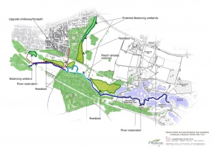
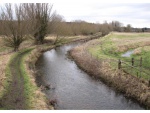
Once the project is complete, approximately 2.5km of the River Wensum flowing through Pensthorpe will have restored ecological and hydrological functionality and provide habitats for a range of key chalk river species such as brown trout, white-clawed crayfish, Desmoulin’s whorl snail and water crowfoot. In addition to this, the adjoining floodplain will have significantly enhanced connectivity to the river and diffuse pollution from both Fakenham and adjoining agricultural land will have been mitigated.
Monitoring surveys and results
Lessons learnt
Image gallery
|
Catchment and subcatchmentSelect a catchment/subcatchment
Catchment
Subcatchment
Other case studies in this subcatchment: Great Ryburgh End Restoration Scheme, Meander reinstatement on the River Wensum at the Ryburgh Loop, River Wensum Restoration, Reach 10 Lenwade, River Wensum Restoration, Reach 3a Costessey, River Wensum Restoration, Reach 9 Attlebridge, River rehabilitation on the River Wensum at Swanton Morley, Sculthorpe Moor Restoration Scheme, Wensum River Restoration and Floodplain Enhancement, Pensthorpe
Site
Project background
Cost for project phases
Reasons for river restoration
Measures
MonitoringHydromorphological quality elements
Biological quality elements
Physico-chemical quality elements
Any other monitoring, e.g. social, economic
Monitoring documents
Additional documents and videos
Additional links and references
Supplementary InformationEdit Supplementary Information
| ||||||||||||||||||||||||||||||||||||||||||||||||||||||||||||||||||||||||||||||||||||||||||||||||||||||||||||||||||||||||||||||||||||||||||||||||||||||||||||||||||||||||||||||||||||||||||||||||||||||||


