Case study:Barking Creek near A13: Difference between revisions
No edit summary |
No edit summary |
||
| Line 41: | Line 41: | ||
}} | }} | ||
{{Image gallery}} | |||
{{Case study image | |||
|File name=Barking - A3.png | |||
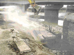
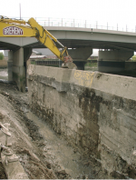
|Caption=During construction | |||
}} | |||
{{Case study image | |||
|File name=Barking - A3 post.png | |||
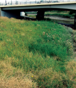
|Caption=Post project | |||
}} | |||
{{Image gallery end}} | |||
{{Toggle button}} | |||
{{Toggle content start}} | |||
{{Case study subcatchment | {{Case study subcatchment | ||
|Subcatchment=Barking Creek | |Subcatchment=Barking Creek | ||
| Line 87: | Line 99: | ||
}} | }} | ||
{{Monitoring documents end}} | {{Monitoring documents end}} | ||
{{Additional Documents}} | {{Additional Documents}} | ||
{{Case study documents | {{Case study documents | ||
| Line 106: | Line 108: | ||
{{Additional links and references footer}} | {{Additional links and references footer}} | ||
{{Supplementary Information}} | {{Supplementary Information}} | ||
{{Toggle content end}} | |||
Revision as of 06:38, 6 September 2013
Project overview
| Status | Complete |
|---|---|
| Project web site | |
| Themes | Habitat and biodiversity, Social benefits |
| Country | England |
| Main contact forename | Toni |
| Main contact surname | Scarr |
| Main contact user ID | User:Ascarr |
| Contact organisation | Environment Agency |
| Contact organisation web site | http://www.environment-agency.gov.uk |
| Partner organisations | |
| Parent multi-site project | |
| This is a parent project encompassing the following projects |
No |
Project summary
Previous site use/issues
• Terrestrial habitat with rank grassland and species poor scrubland.
• Plot of adjacent to Barking Creek, accessible by informal and underused riverside footpath.
• Blind spots within site (formed by sections of redundant fencing) lead to a raised ‘fear of crime’.
• Riverside footpath not suitable for wheelchairs.
• Concrete flood defence in poor condition needing replacing.
Enhancements
• Retreat and renewal of flood defences adapting to climate change by creating increased flood storage capacity and improved riverside and intertidal habitat. Reed bunting and sand martins have been seen in this area.
• Sand martin nesting tubes.
• Improved footpath, suitable for wheelchairs.
• Blind spots remove and the site opened up although reeds allowed establish to help protect the wildlife on the river.
Monitoring surveys and results
Lessons learnt
Image gallery
|
Catchment and subcatchmentSelect a catchment/subcatchment
Site
Project background
Cost for project phases
Reasons for river restoration
Measures
MonitoringHydromorphological quality elements
Biological quality elements
Physico-chemical quality elements
Any other monitoring, e.g. social, economic
Monitoring documents
Additional documents and videos
Additional links and references
Supplementary InformationEdit Supplementary Information
| ||||||||||||||||||||||||||||||||||||||||||||||||||||||||||||||||||||||||||||||||||||||||||||||||||||||||||||||||||||||||||||||||||||||||||||||||||||||||||||||||||||||||


