Uploads by Mobilitydream
Jump to navigation
Jump to search
This special page shows all uploaded files.
| Date | Name | Thumbnail | Size | Description | Versions |
|---|---|---|---|---|---|
| 10:52, 12 October 2018 | Soilvision screenshot.jpeg (file) | 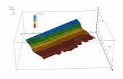 |
126 KB | Model of the west bank of the island affected by mitten crabs in the soil analysis software. | 1 |
| 08:00, 18 August 2018 | Elevation colour map.JPG (file) | 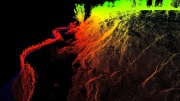 |
589 KB | 1 | |
| 15:19, 29 March 2018 | Soil sampling.jpeg (file) | 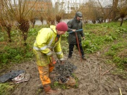 |
6.45 MB | Dr Jamie Standing from Imperial College and Dr Dave Morritt from Royal Holloway with Heena Sheth collecting core samples. | 2 |
| 12:11, 15 March 2018 | 3D model of west bank.jpg (file) |  |
154 KB | 2 | |
| 11:54, 15 March 2018 | Animal photo capture.JPG (file) | 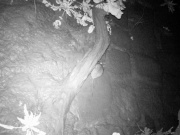 |
543 KB | 1 | |
| 11:46, 15 March 2018 | East bank with new posts.JPG (file) |  |
6.26 MB | 1 | |
| 11:45, 15 March 2018 | EA flood risk level.JPG (file) | 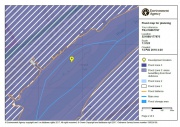 |
186 KB | 1 | |
| 11:44, 15 March 2018 | Records of burrowing species in the Thames tideway.jpg (file) |  |
520 KB | 1 | |
| 11:44, 15 March 2018 | Old Chiswick Conservation Area.JPG (file) | 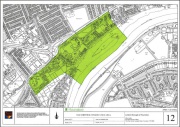 |
167 KB | 1 | |
| 11:41, 15 March 2018 | Thames21 Chiswick Eyot days.png (file) | 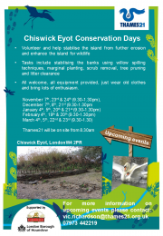 |
730 KB | 1 | |
| 09:43, 15 March 2018 | Thames21 chiswick eyot days.png (file) | 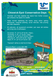 |
730 KB | Thames21 Chiwick Eyot volunteer poster | 1 |
| 09:41, 15 March 2018 | Thornycroft at church wharf chiswick.jpg (file) |  |
317 KB | Thornycroft yard at Chiswick | 1 |
| 09:39, 15 March 2018 | Flood risk level 3.JPG (file) | 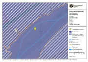 |
186 KB | Flood risk designation EA | 1 |
| 09:38, 15 March 2018 | Old chiswick conservation area.JPG (file) | 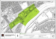 |
167 KB | Old Chiswick Conservation Area, London Borough of Houslow | 1 |
| 09:37, 15 March 2018 | Burrowing species in the thames.jpg (file) |  |
520 KB | Records of burrowing species | 1 |
| 09:34, 15 March 2018 | Bathymetry and scans.JPG (file) |  |
59 KB | Bathymetry and scan data combined | 1 |
| 09:20, 15 March 2018 | Volume calculation using 5m layer.jpg (file) |  |
100 KB | Volume calculation | 1 |
| 09:18, 15 March 2018 | Surface flatness with breaklines labelled.jpg (file) |  |
117 KB | 1 | |
| 09:13, 15 March 2018 | Bank with mola.jpg (file) | 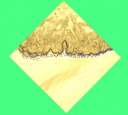 |
120 KB | Points from MoLA surveys against surface created from 2016 scan data | 1 |
| 09:11, 15 March 2018 | Bathymmetry and scans2.JPG (file) | 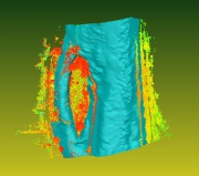 |
120 KB | Bathymetry combined with point cloud | 1 |
| 16:11, 14 March 2018 | Ground extraxction with dense contours.jpg (file) |  |
273 KB | features and elevation contours | 1 |
| 08:47, 11 February 2017 | East bank 2017.JPG (file) | 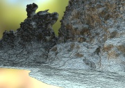 |
491 KB | Photogrammetry model of the East bank of Chiswick Eyot showing crab burrows and erosion. | 1 |
| 08:34, 11 February 2017 | East bank 01022017.JPG (file) |  |
241 KB | More detail from a photogrammetry model made this year of the east bank | 1 |
| 08:32, 11 February 2017 | 01022017 east bank and flat.JPG (file) |  |
178 KB | Photogrammetry model of part of the east bank | 1 |
| 08:22, 27 February 2016 | East bank photos.JPG (file) | 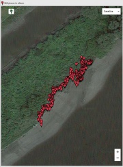 |
92 KB | Position of photos used to create photogrammetry models displayed in Google Earth. Hundreds of high resolution (16 M pixels) may be used to create detailed 3D models of the bank. this sytem is cost-effective and well suited to small-scale complex topog... | 1 |
| 08:17, 27 February 2016 | Scanning from gardens along the Chiswick Mall.JPG (file) |  |
3.21 MB | David Ackerley from the University of Leicester using the Leica P40, high resolution scanner to capture a 3 dimensional model of the island | 1 |
| 08:13, 27 February 2016 | West bank point cloud pic.JPG (file) |  |
120 KB | 3D point cloud of a partially restored section of the bank made using photogrammetry. A GPS enabled Nikon CoolPix AWS110 was used with AgiSoft software to create the cloud | 1 |
| 08:11, 27 February 2016 | Photos against surface.JPG (file) | 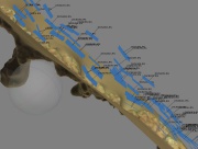 |
86 KB | Surface model of part of the bank created using photogrammetry. The blue tiles represent original photographs and show the orientation and location. | 1 |
| 08:09, 27 February 2016 | Screen1.jpg (file) | 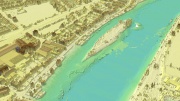 |
274 KB | Detail from a LiDAR dataset including the island | 1 |
| 08:07, 27 February 2016 | Chiswick EastBurrows snapshot2.jpg (file) |  |
1,019 KB | Detail of a scan of part of the bank. The equipment used was a Leica P40 laser scanner with a differential satellite positioning system. A scan was made of the entire island which will be compared to a scan to be made next year (2017). | 1 |
| 08:02, 27 February 2016 | Bank Erosion.jpg (file) | 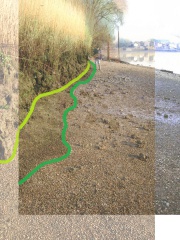 |
496 KB | Combination photo showing a comparison of 2002 and 2014 bottom of bank | 1 |
| 10:03, 10 June 2015 | Chiswick Eyot profiles.pdf (file) | 374 KB | Historical changes to Chiswick Eyot over time. | 1 | |
| 19:11, 8 April 2015 | Mittencrabburrows.JPG (file) | 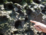 |
3.43 MB | 1 | |
| 19:06, 8 April 2015 | Slumping bank.JPG (file) | 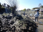 |
3.34 MB | 1 | |
| 19:00, 8 April 2015 | Eyot1.JPG (file) | 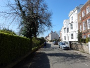 |
3.51 MB | 1 | |
| 16:08, 20 February 2015 | Eyot erosion.jpeg (file) | 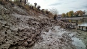 |
1.07 MB | Reverted to version as of 14:45, 20 February 2015 | 3 |
| 15:41, 20 February 2015 | DSC 0094.JPG (file) |  |
140 KB | 1 | |
| 14:57, 20 February 2015 | Defences.jpg (file) | 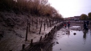 |
0 bytes | Erosion behind defence structures on the north bank of the Eyot. | 1 |
| 14:53, 20 February 2015 | Mitten crab burrows.jpeg (file) | 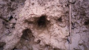 |
0 bytes | Detail of entrance to mitten crab burrows in the banks of Chiswick Eyot. | 1 |