Uploads by KristinKlausen
Jump to navigation
Jump to search
This special page shows all uploaded files.
| Date | Name | Thumbnail | Size | Description | Versions |
|---|---|---|---|---|---|
| 14:15, 2 November 2020 | Gravel for spawning grounds.jpg (file) |  |
5.97 MB | Gravel for spawning grounds. Photo: Kristin B. Klausen, local watercoordinator. | 1 |
| 14:13, 2 November 2020 | After digging of ditches and reinforcement of ditches.jpg (file) |  |
5.54 MB | After digging of ditches and reinforcement of ditches. Photo: Kristin B. Klausen, local watercoordinator. | 1 |
| 14:11, 2 November 2020 | Digging of ditches and reinforcement of ditches.JPG (file) |  |
2.63 MB | Digging of ditches and reinforcement of ditches. Photo: Kristin B. Klausen, local watercoordinator. | 1 |
| 14:06, 2 November 2020 | Fish ladder after measure.JPG (file) |  |
5.09 MB | Fish ladder after measure. Photo: Kristin B. Klausen, local watercoordinator. | 1 |
| 14:03, 2 November 2020 | Sediment pond in the middle part after measure.jpg (file) |  |
5.11 MB | Sediment ponds in the middle part of the river after measure. Photo: Kristin B. Klausen, local watercoordinator. | 1 |
| 14:02, 2 November 2020 | Excavation of sediment pond in the middel part.JPG (file) |  |
3.17 MB | Excavation of sediment ponds in the middle part of the river. Photo: Kjetil Hansen, Rødøy municipality. Photo: Kjetil Hansen, Rødøy municipality. Photo: Kjetil Hansen, Rødøy municipality | 1 |
| 13:58, 2 November 2020 | Sediment pond after measure.JPG (file) | 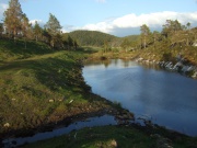 |
2.97 MB | Sediment pond after measure. Photo: Kjetil Hansen, Rødøy municipality. Photo: Kjetil Hansen, Rødøy municipality | 1 |
| 13:56, 2 November 2020 | Excavation of sediment ponds.JPG (file) |  |
3.13 MB | Excavation of sediment ponds in the upper part of the river. Photo: Kjetil Hansen, Rødøy municipality | 1 |
| 13:53, 2 November 2020 | After measures in the lower part of river.JPG (file) |  |
5.2 MB | After removal of the inorganic material (sludge/fine sand), reinfoorcement of river bank and gravel for spawning grounds. Photo: Kristin B. Klausen, local watercoordinator. | 1 |
| 13:51, 2 November 2020 | Removing inorganic material.JPG (file) | 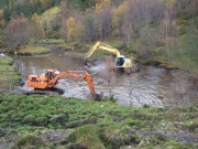 |
3.01 MB | Removing inorganic material (sludge/fine sand. Photo: Kjetil Hansen, Rødøy municipality | 1 |
| 13:46, 2 November 2020 | Construction of fishing ladder.jpg (file) | 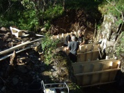 |
3.12 MB | Construction of fishing ladder. Photo: Kjetil Hansen, Rødøy municipality | 1 |
| 13:43, 2 November 2020 | Sediment pond in the middel part after measure.jpeg (file) |  |
5.11 MB | Sediment ponds in the middle part of the river after measure. Photo: Kristin B. Klausen, local watercoordinator. | 1 |
| 13:41, 2 November 2020 | Sediment pond in the middel part.jpeg (file) |  |
3.17 MB | Excavation of sediment ponds in the middle part of the river. Photo: Kjetil Hansen, Rødøy municipality. | 1 |
| 13:39, 2 November 2020 | Sediment pond.jpeg (file) | 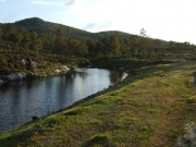 |
3.08 MB | Sediment pond. Photo: Kjetil Hansen, Rødøy municipality | 1 |
| 13:35, 2 November 2020 | Excavation of sediment ponds.jpeg (file) |  |
3.03 MB | Excavation of sediment ponds in the upper part of the river. Photo: Kjetil Hansen, Rødøy municipality | 1 |
| 11:18, 2 November 2020 | After measures in the lower part of river.jpeg (file) |  |
5.2 MB | After removal of the inorganic material (sludge/fine sand), reinfoorcement of river bank and gravel for spawning grounds. Photo: Kristin B. Klausen, local water coordinator. | 1 |
| 11:02, 2 November 2020 | Utgraving Avsnitt 2A.JPG (file) | 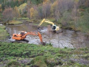 |
3.01 MB | Removing inorganic material (sludge/fine sand). Photo: Kjetil Hansen, Rødøy municipality. | 1 |
| 09:52, 2 November 2020 | Graving 2 fangdam avsnitt G .JPG (file) |  |
3.13 MB | Diggin out sediment ponds in the upper part of the river. Photo: Kjetil Hansen | 2 |