File list
Jump to navigation
Jump to search
This special page shows all uploaded files.
| Date | Name | Thumbnail | Size | User | Description | Versions |
|---|---|---|---|---|---|---|
| 10:33, 27 February 2026 | 2022-09-27.jpg (file) |  |
1.91 MB | Alan Graham | 1 | |
| 12:06, 26 February 2026 | Edingale Cdr numbered interventions.pdf (file) | 1.62 MB | Alan Graham | 1 | ||
| 11:57, 26 February 2026 | 2025-04-29.jpg (file) |  |
4.35 MB | Alan Graham | 1 | |
| 11:48, 26 February 2026 | Cotom4.jpeg (file) |  |
4.42 MB | Alan Graham | 1 | |
| 11:41, 26 February 2026 | Measemeadows.png (file) |  |
20.95 MB | Alan Graham | 1 | |
| 11:40, 26 February 2026 | Cotom1.jpeg (file) |  |
3.95 MB | Alan Graham | Cotom in the Elms 2022 | 2 |
| 11:21, 26 February 2026 | IMG 1229.jpeg (file) |  |
4.5 MB | James.thomas | 1 | |
| 11:17, 26 February 2026 | CapitalMeaseRRC.jpeg (file) |  |
1.45 MB | Alan Graham | 1 | |
| 11:12, 26 February 2026 | Tattiscombe.jpeg (file) |  |
4.53 MB | James.thomas | Tattiscombe Floodplain Reconnection | 1 |
| 11:11, 26 February 2026 | Capital Mease RRC.jpg (file) |  |
1.41 MB | Alan Graham | Capital works completed in the River Mease catchment | 1 |
| 10:33, 26 February 2026 | Tattiscombe.jpg (file) |  |
4.53 MB | James.thomas | Tattiscombe Site | 1 |
| 10:30, 26 February 2026 | Tattiscombe JT Photo.jpg (file) |  |
4.53 MB | James.thomas | Photo of the floodplain reconnection site at Tattiscombe taken by James Thomas | 1 |
| 15:54, 25 February 2026 | Cannop project picture.png (file) |  |
155 KB | Joe.Baker02 | 1 | |
| 15:34, 25 February 2026 | Cannop picture.jpg (file) |  |
484 KB | Joe.Baker02 | Image of one section of the project | 1 |
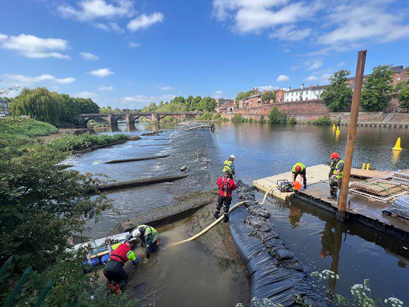
| 15:09, 25 February 2026 | Cannop reach 2 and 3.jpg (file) |  |
1.01 MB | Joe.Baker02 | Gloucestershire County Council and Forestry England partnership natural flood management project | 1 |
| 18:56, 20 February 2026 | R Mease catchment.pdf (file) | 40 KB | Ruth Needham | Graphic illustration of the Mease catchment, showing the key rivers, transport corridors and urban areas. | 1 | |
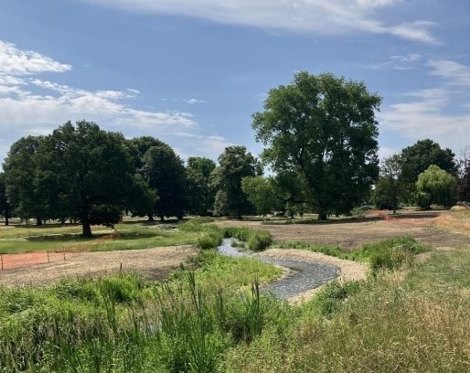
| 18:28, 20 February 2026 | Mease meadows.jpg (file) |  |
2.57 MB | Ruth Needham | Restored reach of River Mease, showing re-profiled riverbank, vegetated buffer and in-channel vegetation. | 1 |
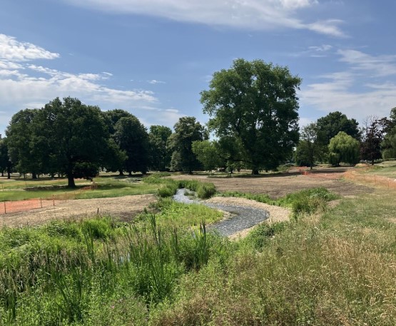
| 18:15, 20 February 2026 | 2022-11-04 MME.jpg (file) |  |
2.57 MB | Ruth Needham | Image of a restored reach of the main channel of the River Mease, showing re-profiled banks, vegetated buffer, and in-channel vegetation. | 1 |
| 12:38, 19 February 2026 | Lukely Brook.png (file) |  |
24.52 MB | Southern Water Catchment Team | 1 | |
| 11:47, 19 February 2026 | DonUSMigrationStatus2024 05 BM.jpg (file) |  |
5.46 MB | Mattduffy | 1 | |
| 14:26, 18 February 2026 | Postern mill bypass.jpg (file) |  |
2.05 MB | LivingRivers | Postern Mill Wier Bypass Channel | 1 |
| 14:25, 18 February 2026 | 20250324 123303.jpg (file) |  |
2.05 MB | LivingRivers | Postern Mill Weir Bypass Channel | 1 |
| 15:47, 20 January 2026 | Photo 1.JPG (file) |  |
6.9 MB | KStandbrook | 1 | |
| 11:49, 19 December 2025 | Vivillo meander before project.webp (file) | Error creating thumbnail: The system cannot find the path specified.
Error code: 1 |
160 KB | Ecopatrimonio | 1 | |
| 11:45, 19 December 2025 | Governance-participation-actions-03.jpg (file) |  |
452 KB | Ecopatrimonio | Governance-participation-actions-03.jpg | 1 |
| 11:36, 19 December 2025 | Governance-participation-actions-01.jpg (file) |  |
1.56 MB | Ecopatrimonio | 1 | |
| 11:31, 19 December 2025 | Logotipovivillovertical.png (file) |  |
49 KB | Ecopatrimonio | 1 | |
| 11:03, 19 December 2025 | Logotipo-vivillo-vertical.png (file) |  |
49 KB | Ecopatrimonio | 1 | |
| 10:46, 2 December 2025 | Image (2).png (file) | .png) |
2.28 MB | Ascarr | 1 | |
| 10:46, 2 December 2025 | Image (4).png (file) | .png) |
717 KB | Ascarr | 1 | |
| 10:45, 2 December 2025 | Image (1).png (file) | .png) |
2.23 MB | Ascarr | 1 | |
| 10:37, 2 December 2025 | Gadebridge.jpeg (file) |  |
116 KB | Ascarr | 1 | |
| 10:34, 2 December 2025 | Image (3).png (file) | .png) |
667 KB | Ascarr | 1 | |
| 14:16, 25 November 2025 | 251121 R.Wiki.jpg (file) |  |
311 KB | KStandbrook | 1 | |
| 14:13, 25 November 2025 | 251121.jpg (file) |  |
311 KB | KStandbrook | River Gade looking downstream | 1 |
| 08:20, 15 October 2025 | Case study 2025.jpg (file) |  |
76 KB | KStandbrook | New channel looking downstream | 1 |
| 12:41, 9 October 2025 | Riverbank planting 2.jpg (file) |  |
2.82 MB | KStandbrook | New River Gade, Gadebridge Park | 1 |
| 12:36, 9 October 2025 | Riverwiki2025.jpg (file) |  |
76 KB | KStandbrook | New River Gade, Gadebridge Park | 1 |
| 12:32, 9 October 2025 | Riverwiki.jpg (file) |  |
85 KB | KStandbrook | 1 | |
| 12:16, 9 October 2025 | Offtake Gadebridge.jpg (file) |  |
95 KB | KStandbrook | New channel looking downstream | 1 |
| 12:12, 9 October 2025 | Offtake.jpg (file) |  |
95 KB | KStandbrook | 1 | |
| 16:58, 8 October 2025 | River pic.png (file) |  |
317 KB | Ascarr | 1 | |
| 14:32, 7 July 2025 | Brecon weir aerial-4.jpg (file) |  |
465 KB | JoshRRC | 1 | |
| 13:55, 7 July 2025 | Senni-bridge.jpeg (file) |  |
151 KB | JoshRRC | 1 | |
| 14:50, 4 July 2025 | Examples-of-large-wood-in-river-tarell.png (file) |  |
2.58 MB | JoshRRC | 1 | |
| 13:54, 4 July 2025 | Pont-pantyscallog-on-the-usk-april-2022.jpg (file) |  |
215 KB | JoshRRC | 1 | |
| 12:41, 4 July 2025 | 20230920 143251.jpg (file) |  |
4.69 MB | JoshRRC | 1 | |
| 10:49, 4 July 2025 | Chester-weir.jpg (file) |  |
71 KB | JoshRRC | 1 | |
| 10:17, 4 July 2025 | Erbistock 1.jpg (file) |  |
628 KB | JoshRRC | 1 | |
| 09:18, 4 July 2025 | Dee-project-image.jpg (file) |  |
75 KB | JoshRRC | 1 |