Case study:Wensum River Restoration and Floodplain Enhancement, Pensthorpe

From RESTORE
Jump to navigation Jump to search
3.00
(one vote)


To discuss or comment on this case study, please use the discussion page.


Location: 52° 49' 18.39" N, 0° 53' 4.15" E
Loading map...
Left click to look around in the map, and use the wheel of your mouse to zoom in and out.


Project overview

Edit project overview
Status In progress
Project web site http://www.environment-agency.gov.uk/homeandleisure/wildlife/114676.aspx
Themes Habitat and biodiversity, Hydromorphology
Country England
Main contact forename Robin
Main contact surname Chase
Main contact user ID
Contact organisation Pensthorpe Conservation Trust
Contact organisation web site http://www.pensthorpetrust.org.uk/
Partner organisations Environment Agency, Norfolk Rivers Trust, Natural England, Norfolk Rivers Internal Drainage Board
Parent multi-site project
This is a parent project
encompassing the following
projects
No
This case study hasn’t got a picture, you can add one by editing the project overview.

Project summary

Edit project overview to modify the project summary.


The unfavourable ecological condition of the River Wensum SSSI/SAC has arisen over the years through a series of adverse modifications in hydromorphology of the River Wensum, leading to failure of Waterbody GB105034055881 to achieve ‘Good Ecological Potential’ under the WFD. Diffuse water pollution to River Wensum from both agricul-ture and urban sources and disconnection of the River Wensum from its floodplain have also led to consequent eco-logical impoverishment of the floodplain. The River Wensum and Floodplain Restoration Project is therefore designed to implement restoration measures to restore the form and function typical of a Norfolk Chalk River (e.g. channel narrowing, restoring gravel beds, in-creasing sinuosity, increasing woody debris). This will Improve fisheries, invertebrates and plant communities within the SSSI and SAC and restore the connectivity of the floodplain and floodplain wetland habitats; including the restoration and creation of reedbed and fen habitats. Water quality of urban run-off from Fakenham and adjacent agricultural land will also be improved before reaching the river. Significant and measureable improvements in habitat for designated features of the River Wensum SSSI/SAC (as identified in the River Wensum Restoration Strat-egy) are key objectives of the project.

Monitoring surveys and results

This case study hasn’t got any Monitoring survey and results, you can add some by editing the project overview.

Lessons learnt

This case study hasn’t got any lessons learnt, you can add some by editing the project overview.


Image gallery


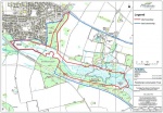
Site location plan
ShowHideAdditionalImage.png


Catchment and subcatchment

Catchment

River basin district Anglian
River basin Broadland Rivers

Subcatchment

River name Wensum US Norwich
Area category 100 - 1000 km²
Area (km2)
Maximum altitude category Less than 100 m
Maximum altitude (m) 9898 m <br />0.098 km <br />9,800 cm <br />
Dominant geology Calcareous
Ecoregion Great Britain
Dominant land cover Arable and Horticulture
Waterbody ID GB105034055881


Other case studies in this subcatchment: Great Ryburgh End Restoration Scheme, Meander reinstatement on the River Wensum at the Ryburgh Loop, River Wensum Restoration, Reach 10 Lenwade, River Wensum Restoration, Reach 3a Costessey, River Wensum Restoration, Reach 9 Attlebridge, River rehabilitation on the River Wensum at Swanton Morley, Sculthorpe Moor Restoration Scheme, Wensum River Restoration and Floodplain Enhancement


Site

Name River Wensum
WFD water body codes GB105034055881
WFD (national) typology
WFD water body name
Pre-project morphology Straightened
Reference morphology Sinuous
Desired post project morphology
Heavily modified water body No
National/international site designation EU - Special Area of Conservation
Local/regional site designations
Protected species present No
Invasive species present No
Species of interest
Dominant hydrology
Dominant substrate
River corridor land use Intensive agriculture (arable)
Average bankfull channel width category
Average bankfull channel width (m)
Average bankfull channel depth category
Average bankfull channel depth (m)
Mean discharge category
Mean annual discharge (m3/s)
Average channel gradient category
Average channel gradient
Average unit stream power (W/m2)


Project background

Reach length directly affected (m)
Project started 2012/07/01
Works started
Works completed
Project completed 2015/03/31
Total cost category 500 - 1000 k€
Total cost (k€) 900900 k€ <br />900,000 € <br />
Benefit to cost ratio
Funding sources Catchment Restoration Funds

Cost for project phases

Phase cost category cost exact (k€) Lead organisation Contact forename Contact surname
Investigation and design
Stakeholder engagement and communication
Works and works supervision
Post-project management and maintenance
Monitoring


Reasons for river restoration

Mitigation of a pressure Pollution incident, Urbanisation
Hydromorphology Continuity for organisms, Substrate conditions, Structure & condition of riparian/lake shore zones
Biology Invertebrates, Macrophytes
Physico-chemical
Other reasons for the project


Measures

Structural measures
Bank/bed modifications Restoring gravel bed
Floodplain / River corridor Floodplain reconnection
Planform / Channel pattern Channel narrowing
Other
Non-structural measures
Management interventions
Social measures (incl. engagement)
Other


Monitoring

Hydromorphological quality elements

Element When monitored Type of monitoring Control site used Result
Before measures After measures Qualitative Quantitative

Biological quality elements

Element When monitored Type of monitoring Control site used Result
Before measures After measures Qualitative Quantitative

Physico-chemical quality elements

Element When monitored Type of monitoring Control site used Result
Before measures After measures Qualitative Quantitative

Any other monitoring, e.g. social, economic

Element When monitored Type of monitoring Control site used Result
Before measures After measures Qualitative Quantitative


Monitoring documents


Additional documents and videos


Additional links and references

Link Description
http://www.environment-agency.gov.uk/ UK - Environment Agency website
http://www.pensthorpetrust.org.uk/ The Pensthorpe Conservation Trust (PCT) was formed in January 2003 to carry forward the work of its predecessor, the Pensthorpe Waterfowl Trust; and to establish a centre of excellence in ecological restoration. Its focus is the captive breeding of threatened species, particularly those associated with wetlands, such as cranes and wildfowl (ducks, geese and swans); ecologically sustainable farming; plus habitat restoration and management.
http://www.naturalengland.org.uk/ Natural England is an Executive Non-departmental Public Body responsible to the Secretary of State for Environment, Food and Rural Affairs. The purpose is to protect and improve England’s natural environment and encourage people to enjoy and get involved in their surroundings.

Supplementary Information

Edit Supplementary Information