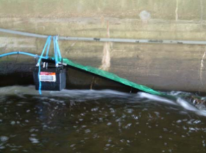
Case study:Weir upstream of Redbridge roundabout
Project overview
| Status | Planned |
|---|---|
| Project web site | |
| Themes | Flood risk management, Habitat and biodiversity |
| Country | England |
| Main contact forename | Rebecca |
| Main contact surname | O’Shea |
| Main contact user ID | |
| Contact organisation | Environment Agency |
| Contact organisation web site | http://www.gov.uk/government/organisations/environment-agency |
| Partner organisations | |
| Parent multi-site project | |
| This is a parent project encompassing the following projects |
No |
Project summary
To remove the existing notched weir and regrade the bed to establish more natural processes on this stretch of river and improve marginal vegetation/ habitat as a result. This in turn will benefit fauna dependent on marginal and aquatic habitats and fish passage will be unrestricted. This length of river is largely owned by the EA and was straightened to accommodate the M11 and North Circular improvements. The channel was over-sized channel with flood embankments on both sides set back a few metres from the “first stage” riverbanks. The weir may have been installed to reduce the gradient. These channel modifications have resulted in a degraded stretch river in terms of both ecology and geomorphology.
Monitoring surveys and results
Lessons learnt
Image gallery
|
Catchment and subcatchmentSelect a catchment/subcatchment
Catchment
Subcatchment
Other case studies in this subcatchment: Chigwell Brook, Fresh Wharf, Land opposite Wanstead Park, River Roding at Ray Lodge Park, Valentines Park
Site
Project background
Cost for project phases
Reasons for river restoration
Measures
MonitoringHydromorphological quality elements
Biological quality elements
Physico-chemical quality elements
Any other monitoring, e.g. social, economic
Monitoring documents
Additional documents and videos
Additional links and references
Supplementary InformationEdit Supplementary Information
| ||||||||||||||||||||||||||||||||||||||||||||||||||||||||||||||||||||||||||||||||||||||||||||||||||||||||||||||||||||||||||||||||||||||||||||||||||||||||||||||||||||||||||||||||||||||||||||||||||||||||

