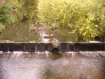
Case study:Weir removal at Tile Kiln Park
Jump to navigation
Jump to search
Location: 51° 36' 56.62" N, 0° 5' 15.56" W
Left click to look around in the map, and use the wheel of your mouse to zoom in and out.
Project overview
| Status | Complete |
|---|---|
| Project web site | |
| Themes | Fisheries, Flood risk management, Habitat and biodiversity |
| Country | England |
| Main contact forename | Colin |
| Main contact surname | Street |
| Main contact user ID | |
| Contact organisation | Environment Agency |
| Contact organisation web site | http://www.gov.uk/government/organisations/environment-agency |
| Partner organisations | |
| Parent multi-site project | |
| This is a parent project encompassing the following projects |
No |
Project summary
Edit project overview to modify the project summary.
To remove an obsolete weir on the Pymmes Brook to restore hydro-morphological processes and connectivity of the river corridor. An area of urban deprivation where the Envionment Agency is working with the local Authority to improve the area of Tile Kiln Park in Enfield.
Monitoring surveys and results
This case study hasn’t got any Monitoring survey and results, you can add some by editing the project overview.
Lessons learnt
Edit project overview to modify the lessons learnt.
Success
Image gallery
|
Catchment and subcatchmentSelect a catchment/subcatchment
Catchment
Subcatchment
Other case studies in this subcatchment: Arnos Park - Pymmes Brook, Friary Park, Friern Barnet Former Sewage Works, Merdian Water development site, Parks between A10 and Melville Gardens, Pymmes Brook and new river crossing point, Wilmer Way School Playing Field
Site
Project background
Cost for project phases
Reasons for river restoration
Measures
MonitoringHydromorphological quality elements
Biological quality elements
Physico-chemical quality elements
Any other monitoring, e.g. social, economic
Monitoring documents
Additional documents and videos
Additional links and references
Supplementary InformationEdit Supplementary Information
| ||||||||||||||||||||||||||||||||||||||||||||||||||||||||||||||||||||||||||||||||||||||||||||||||||||||||||||||||||||||||||||||||||||||||||||||||||||||||||||||||||||||||||||||||||||||||||||||||||||||||


