Case study:Tidal Dee Love my Estuary
Project overview
| Status | Complete |
|---|---|
| Project web site | http://www.cheshirewildlifetrust.org.uk/lovemyestuary |
| Themes | Estuary, Habitat and biodiversity, Land use management - agriculture, Urban, Water quality |
| Country | England, Wales |
| Main contact forename | Sarah |
| Main contact surname | Bennett |
| Main contact user ID | |
| Contact organisation | Cheshire Wildlife Trust |
| Contact organisation web site | http://www.cheshirewildlifetrust.org.uk/ |
| Partner organisations | |
| This is a parent project encompassing the following projects |
Project summary
The Dee (N.Wales) transitional waterbody is currently at moderate potential, with levels of Dissolved Inorganic Nitrate (DIN) identified as the Reason for Not Achieving Good status. As a transitional waterbody, the vast majority of water quality issues are inherited from upstream. With only a short stretch of the River Dee sitting within our catchment partnership area, we focussed on reducing water pollution on the small coastal waterbodies sitting on the English side of the border: Finchetts Gutter, Shotwick Brook and Burton Brook, as well as the unclassified land bordering the eastern coast of the Estuary (West Wirral), which features a designated Bathing Water at West Kirby. The Estuary features designated Shellfish Waters (Dee (West) and Dee (East)) and is internationally important for wildlife; as reflected in its designations as an SAC, SPA and Ramsar site.
The Tidal Dee Catchment Partnership has identified misconnections and poorly managed septic tanks as a significant pollution issue within these waterbodies, particularly due to the lack of mains sewerage on Burton Brook and Shotwick Brook and due to the urban nature of Finchetts Gutter. These issues are reflected in the Reasons for Not Achieving Good Status for our 3 target waterbodies and the Dee (N.Wales) transitional waterbody. Finchetts Gutter also sits within a Nutrient Sensitive Area.
The Tidal Dee Catchment Partnership, through stakeholder engagement, has identified a general detachment from the estuary amongst local communities – particularly a lack of understanding of how personal actions affect the water environment. Learning from the successes of the Environment Agency/United Utilities/Keep Britain Tidy “Love my Beach” project, we want to use water pollution issues as a way to inspire stakeholders towards greater stewardship of the water environment as well as achieving a greater understanding of the importance of water quality on wildlife amongst local communities.
Whilst advice is available on water pollution issues with leaflets often offered, tailored advice packs for different sectors do not currently exist. Not knowing which organisation to seek what type of advice from often leads to issues with getting across simple, succinct and relevant advice.
We are aware that these issues are far from unique to this catchment, so we wish to utilise this as an opportunity to scope best practice in order to help towards the reduction of water pollution nationally.
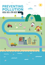
Work included educating the community on environmental protection and promoting environmentally-friendly behaviour.
Monitoring surveys and results
A good coverage was achieved across all three waterbodies with nearly 80% of their total length covered by walkover surveys. This resulted in 293 recorded pollution sources, whether observed or potential. The vast majority of pollution sources noted only showed potential for impacting the waterbodies, with comparatively few (9 significant) having a significant impact on over 100 metres of watercourse.
Lessons learnt
Water pollution is a difficult topic to engage and enthuse members of the public about. More people were engaged about the topic when we held stands at already existing events that people would be going to rather than hoping people would attend an event specifically held by this project. We found that making the events aimed at homeowners targeted to families meant that more people attended and we could discuss general water management and water pollution with the adults whilst the children did craft activities. Relating water pollution to wildlife on the estuary (which is a prominent feature locally) meant it was easier to engage members of the public about the topic.
The walkover surveys were a success in gathering information to inform future delivery projects and in engaging partner organisations in Water Framework Directive project delivery.
The quality of the Pollution Prevention Pack was highly regarded by partners including stakeholders from other Catchment Partnerships. Enthusiasm for the packs has come from stakeholders in Devon, Gloucestershire, Northumberland, Derbyshire, Sussex, Shropshire and Bedfordshire. We know of two organisations from neighbouring Catchment Partnerships that are making minor amendments to the electronic version so they can use them locally.
Catchment and subcatchment
Edit the catchment and subcatchment details
(affects all case studies in this subcatchment)
Catchment
| River basin district | Dee |
|---|---|
| River basin | Tidal Dee |
Subcatchment
| River name | Unnamed Dee Estuary South |
|---|---|
| Area category | Less than 10 km² |
| Area (km2) | |
| Maximum altitude category | 200 - 500 m |
| Maximum altitude (m) | 253253 m <br />0.253 km <br />25,300 cm <br /> |
| Dominant geology | Calcareous |
| Ecoregion | Great Britain |
| Dominant land cover | Improved grassland |
| Waterbody ID | GB111067057050 |
Image gallery
|
Site
Project background
Cost for project phases
Reasons for river restoration
Measures
MonitoringHydromorphological quality elements
Biological quality elements
Physico-chemical quality elements
Any other monitoring, e.g. social, economic
Monitoring documents
Additional documents and videos
Additional links and references
Supplementary InformationEdit Supplementary Information
| ||||||||||||||||||||||||||||||||||||||||||||||||||||||||||||||||||||||||||||||||||||||||||||||||||||||||||||||||||||||||||||||||||||||||||||||||||||||||||||||||||||||||||||||||||

