Case study:Stage 0 channel restoration
Project overview
| Status | Complete |
|---|---|
| Project web site | |
| Themes | Environmental flows and water resources, Fisheries, Habitat and biodiversity, Water quality |
| Country | England |
| Main contact forename | Thomas |
| Main contact surname | Hartland Smith |
| Main contact user ID | User:Tom UK |
| Contact organisation | Severn Rivers Trust |
| Contact organisation web site | http://https://www.severnriverstrust.com/ |
| Partner organisations | Dudley Council, Wolverhampton City Council |
| Parent multi-site project | |
| This is a parent project encompassing the following projects |
No |
Project summary
This project, set in the heart of Saltwells NNR, was one of several across the Black Country that collectively advanced the Severn Rivers Trust's efforts in the Worcestershire Middle Severn catchment area. With funding from the European Regional Development Fund (ERDF), the Black Country Blue Networks 2 project enabled this work between 2021 and 2023.
After multiple on-site discussions, we ultimately decided to pursue a stage 0 channel restoration. This approach, which involved resetting the river to allow it to develop a more natural single or multi-channel structure, was particularly exciting. However, due to the site’s highly urbanized setting, concerns arose about flood risk, access challenges, historical pollution, infrastructure impacts, and public perception.
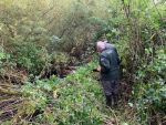
Initial Meetings: At the project’s outset, staff from the Severn Rivers Trust engaged with Dudley Council rangers to identify potential site-specific features that could benefit the blue network. The senior ranger vaguely remembered a weir within the NNR. Since access was challenging, clearing a path was necessary to reach the site and assess the structure's passability. Upon visiting the site and conducting the assessment, we confirmed that the weir remained intact and posed a complete barrier to fish passage. As a result, we began developing a project to either remove or bypass this barrier.
Getting Started: Dudley Metropolitan Borough Council (MBC) supported the idea of removing or bypassing the weir. Given that Black Brook is classified as an ordinary watercourse, we held pre-application meetings with the Lead Local Flood Authority. It’s common for Severn Rivers Trust staff to conduct desk studies during this stage to support the application. This involves reviewing services, historical maps, species data, and other relevant information to shape project plans. During this analysis, we uncovered previously unknown site features, including a second, larger weir upstream and a greater extent of channel straightening and dredging than initially identified. These findings, made possible through LiDAR analysis, highlighted the value of thorough preliminary research.
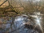
Project Development: Considering the entire site, it became clear that restoring the channel to its natural state would require significant funding and cause substantial environmental disturbance to the reach. Machine access would be difficult, necessitating bog matting and wide-track equipment along the length of the site. This led us to explore a stage 0 approach, which involved installing a single channel block to divert water from the artificial channel. This would allow the water to naturally reshape its path across the landscape on the true left-hand bank. As the water carved its way, new channels would form in the landscape, creating a dynamic, braided wetland that could move laterally and stay fully connected to the surrounding floodplain.
Design and Consenting: Given the project’s location, diverting water out of the established channel raised concerns about potential risks to the wider landscape and local community. Therefore, detailed modeling was required to obtain ordinary watercourse consent. Dynamic Rivers conducted the modeling, allowing us to evaluate the potential impacts of three different blockage designs. By incorporating topography and flow data, we could conclude that the project would not have negative effects and would likely enhance the catchment's resilience to high-flow events.
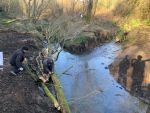
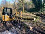
To mitigate risks of erosion and damage to downstream infrastructure during high flows, trees were felled across the bund and downstream to prevent bank erosion as the brook returned to its previous channel.
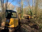
Project Delivery: The contractor, Sandfields, was selected through a competitive tendering process, ensuring a range of skills for the work. During site visits with the contractor, we agreed on a high bankside approach to minimize impacts on riparian vegetation and reduce the risk of equipment becoming bogged down. Arrangements for site access were coordinated with the council well in advance, and public notices were posted weeks before the project began. Mobilization and the on-site work were completed over two days.
Monitoring surveys and results
Unfortunately this project was a capital project which did not allow for monitoring, however monitoring of the instillation of the bund and the large woody material to make sure if they have moved or are eroding.
Lessons learnt
Image gallery
|
Catchment and subcatchmentSelect a catchment/subcatchment
Catchment
Subcatchment
Site
Project background
Cost for project phases
Reasons for river restoration
Measures
MonitoringHydromorphological quality elements
Biological quality elements
Physico-chemical quality elements
Any other monitoring, e.g. social, economic
Monitoring documents
Additional documents and videos
Additional links and references
Supplementary InformationEdit Supplementary Information
| ||||||||||||||||||||||||||||||||||||||||||||||||||||||||||||||||||||||||||||||||||||||||||||||||||||||||||||||||||||||||||||||||||||||||||||||||||||||||||||||||||||||||||||||||||||||||||||||


