Case study:Sheephouse Wood Mine Water Treatment Scheme
Project overview
| Status | Complete |
|---|---|
| Project web site | |
| Themes | Environmental flows and water resources, Fisheries, Habitat and biodiversity, Social benefits, Water quality |
| Country | England |
| Main contact forename | Sinead |
| Main contact surname | Chamberlain |
| Main contact user ID | User:Coal Authority |
| Contact organisation | The Coal Authority (UK) |
| Contact organisation web site | http://coal.decc.gov.uk |
| Partner organisations | |
| Parent multi-site project | |
| This is a parent project encompassing the following projects |
No |
Project summary
Sheephouse Wood mine water treatment scheme addresses a long-standing coal mine water pollution problem associated with the Sheephouse Wood adit, in South Yorkshire, England.
The mine water treatment scheme is built on the site of the former Hand Bank Colliery, which closed in the 1930s. Fireclay was also previously mined on the site. The original discharge was via a drainage adit running under the site located at a depth of 30 metres. This adit discharged into a drainage channel, which extends for approximately 2km bypassing the Underbank Reservoir. In February 2002, a sudden outrush of contaminated mine water occurred which damaged a section of the major trunk road between Sheffield and Manchester (A616). This was caused by a collapse in the adit, leading to water pressure building up in the workings. Remedial works were carried out on the adit and to repair the road but in 2005 another blockage in the adit led to water levels rising. This resulted in the majority of the flow emerging from a second discharge located a short distance to the north. Flow from this discharge affected a stretch of the Little Don River.
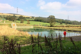
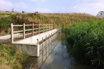
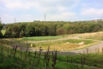
The Coal Authority stepped in to construct a scheme to treat the mine water and control water levels and pressure, in order to prevent significant outbreaks of pollution which had occurred at this site in the past. The scheme comprises of two lagoons and a reed bed to remove iron from the water prior to it being discharged into the local watercourse.
Monitoring surveys and results
This scheme has significantly improved the water over 2.4km.
Lessons learnt
Image gallery
|
Catchment and subcatchmentSelect a catchment/subcatchment
Catchment
Subcatchment
Other case studies in this subcatchment: Little Don Catchment Case Study
Site
Project background
Cost for project phases
Reasons for river restoration
Measures
MonitoringHydromorphological quality elements
Biological quality elements
Physico-chemical quality elements
Any other monitoring, e.g. social, economic
Monitoring documents
Additional documents and videos
Additional links and references
Supplementary InformationEdit Supplementary Information
| ||||||||||||||||||||||||||||||||||||||||||||||||||||||||||||||||||||||||||||||||||||||||||||||||||||||||||||||||||||||||||||||||||||||||||||||||||||||||||||||||||||||||||||||||||||||||||||||||||||||||


