Case study:Saltburn Gill ironstones mines
Project overview
| Status | In progress |
|---|---|
| Project web site | |
| Themes | Economic aspects, Social benefits, Water quality |
| Country | England |
| Main contact forename | Hugh |
| Main contact surname | Potter |
| Main contact user ID | User:HPotter |
| Contact organisation | Environment Agency |
| Contact organisation web site | http://www.environment-agency.gov.uk/ |
| Partner organisations | Environment Agency, Defra, The Coal Authority (UK) |
| Parent multi-site project | |
| This is a parent project encompassing the following projects |
No |
Project summary
Saltburn Gill is a short coastal river, flowing into the North Sea across Saltburn Beach - a designated bathing water beach and one of the most popular surfing beaches on the east coast. The river extends inland for about 8km in a steep sided valley, part of the Saltburn Gill Nature Reserve Site of Special Scientific Interest (SSSI).
This on-going project targets a section of the Saltburn Gill that was negatively impacted by Acid Mine Drainage (AMD) from abandoned mine workings, located upstream of the discharge point. Historically, East Cleveland was a major source of ore for the Teesside iron and steel industry, specially from the 1850’s until the early 1960’s. Afterwards, the decline of the mining activity resulted in an uncontrolled abandonment of the working mines in within the region.
In May 1999, an uncontrolled mine discharge increased the typical iron levels of the Saltburn Beck from around 0.1 milligrammes per litre (mg/l) to in excess of 1200mg/l. Over 330kg of iron ochre was deposited on the stream bed every day. In one year, this is the equivalent of over 100 tonnes of iron being discharged into the North Sea. The devastating effects on the ecology readily appeared, mainly due to the drastic depletion in the oxygen levels. A biological impact survey of the stream showed that the pollution reduced the water quality of the beck from good to bad status along 2km of the watercourse, from the discharge point to the sea.
The Saltburn Gill Action Group (SGAG) was set up in 2005 as a community action group. Assistance was given by The Environment Agency, Teesside University, the local Wildlife Trust, the Parish Council and others to try to find a solution to this problem. Then, several site investigations were carried out with insights to build up a treatment plant. A major partnership project between us, the Coal Authority and Saltburn Gill Action Group has been working to clean up the pollution since 2008.
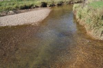
During the summer of 2013, Defra provided funding for the Coal Authority to pump water from the mines and build the first stage of a treatment scheme. This first stage is a settlement lagoon where iron precipitates out of the mine water to form a sludge at the bottom. A temporary chemical dosing system helps to remove more iron while the second stage is being built. Clean water is put back into the Gill, and since January 2014, the stream is no longer orange.
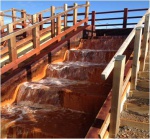
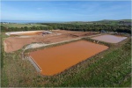
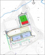
In the summer of 2014, work started on the second stage of the passive treatment scheme – made up of 4 settlement ponds, a sludge drying bed and a reed bed wetland. The abstracted mine water first flows over an aeration cascade, which adds oxygen to the water and improves the rate the iron oxidises into a precipitate. It then flows by gravity into settlement ponds, where the metals can settle out to the bottom. This process takes 1 to 2 days, and leaves a sludge, iron ochre, which is disposed of at a later date.
After the mine water has passed through the settlement ponds it then flows by gravity into the reed bed wetland. The reeds act like a natural filter, removing the majority of the remaining metal pollution. Clean water is then returned to the Gill. Once the treatment scheme is finished, the chemical dosing system can be removed – reducing long-term costs. The construction phase should be completed in early 2015, and the reeds will be planted in May 2015. As well as filtering and cleaning the mine water, the reed beds will provide a valuable new habitat for wildlife.
Laboratory and field scale tests have shown that up to 99% of the iron should be removed by the treatment plant, with the local economic benefits of raising the quality of the river and foreshore predicted to be around £10.5 million over 25 years. This significantly outweighs the predicted lifetime cost of building and running the treatment plant (~£7m).
Benefits of remediation:
- The Saltburn Gill and Skelton Beck will no longer be polluted, and the risk of a catastrophic breakout of minewater will be reduced.
- The aesthetic, ecological and recreational value of Saltburn Gill, Saltburn Beach and the Saltburn Gill Nature Reserve will be improved.
- Improved bathing water quality on Saltburn beach, encouraging recreation that contributes to the local economy.
- The water body will achieve good chemical and ecological status as required by the Northumbria River Basin Management Plan.
Monitoring surveys and results
Lessons learnt
Image gallery
|
Catchment and subcatchmentSelect a catchment/subcatchment
Catchment
Subcatchment
Site
Project background
Cost for project phases
Reasons for river restoration
Measures
MonitoringHydromorphological quality elements
Biological quality elements
Physico-chemical quality elements
Any other monitoring, e.g. social, economic
Monitoring documents
Additional documents and videos
Additional links and references
Supplementary InformationEdit Supplementary Information
|
||||||||||||||||||||||||||||||||||||||||||||||||||||||||||||||||||||||||||||||||||||||||||||||||||||||||||||||||||||||||||||||||||||||||||||||||||||||||||||||||||||||||||||||||||||||||||||||||||||||||||||||


