Case study:River rehabilitation on the River Wensum at Swanton Morley
Project overview
| Status | Complete |
|---|---|
| Project web site | |
| Themes | Fisheries, Habitat and biodiversity, Hydromorphology |
| Country | England |
| Main contact forename | Rob |
| Main contact surname | Dryden |
| Main contact user ID | |
| Contact organisation | Environment Agency |
| Contact organisation web site | http://www.environment-agency.gov.uk |
| Partner organisations | |
| Parent multi-site project | |
| This is a parent project encompassing the following projects |
No |
Project summary
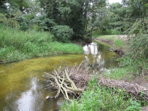
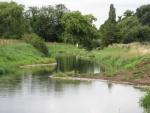
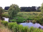
The restored reach at Swanton Morley extends downstream of Swanton Morley Weirs and had been historically dredged for land drainage purposes. As a result the channel was over deep and over wide and isolated from the floodplain by large spoil embankments. The channel lacked flow diversity, in-channel habitat, woody debris and tree cover. The restoration scheme aimed to re-establish the natural form and function of the river, improve the ecology of both the SSSI and SAC and reconnect the river and floodplain.
Pools and glides were created using imported gravel from a local quarry and designed such that finer sediment would not settle out under any flow conditions and the coarser gravel would not be washed out in high flow conditions. Lateral berms were created to increase sinuosity by placing a line of gravel rejects to define the outer edge, then transplanting existing bank vegetation behind the gravel and backfilling using material excavated from the spoil banks. Woody debris was installed to create flow diversity, increase sinuosity and create additional habitat and refuge areas. Selective tree planting of predominantly alder and willow has been carried out along the banks to increase riparian cover. A meander loop, bypassed in the 1950s, was reconnected by plugging the existing straight channel so that flows are diverted into the loop. Desilting of the meander was required to expose the hard bed underneath.
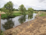
Reconnection of the river with the floodplain, to increase biodiversity and provide a sink for sediment during high flow conditions, has been achieved by lowering the spoil embankment in places. An Internal Drainage Board drain is situated within the floodplain and so work was undertaken to ensure that this did not become surcharged during flood events which could potentially cause adverse impacts downstream. The floodplain was re-profiled in places, working with the existing topography and using spoil from the river embankments to create a defined area which will be inundated during high flows and then allow water to drain back to the river as water levels recede.
Monitoring surveys and results
The pre-works baseline fish survey completed in 2012 recorded a total of 45 fish of 7 species. The repeat survey in 2013, one year after restoration, recorded 143 fish of 11 species. The improved habitat has seen 3-spined stickleback, brown trout, dace and stone loach moving into the reach. Fish density increased from 1.4 fish per 100m² in 2012 to 3.2 fish per 100m² in 2013. Fish standing crop saw a moderate drop from 2057 grams 100m² to 1606 grams per 100m² over the same period. The change in standing crop is largely accounted for by the reduction in numbers of pole caught in the 2013 sample.
Kick sampling for invertebrates has shown a post-restoration increase in the diversity of taxa in all but one of the sample locations within the restored reach. It was particularly exciting to find two species of stonefiles, which require a pebbly substrate with plenty of small spaces and high dissolved oxygen levels. Caseless caddis flies were absent from the pre-works survey, but were recorded across the whole reach in the post-works survey. These species required larger stable substrates and will have benefited from the installation of the gravel glides. Mayfly species diversity has increased in the post-restoration survey samples. Despite these encouraging signs the number of invertebrates found was quite low. This might indicate high predation pressure from the invasive non-native signal crayfish which are abundant in this section of the Wensum.
Aquatic plant populations remain poor on the restoration reach. Again, this may relate to the large population of signal crayfish.
Lessons learnt
The in-channel works have been successful and flow diversity and sinuosity has been achieved. Both the berms and woody debris have vegetated rapidly and the works are now barely discernible. A diverse range of marginal vegetation has established and trout were observed resting on the glides. Ecological surveys were carried out in August 2013 and the results of these will determine the extent of ecological recovery following the works.
Some adaptive management of the plug has been necessary as a result of the extremely high flows experienced immediately after construction. Clay, overlain with coir matting, was used to reinforce the plug and this appears to have worked well with flows directed around the meander other than in high flows. Some erosion has occurred on the outside of the meander bend cutting back the bank and exposing patches of bare chalk. The material eroded has been deposited downstream of the meander loop and formed a natural berm on the inside of the bend. On the day that RRC visited the Environment Agency Field Team were on site pinning an alder tree that had fallen across the meander loop. The Alder was repositioned in order to maintain access for canoeists as well as retain its function as large woody debris.
The floodplain reconnection has been successful with suspended sediment settling out on the floodplain during high flow events and water draining back into the river as flood levels subside.
Image gallery
|
Catchment and subcatchmentSelect a catchment/subcatchment
Catchment
Subcatchment
Other case studies in this subcatchment: Great Ryburgh End Restoration Scheme, Meander reinstatement on the River Wensum at the Ryburgh Loop, River Wensum Restoration, Reach 10 Lenwade, River Wensum Restoration, Reach 3a Costessey, River Wensum Restoration, Reach 9 Attlebridge, Sculthorpe Moor Restoration Scheme, Wensum River Restoration and Floodplain Enhancement, Wensum River Restoration and Floodplain Enhancement, Pensthorpe
Site
Project background
Cost for project phases
Reasons for river restoration
Measures
MonitoringHydromorphological quality elements
Biological quality elements
Physico-chemical quality elements
Any other monitoring, e.g. social, economic
Monitoring documents
Additional documents and videos
Additional links and references
Supplementary InformationEdit Supplementary Information
| ||||||||||||||||||||||||||||||||||||||||||||||||||||||||||||||||||||||||||||||||||||||||||||||||||||||||||||||||||||||||||||||||||||||||||||||||||||||||||||||||||||||||||||||||||||||||||||||||||||||||


