Case study:River Worfe Restoration Initiative
Project overview
| Status | In progress |
|---|---|
| Project web site | |
| Themes | Economic aspects, Environmental flows and water resources, Fisheries, Flood risk management, Habitat and biodiversity, Hydromorphology, Land use management - agriculture, Monitoring, Social benefits, Water quality, Urban |
| Country | England |
| Main contact forename | Peter |
| Main contact surname | Dennis |
| Main contact user ID | User:PETERD |
| Contact organisation | APEM Ltd |
| Contact organisation web site | http://www.apemltd.co.uk |
| Partner organisations | Severn Rivers Trust |
| Parent multi-site project | |
| This is a parent project encompassing the following projects |
No |
Project summary
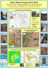
APEM was commissioned by Severn Rivers Trust to undertake a series of surveys in the River Worfe catchment, a tributary of the River Severn in Shropshire, England. Particular interest and survey effort was focussed on a sub-catchment of the River Worfe, Wesley Brook which has, historically, been influenced by a wide variety of human activity and where pressures from surrounding land uses and development are causing the watercourse to fail Water Framework Directive (WFD) objectives. The brook was selected as a priority catchment which has significant capacity for improvement using funds made available to SRT via the Catchment Restoration Funding initiative.
In 2012/13 APEM undertook a walkover survey of the entire Worfe catchment to assess the current condition of the river and the pressures imposed on the watercourse by surrounding land practices. APEM undertook a walkover survey mapping fish habitat and diffuse pollution sources throughout the entire catchment. The findings of these surveys in partnership with high resolution imagery allowed accurate and informed interpretation of the sources and pathways of contaminants entering the river system with subsequent mitigation measures aimed at source inhibition. Validation of suspected diffuse pollution sources were also subsequently determined by a series of wet weather sampling events in winter 2013 / 14.
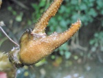
In addition, a variety of ecological surveys using both ground and remote sensing applications have been undertaken in order to establish a baseline in the most sensitive and impacted sub-catchments. As part of these surveys barriers to fish migration in the catchment have been mapped and subsequent site visits have been performed looking at potential fish passageway measures at each. In addition protected species surveys have been established, notably looking at the population status of white clawed crayfish in the catchment.
It was intended that these surveys would inform mitigation work to facilitate a potential move towards good ecological status in the catchment, as required by the WFD. Prior to the implementation of any improvement measures, it was essential to acquire a comprehensive understanding of the current pressures on the catchment. This understanding enabled measures to be targeted to the specific issues impacting the water body and, as a result, provide the most ecological and cost effective mitigation strategy.
This work has led to the initiation of a riverine restoration plan on Wesley Brook. In 2013 APEM presented the findings of the catchment surveys to the East Shropshire National Farmers Union in Telford. Subsequently, APEM have undertaken 20 farm visits in the Worfe catchment to discuss high priority issues. The contribution of the land owners and farmers in the area to date has been excellent and a number of proposals have been put forward to the SRT and the Environment Agency which aim to mitigate future diffuse pollution issues on Wesley Brook, of which a significant number have been implemented
Monitoring surveys and results
The Worfe catchment comprises nine water bodies, of which eight are in poor or moderate condition and only one water body is currently classed as Good status, but this is at risk of failing Good status. The reasons for failure to reach Good status include Phosphate, Fish, Nitrate, Diatoms, Macronvertebrates, BOD, Flow, Macrophytes, Dissolved Oxygen and Sedimentation.
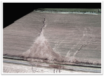
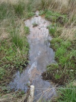
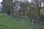
Using a standardised and complimentary approach, walkover and remote sensing surveys were undertaken in 2012/13 allowing us to identify the areas where pollution inputs were most likely to be occurring. Impacts were graded on a scale of Grade 1 to Grade 3; Grade 1 being the most severe. In total, 190 sources were identified, with 17 of these recognised as high priority ‘Grade 1’ sources. This standardised categorisation facilitated subsequent analysis, enabling key issues to be identified. Photographs and/ or video footage were taken at each location, depending on the severity of the issues identified along with comments to provide specific details of the observations made. Furthermore, the location of each source was recorded in the field using a GPS, enabling subsequent GIS analysis of the spatial distribution of sources to be undertaken.
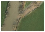
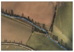
Using the data recorded during the walkover surveys, a wet weather sampling plan was established to ascertain the area’s most susceptible to pollutant inputs and to quantify the relative inputs. Under the appropriate wet weather conditions a team of field scientists from APEM were mobilised to the Worfe catchment and samples were taken at each of the pre-determined locations. During the wet weather sampling on the ground, high resolution imagery was also recorded from an aircraft to further identify sources of pollution and runoff pathways.
The combined data provided from the initial walkover survey and subsequent wet weather sampling allowed a more targeted approach in the areas of the catchment most likely to be having a negative impact on water quality. Agricultural visits were arranged in these high priority areas, providing targeted farm advice on controlling diffuse pollution in meetings with landowners. Farm information packs and action plans were produced to notify landowners of issues relevant to their business and implement practical solutions for diffuse pollution remediation. By taking this approach we have been able to implement solutions to reduce pollution and improve quality in the catchment.
We have developed a standardised approach that has been identified as best practice by the Environment Agencys and adopted by Natural England and Rivers Trusts amongst others. Identifying the issues is only the start. We are helping to provide the evidence base to address the issues. Ultimately knowing the problem is only the start and we are developing tools to provide solutions and make real changes. The catchment based approach is not only about understanding a catchment but making the changes to improve it.
The SRT has wider catchment restoration visions for the entirety of the River Severn watershed – notably in other high priority failing watercourses. The contribution of the Worfe restoration work to this vision is vital and the project aims to result in the improvements to at least 27 WFD elements and the status of all nine water bodies in the catchment by 2015. In addition, the improvement in water quality in the Worfe catchment will have wide ranging implications for the WFD categorisation of the River Severn as a whole and will contribute to measures actioned in the Midlands Catchment Flood Management Plans.
Lessons learnt
Complimentary catchment walkover and remote sensing approaches are increasingly being used to understand the issues facing a failing catchment. The most challenging aspect of the River Worfe Restoration Project has been the survey logistics, whether on the ground or in the sky. In order to survey such a large area in a relatively short space of time, good preparation is vital. To ensure successful capture of all potential sources at the walkover stage, the entire catchment must be surveyed, which can be supported by the use of high resolution imagery. GIS software is used along with detailed maps at the preparation stage to ensure that all of the watercourses within the catchment are covered, before leaving the office. This approach enabled large areas to be covered systematically and efficiently. There were also logistical challenges at the sampling stage of the process, as not only was a large team required to sample 51 individual sites throughout the catchment in the space of a few hours, but also the weather conditions had to be favourable.
Gaining the trust of stakeholders and land owners to make changes was key. It took time to build trust with them and this only occurred when we had credible evidence, presented in an understandable way which demonstrated clear improvements. Understanding the business of arable farming in the Worfe catchment and the practical challenges was key to gaining the trust and respect of stakeholders. High resolution digital imagery from APEM’s aerial surveys of the entire Worfe catchment proved to be a very effective tool for engaging interest and understanding among stakeholders. We also spent time developing an ongoing relationship with stakeholders using a continuity of people in contact with them.
Image gallery
|
Catchment and subcatchmentSelect a catchment/subcatchment
Catchment
Subcatchment
Other case studies in this subcatchment: Telford Catchment Restoration Project
Site
Project background
Cost for project phases
Reasons for river restoration
Measures
MonitoringHydromorphological quality elements
Biological quality elements
Physico-chemical quality elements
Any other monitoring, e.g. social, economic
Monitoring documents
Additional documents and videos
Additional links and references
Supplementary InformationEdit Supplementary Information
| ||||||||||||||||||||||||||||||||||||||||||||||||||||||||||||||||||||||||||||||||||||||||||||||||||||||||||||||||||||||||||||||||||||||||||||||||||||||||||||||||||||||||||||||||||||||||||||||

