Case study:River Valency at Boscastle
Project overview
| Status | Complete |
|---|---|
| Project web site | |
| Themes | Flood risk management |
| Country | England |
| Main contact forename | James |
| Main contact surname | Burke |
| Main contact user ID | |
| Contact organisation | Environment Agency |
| Contact organisation web site | http://www.environment-agency.gov.uk/ |
| Partner organisations | |
| Parent multi-site project | |
| This is a parent project encompassing the following projects |
No |
Project summary
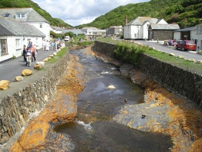
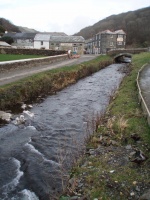
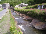
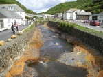
Boscastle village is located in a steep sided and narrow valley through which the River Valency flows down to the harbour. In 2004 an intense storm centred over the small wooded catchment caused massive erosion of sediment and river-side trees. This,combined with high flows, inundated the village with water and debris causing extensive damage.
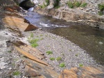
Enlargement of the river channel offered the only viable way to reduce flood risk and improve the flood capacity and sediment conveyance of the river. The scheme aimed to avoid producing a deep geometrically uniform’channel. The channel was designed in such a way that it simulated the natural features found higher up in the undisturbed reaches of the river by engineering features into the excavated bedrock.
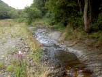
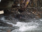
A detailed topographical survey of the longitudinal profile of the river was an important design tool. This enabled a new, lower bed gradient to be superimposed onto the original one, giving the ‘best fit’ with the levels upstream and downstream of the reach. The natural valley slope at Boscastle is 1 in 45 and the channel bed upstream of the village has a depth of approximately 2.5m. Extending this channel depth down through the village to the harbour, the longitudinal section showed the original bed to be typically 1 metre higher. This helped to explain the loss of capacity through the village and its propensity to flood. Bed regrading to this 2.5m depth profile was therefore considered feasible (Figure 6.4.2). The design of the cross section and longitudinal profile of the lowered bed involved close study of the natural characteristics of the rock visible in the upper river and in the harbour. The rock featured strong bedding planes that typically dip from left to right bank, angled downstream at about 45°. It had vertical fracture lines as well as regular intrusions of much harder quartz. Concept drawings were provided to show how the rock was to be removed. An engineer worked closely with machine operators to obtain the desired result of the left side sloping with the dip and the right side vertical along the fractures. Both sides were zig-zagged to stay within the'character' stone retaining walls.
Monitoring surveys and results
Lessons learnt
Image gallery
|
Catchment and subcatchmentSelect a catchment/subcatchment
Catchment
Subcatchment
Site
Project background
Cost for project phases
Supplementary funding informationThe exact cost of the river restoration element of this project is unknown. The project was part of a £6.3M (€7.3M) flood risk management scheme.
Reasons for river restoration
Measures
MonitoringHydromorphological quality elements
Biological quality elements
Physico-chemical quality elements
Any other monitoring, e.g. social, economic
Monitoring documents
Additional documents and videos
Additional links and references
Supplementary InformationEdit Supplementary Information
| |||||||||||||||||||||||||||||||||||||||||||||||||||||||||||||||||||||||||||||||||||||||||||||||||||||||||||||||||||||||||||||||||||||||||||||||||||||||||||||||||||||||||||||||||||||||||||||||||||||||||||||||


