Case study:River Ouse at Sharpsbridge Rock Ramp Fish Easement Project
Project overview
| Status | Complete |
|---|---|
| Project web site | |
| Themes | Fisheries, Flood risk management, Habitat and biodiversity, Hydromorphology, Water quality |
| Country | England |
| Main contact forename | Ian |
| Main contact surname | Dennis |
| Main contact user ID | |
| Contact organisation | Royal HaskoningDHV |
| Contact organisation web site | http://www.royalhaskoningdhv.com/ |
| Partner organisations | Environment Agency, Ouse and Adur Rivers Trust, C A Blackwell |
| Parent multi-site project |
Case_study:The Middle Ouse Restoration of Physical Habitats (MORPH) |
| This is a parent project encompassing the following projects |
No |
Project summary
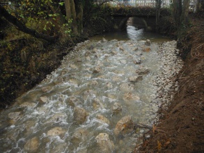
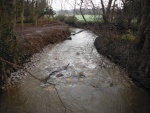
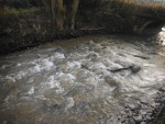
Sharpsbridge is a road bridge, with two culverts that carry flow under the road and an island in the channel downstream. The footings of the road bridge are formed of a solid concrete slab which acts as a weir, backing up flow. The height of the drop between the concrete slab and the water level was causing a barrier to fish passage. Previous work was undertaken to place rubble rock at the downstream extent of the concrete slab to enable fish migration; however, this began to function as an additional barrier. The aim of this project was to improve fish passage in one of the culverts, to allow free movement of fish upstream. In order to eliminate the barrier to fish passage, the water levels in the downstream weir pool were raised by the addition of a rock ramp structure.
Preparation
- The western channel was blocked using temporary dams and pumps to move water through the eastern side of the bridge. During high water flows, the dams were periodically removed to prevent flooding.
Works
- The existing rubble rock weir was removed.
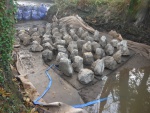
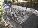
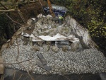
- A 4.5 m wide rock ramp was constructed in-situ, using granular fill and geotextile at the base, concrete at the upstream end, and rock armour forming the surface of the ramp.
- Kentish ragstone (a hard limestone) was used for the main perturbation boulders because of its durability.
- Rocks were positioned approximately equidistant, with increasing height of rocks upstream, to ensure a smooth gradient of flow over the former head drop.
Post-construction works
- Works to rectify the site compound were undertaken. Signs were erected to divert canoeists around the eastern channel.
Monitoring surveys and results
Lessons learnt
- The project team was able to draw upon experience from Belgium and The Netherlands to help determine the best layout of the large boulders on the ramp.
- Carbon calculators were used, and were able to highlight the transport of materials as a high carbon cost, leading to the successful sourcing of local materials to construct the ramp.
Image gallery
|
Catchment and subcatchmentSelect a catchment/subcatchment
Catchment
Subcatchment
Other case studies in this subcatchment: Spring Meadow Meander Restoration
Site
Project background
Cost for project phases
Reasons for river restoration
Measures
MonitoringHydromorphological quality elements
Biological quality elements
Physico-chemical quality elements
Any other monitoring, e.g. social, economic
Monitoring documents
Additional documents and videos
Additional links and references
Supplementary InformationEdit Supplementary Information
| ||||||||||||||||||||||||||||||||||||||||||||||||||||||||||||||||||||||||||||||||||||||||||||||||||||||||||||||||||||||||||||||||||||||||||||||||||||||||||||||||||||||||||||||||||||||||||||||

