Case study:River Monnow (Going Native)
Project overview
| Status | In progress |
|---|---|
| Project web site | http://www.monnow.org/ |
| Themes | Fisheries, Habitat and biodiversity |
| Country | England |
| Main contact forename | Robert |
| Main contact surname | Denny |
| Main contact user ID | |
| Contact organisation | Monnow Rivers Association |
| Contact organisation web site | http://www.monnow.org/ |
| Partner organisations | |
| Parent multi-site project | |
| This is a parent project encompassing the following projects |
No |
Project summary
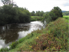
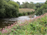
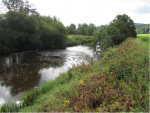
The River catchment was dominated by invasive non-native species, specifically American mink and Himalayan Balsam, as well as Japanese Knotweed and Giant Hogweed. Their presence in the catchment was having a significant effect not only on ecology, but also access for recreational activities such as walking and fishing.
Project objectives included:
• The identification of bankside areas affected by invasive non-native species
• Achieve catchment wide eradication of Himalayan Balsam (HB), Japanese Knotweed (JK) and Giant Hogweed (GHW)
• Maintain mink free status of the catchment (developed by the game and wildlife conservation trust) to monitor and control mink and reintroduce water voles to the River Dore
• Educate children, local community and other catchments about invasive non-native species and the River Monnow project
All sites with GHW and JK were mapped in 2007, as well as an estimation of the upper extent of HB sites on tributaries. Volunteers were used to spray and hand pulled large areas of HB which was repeated 3 or 4 times before the first frost. All HB sites were revisited several times to ensure no plants went to seed, and the control area was extended, again with the use of volunteers. After year 3 of treatments HB had been eradicated. This process of HB eradication was rolled out catchment wide using paid contractors, with follow up by volunteers. By Autumn 2012 70km of previously effected area will have had the initial treatment phase, with 25km of the catchment now HB free. GNW and JK was sprayed in the spring and treated in the autumn annually, however these were not widespread in the catchment. Costs for the last three years of work amount to £60,000 with 4,600 paid-for man hours and 1,200 voluntary hours. This equates to a figure so far of £822 per kilometre with an effort of 87 man hours per kilometre. Two more years of work are estimated (mainly hand-pulling and largely by volunteers), which would add a further 20% to those figures. The project has been funded by Environment Agency, Natural England and Tidy Towns Wales. Generous private donations from fishery owners and fund-raising by the association has added to the project budget. Mink have been monitored by volunteers, with captured numbers reducing to just 5 in 2007. Volunteers also annually monitor areas where water voles have been reintroduced, numbers and range are increasing. Two schools have been introduced to “the joys of Mayfly in the classroom”, to introduce children to the importance of healthy rivers and the connection between fishing and conservation. Produced and erected 100 signs on footpaths identifying the problem of Himalayan Balsam. By 2014 the project aims to have eradicated Himalayan Balsam from the catchment. Natural bankside vegetation is already re-established in many areas, significantly reducing erosion and sediment release.
Monitoring surveys and results
Lessons learnt
Image gallery
|
Catchment and subcatchmentSelect a catchment/subcatchment
Catchment
Subcatchment
Other case studies in this subcatchment: Kentchurch Weir Removal
Site
Project background
Cost for project phases
Supplementary funding informationCosts for the last three years of work (2010 to 2013) amount to £60,000 with 4,600 paid-for man hours and 1,200 voluntary hours. This equates to a figure so far of £822 per kilometre with an effort of 87 man hours per kilometre. Two more years of work are estimated (mainly hand-pulling and largely by volunteers), which would add a further 20% to those figures.
Reasons for river restoration
Measures
MonitoringHydromorphological quality elements
Biological quality elements
Physico-chemical quality elements
Any other monitoring, e.g. social, economic
Monitoring documents
Additional documents and videos
Additional links and references
Supplementary InformationEdit Supplementary Information
| ||||||||||||||||||||||||||||||||||||||||||||||||||||||||||||||||||||||||||||||||||||||||||||||||||||||||||||||||||||||||||||||||||||||||||||||||||||||||||||||||||||||||||||||||||||||||||||||||||||||||


