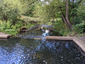
Case study:River Cole Restoration
This case study is pending approval by a RiverWiki administrator.
Project overview
| Status | In progress |
|---|---|
| Project web site | |
| Themes | Economic aspects, Environmental flows and water resources, Flood risk management, Habitat and biodiversity, Hydromorphology, Social benefits, Spatial planning, Water quality, Urban |
| Country | England |
| Main contact forename | Thomas |
| Main contact surname | Levick |
| Main contact user ID | User:Tlevick |
| Contact organisation | Sanctus Ltd |
| Contact organisation web site | http://www.sanctusltd.co.uk/ |
| Partner organisations | Environment Agency, University of Birmingham |
| Parent multi-site project | |
| This is a parent project encompassing the following projects |
No |
Project summary
The River Cole is situated within a green corridor running through East Birmingham, Solihull and Warwickshire. The area is historically impacted by industry, straightening and oversteepening. This project is vital for improving the catchment biodiversity, accessibility and water quality. The project is unique because of its placement within one of the largest and most industrialised cities in the UK. It incorporates a catchment-based approach with multiple weir removals, wetland additions, reconnection with flood plains and improvements to biodiversity , focusing on the projects within the scheme undertaken by Sanctus thus far in this urban setting (and as part of a wider 11 schemes).
Removing the weir at Tyseley unlocked one of the first major migration barriers on the Cole as well as ancillary tasks involving canopy thinning, invasive species management and general improvements. This project presented a large volume of flotsam management due the accumulation of a rubbish dam. This smaller removal of a 1m head structure started to address the real issues the length of the River Cole throughout Birmingham.
The large Ackers Weir structure created some 2.4m of head difference in the Cole and impounded contaminated silts. De-silting was conducted behind Ackers weir and along Tyseley brook which then required processing away from the river via bioremediation so that it becomes physically and chemically suitable for re-use on sit these treated materials were retained on site and formed into wildlife hibernacula to enhance habitat provision for reptiles, mammals and amphibians within the area. Utilising brash and site won materials
Sanctus implemented green engineering techniques to stabilise the riverbank by securing organic bio-degradable coir erosion control blankets to the new slope cuttings which incorporated a specifically selected native seed mix. Sympathetic rock rapids were arranged riverbed to provide naturalised erosion control and shelter for aquatic species. Whilst addressing and mitigating nick points. This erosion control will be helped with bank stabilisation from carefully selected native wildflowers, shrubs and trees to be planted.
To increase the rivers flood storage capacity and habitat diversity, the objectives for Kingfisher Park will be to create marginal shelves, widening the river corridor, with areas to act as buffers for the water overflow. The formation of meanders will re-naturalise the channel, as will the installation of berms and low-level riffles and gravel shoals. Combined they slow the flow of water, trap sediment and provide suitable habitat for aquatic species at different life stages.
Monitoring surveys and results
Pre-project baseline MoRPh surveys have been undertaken at Ackers Weir and at Heybarnes Recreation Ground. These Modular River Surveys will be used again to establish post-project changes.
The project has various degrees of monitoring, the lengthiest of these being the rigorous INNS (Invasive Non-Native Species) management plan in place targeting the Himalayan balsam (Impatiens glandiferula) along the banks of the river Cole. The plan predominantly targets Himalayan balsam, populations of Giant hogweed (Heracleum mantegazzianum) and Japanese knotweed (Reynoutria japonica) present on site will also be monitored.
Across all sites, Sanctus used automated continual monitoring upstream and downstream of the works. This ensures that the works were not negatively impacting the water quality, providing real time data for project partners, often showing a near immediate benefit in oxygenation levels.
Sanctus have provided 4 months of aftercare and bioremediation to materials taken from the river channel after the Ackers weir removal to improve contaminated material to form new habitats.
For the wider project, funding is being secured to create a programme of citizen science monitoring projects working with organised post-graduate and post doctorate researchers to establish monitoring across a wider range of subjects and disciplines including water quality, air quality, habitat monitoring.
Lessons learnt
Image gallery
|
Catchment and subcatchment
Site
Project background
Cost for project phases
Reasons for river restoration
Measures
MonitoringHydromorphological quality elements
Biological quality elements
Physico-chemical quality elements
Any other monitoring, e.g. social, economic
Monitoring documents
Additional documents and videos
Additional links and references
Supplementary InformationEdit Supplementary Information
| ||||||||||||||||||||||||||||||||||||||||||||||||||||||||||||||||||||||||||||||||||||||||||||||||||||||||||||||||||||||||||||||||||||||||||||||||||||||||||||||||||||||||||||||||||||||||


