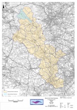
Case study:Peatland restoration project: Rivers Alport and Ashop
Project overview
| Status | Complete |
|---|---|
| Project web site | http://www.moorsforthefuture.org.uk/peatland-restoration-project-rivers-alport-and-ashop |
| Themes | Economic aspects, Flood risk management, Habitat and biodiversity, Hydromorphology, Monitoring, Peat, Water quality |
| Country | England |
| Main contact forename | Richard |
| Main contact surname | Vink |
| Main contact user ID | |
| Contact organisation | The National Trust for Places of Historic Interest or Natural Beauty |
| Contact organisation web site | http://www.moorsforthefuture.org.uk/peatland-restoration-project-rivers-alport-and-ashop |
| Partner organisations | Moors for the Future |
| Parent multi-site project | |
| This is a parent project encompassing the following projects |
No |
Project summary
The funding obtained from CRF will be used to implement a programme of moorland restoration aimed at improving the water quality in two river catchments within the Dark Peak SSSI. Many river catchments of the Dark Peak SSSI contain significant areas of bare and eroding peat, which is the dominant reason for failure of various waterbodies. There are significant correlations between levels of dissolved organic carbon (DOC), colour and organic phosphorus, and particulate organic carbon (POC) and metals in the water.
Works included:
Timber and stone dams creation; aerial spreading of lime/seeds/fertiliser; supply and spread bags of heather brash.
This project is one of 3 Multi-objective Flood Demonstration Catchment Projects funded by Defra in response to the Pitt review of the 2007 summer floods. The project aims to gather evidence on the impact of the stabilisation of bare and eroding peat on upland blanket bog habitat in the South Pennine Moors Special Area of Conservation (SAC). An ecological restoration toolkit used to 'restore' blanket bogs for Natural Flood Management (NFM) benefits was tested within 1ha experimental headwater catchments and attempts were made to identify the mechanisms through which NFM benefits are realised. The restoration method included blocking deep erosion gullies using timber and stone dams and revegetation of bare peat with a facultative grass crop that provided temporary stabilisation of the peat mass. The developing vegetation, in addition to several years of lime and fertiliser, helped to ameliorate environmental conditions and facilitate the subsequent diversification to a community typical of blanket bogs, including Sphagnum mosses. Modelling was carried out in the project both to upscale the results and to indicate how gully blocking techniques could be optimised for NFM benefit. An earlier study had found that water flow velocities were slower through Sphagnum than through grass/sedge vegetation (Holden et al. 2008), meaning that additional benefits are likely to be realised as Sphagnum becomes established. To 'fast track' this evidence, 36,000 sphagnum plants were planted in 2014 into one of the 1ha experimental catchments. Monitoring is ongoing with funding in place to continue until 2021, 9 years post stabilisation and 6 years after Sphagnum application.
Evidence from data collected for 3 years following bare peat stabilisation (involving revegetation with a facultative nurse grass crop) resulted in:
• statistically significant: reductions in peak storm discharge (37%)
• increases in storm-flow lag times (267%)
• increases in water tables (35mm)
• increases in overland flow production (18%)
There were no statistically significant changes in percentage run-off, indicating limited changes to within-storm catchment storage. Although there appeared to be some additional benefits of gully blocking, these were not statistically significant compared with the impacts of revegetation of bare peat alone. Stormwater moved through stabilised catchments more slowly, attenuating flow and storm hydrograph responses. The most important hydrological process response to stabilisation was a reduction in flow velocities associated with increased surface roughness following the establishment of vegetation cover, with these benefits largely realised within one year of intervention.
https://www.therrc.co.uk/sites/default/files/projects/35_moorsforthefuture.pdf
Monitoring surveys and results
Lessons learnt
Image gallery
|
Catchment and subcatchmentSelect a catchment/subcatchment
Catchment
Subcatchment
Site
Project background
Cost for project phases
Reasons for river restoration
Measures
MonitoringHydromorphological quality elements
Biological quality elements
Physico-chemical quality elements
Any other monitoring, e.g. social, economic
Monitoring documents
Additional documents and videos
Additional links and references
Supplementary InformationEdit Supplementary Information
| ||||||||||||||||||||||||||||||||||||||||||||||||||||||||||||||||||||||||||||||||||||||||||||||||||||||||||||||||||||||||||||||||||||||||||||||||||||||||||||||||||||||||||||||||||||||||||||||||||||||||

