Case study:Lustrum Beck Flood Alleviation Scheme: Phase 2
Project overview
| Status | In progress |
|---|---|
| Project web site | http://www.therrc.co.uk/sites/default/files/projects/21_lustrum.pdf |
| Themes | Flood risk management, Habitat and biodiversity, Hydromorphology, Land use management - agriculture, Land use management - forestry |
| Country | England |
| Main contact forename | Ted |
| Main contact surname | Thomas |
| Main contact user ID | |
| Contact organisation | Environment Agency |
| Contact organisation web site | http://www.gov.uk/government/organisations/environment-agency |
| Partner organisations | Stockton-on-Tees Borough Council, Forestry Commission, Newcastle University |
| Parent multi-site project | |
| This is a parent project encompassing the following projects |
No |
Project summary
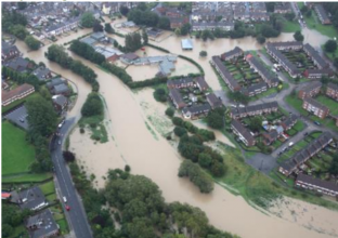
The Lustrum Beck catchment (Map 1) is located in Stockton-on-Tees and is a tributary of the Tees. It has been identified through an ISIS-TUFLOW model that over 150 properties are at risk of flooding in the catchment within 2 main areas: Oxbridge and Browns Bridge. For these sites, the Lustrum Beck Flood Alleviation Scheme (FAS) has been split into 2 phases. Phase 1 is well underway and consists of constructing more traditional flood defences in the urban area of the catchment. Phase 2 is currently in the development stage and will involve storing water at a range of scales in the upstream catchment area using natural processes to attenuate water. This case study focuses on Phase 2 in the Lustrum Beck catchment and how natural processes are being incorporated into the scheme to reduce downstream risk.
The model used identified that a total storage area of around 100,000m³ of storage within the local catchment area could reduce the discharge from the 1 in 100 year return period by 11.5%. This would reduce the peak flow of the 1 in 100 year event to less than 1 in 75 year event.
The Lustrum Beck project is the first flood risk management scheme to develop a business case which includes the use of Natural Flood Management (NFM) to successfully attract Flood Defence Grant in Aid (FDGiA) funding to reduce flood risk.
Monitoring surveys and results
Lessons learnt
Image gallery
|
Catchment and subcatchment
Site
Project background
Cost for project phases
Reasons for river restoration
Measures
MonitoringHydromorphological quality elements
Biological quality elements
Physico-chemical quality elements
Any other monitoring, e.g. social, economic
Monitoring documents
Additional documents and videos
Additional links and references
Supplementary InformationEdit Supplementary Information
| ||||||||||||||||||||||||||||||||||||||||||||||||||||||||||||||||||||||||||||||||||||||||||||||||||||||||||||||||||||||||||||||||||||||||||||||||||||||||||||||||||||||||||||||||||

