Case study:Lowdham NFM
Project overview
| Status | Complete |
|---|---|
| Project web site | |
| Themes | Flood risk management, Habitat and biodiversity, Land use management - agriculture, Monitoring, Water quality |
| Country | England |
| Main contact forename | Alan |
| Main contact surname | Graham |
| Main contact user ID | User:Alan Graham |
| Contact organisation | Trent Rivers Trust |
| Contact organisation web site | http://trentriverstrust.org |
| Partner organisations | Environment Agency, Nottinghamshire County Council |
| Parent multi-site project | |
| This is a parent project encompassing the following projects |
No |
Project summary
The villages of Lambley and Lowdham are situated on the Lambley Dumble/Cocker Beck and currently have 200 homes at significant risk of flooding. Several flood events in both villages have taken place in recent years. The watercourse is extremely flashy draining surface water from the edge of Nottingham. It flows in general within a steep sided wooded valley locally called a dumble, opening up as it approaches the villages.
As part of the Defra funded Natural Flood Management (NFM) Community projects, TRT have been asked to introduce Natural Flood Management (NFM) works which will complement the Environment Agency flood relief scheme for Lowdham in Nottinghamshire.
TRT have been able to determine areas suitable for NFM features in a lowland setting on both watercourses and overland pathways. The aim was to reduce peak flood flows, enhance biodiversity, improve water quality and increase community awareness and involvement.
Measures included a number of attenuation bunds, leaky barriers, tree planting, de-culverting and floodplain reconnection. Work commenced in January 2018 with landowner engagement and walkovers on the Lambley Dumble and Cocker Beck. Construction commenced in November 2018 with 18m of concrete culvert being removed allowing the creation of a new section of sinuous channel.
Monitoring surveys and results
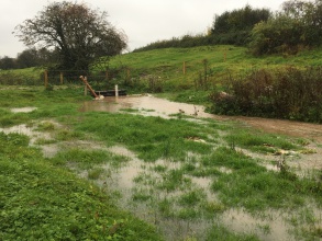
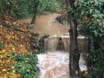
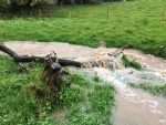
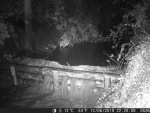
Individual NFM features have been monitored using time lapse photography to show how they function during high flows and show how the locations of the work recover and develop. Additional monitoring is ongoing to assess the impacts of NFM measures on suspended sediment concentrations regarding the bunds installed. Two turbidity sondes (one upstream and one downstream) have been installed to achieve this and assess the cumulative impact of the catchment-wide features.
Monitoring is continuing into 2020. Initial results indicate a reduction of sediment within the watercourse downstream of the floodplain reconnection. During peak flow the interventions are slowing the flow, pushing water onto the floodplain and reducing peak levels.
Lessons learnt
TRT felt that although the project was primarily to deliver NFM and evaluate its performance that we would be able to deliver multiply benefits to the waterbody. We have been successful in these aims and have taken a lot of lessons from the project.
- Do not under estimate the amount of time needed to engage with farmers, landowners and parish councils.
- Not everyone believes that NFM will work and some landowners will refuse to allow you to undertake the work on their land.
- TRT delivered over 50 interventions, which proved successful but the number was largely determined by opportunities that arose. For NFM to be really successful it needs to be upscale and delivered on a far broader scale.
- It is relatively easy to deliver leaky barriers, but more difficult to deliver river restoration, storage and wetland areas.
Image gallery
|
Catchment and subcatchmentSelect a catchment/subcatchment
Catchment
Subcatchment
Site
Project background
Cost for project phases
Reasons for river restoration
Measures
MonitoringHydromorphological quality elements
Biological quality elements
Physico-chemical quality elements
Any other monitoring, e.g. social, economic
Monitoring documents
Additional documents and videos
Additional links and references
Supplementary InformationEdit Supplementary Information
| ||||||||||||||||||||||||||||||||||||||||||||||||||||||||||||||||||||||||||||||||||||||||||||||||||||||||||||||||||||||||||||||||||||||||||||||||||||||||||||||||||||||||||||||||||||||||||||||||||||||||


