Case study:Kirkstall Valley Weir Fish Passes Project
Project overview
| Status | Complete |
|---|---|
| Project web site | |
| Themes | Environmental flows and water resources, Fisheries, Habitat and biodiversity, Social benefits, Urban |
| Country | England |
| Main contact forename | Kevin |
| Main contact surname | Sunderland |
| Main contact user ID | |
| Contact organisation | The Aire Rivers Trust |
| Contact organisation web site | http://www.aireriverstrust.org |
| Partner organisations | Environment Agency, Canoe England, Aire Action Leeds, Leeds City Council, the West Yorkshire CARP Group |
| Parent multi-site project | |
| This is a parent project encompassing the following projects |
No |
Project summary
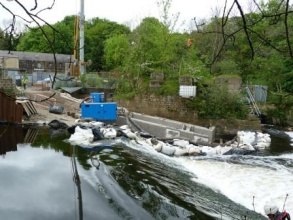
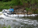
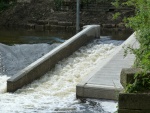
The outcome of the project is the improvement for fish passage around Kirkstall Island on the River Aire in Leeds by provision of fish passes at St Ann's Mills weir and Burley Mills weir. The fish passes will also benefit the other species which already inhabit the river but are prevented from reaching optimal spawning and feeding grounds.
The weirs are both situated on the left side channel (looking downstream) of Kirkstall Island. There are two weirs on the right side channel but careful consideration has led to the belief that fish will use the left side where the heavier flow is located.
Works include: The construction of two fish passes.
Monitoring surveys and results
Evidence suggests(although it cannot be categorically proved) that Salmon are getting past the Kirkstall weirs as a result of the project and other weir removals in the catchment.
Lessons learnt
Image gallery
|
Catchment and subcatchmentSelect a catchment/subcatchment
Catchment
Subcatchment
Other case studies in this subcatchment: Rodley weir by pass channel
Site
Project background
Cost for project phases
Reasons for river restoration
Measures
MonitoringHydromorphological quality elements
Biological quality elements
Physico-chemical quality elements
Any other monitoring, e.g. social, economic
Monitoring documents
Additional documents and videos
Additional links and references
Supplementary InformationEdit Supplementary Information For over 100 years the River Aire, from the Bradford area down to the river's confluence with the Ouse at Airmyn, was almost totally devoid of fish due to gross pollution. Following the alleviation of the pollution in the late 20th century, there are now fish populations along the full length of the river from the source near Malham down to the Ouse. Even though gross pollution has been eliminated, the Aire still suffers from a legacy of industrial and navigational weirs which have prevented the return of migratory fish and harmed the prospects of non-migratory species. The navigational weirs are still in use, and other weirs have been retained for various leisure and conservation reasons. This has meant that fish passes have had to be constructed so that the weirs no longer pose a complete barrier to fish movement. Over the last few years fish passes have been constructed at Castleford, Lemonroyd, Fleet, Rothwell Country Park, Thwaite Mills and Rodley. The fish passes at Burley Mills and St Ann's Mill in Kirkstall are the latest additions to this list. As part of the Leeds Flood Alleviation Scheme, a further two fish passes are planned to be built by 2016 at Knostrop and Crown Point in Leeds. There are strong possibilities for fish passes at a further four sites in the relatively near future. The various Yorkshire Rivers Trusts and the Environment Agency continue to look for further opportunities to add fish passes to Weirs on the Aire and other Yorkshire rivers in order to return the rivers to their full potential for fish and other wildlife.
| ||||||||||||||||||||||||||||||||||||||||||||||||||||||||||||||||||||||||||||||||||||||||||||||||||||||||||||||||||||||||||||||||||||||||||||||||||||||||||||||||||||||||||||||||||||||||||||||||||||||||


