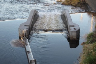
Case study:Hadfield Weir Fish Pass
Project overview
| Status | Complete |
|---|---|
| Project web site | http://www.dcrt.org.uk/hadfield-weir-at-meadowhall-sheffield |
| Themes | Economic aspects, Fisheries, Flood risk management, Habitat and biodiversity |
| Country | England |
| Main contact forename | Karen |
| Main contact surname | Eynon |
| Main contact user ID | User:KarenEynon |
| Contact organisation | Don Catchment Rivers Trust |
| Contact organisation web site | http://www.dcrt.org.uk |
| Partner organisations | |
| Parent multi-site project | |
| This is a parent project encompassing the following projects |
No |
Project summary
Originally the funding for this project was meant to build a fish pass at Sprotbrough weir in Doncaster but British Waterways (BW), the owners of the weir, had a last minute change of heart and announced that they were planning to install a hydro scheme on the weir. They were to use Small Hydro(SH) to build it. . The change required BW to install a fishpass as part of the construction. Despite the fact that a fishpass had already been designed it was essential that a new design was undertaken covering the hydro scheme and fishpass in order to provide an effective solution. As the construction had now become part of a commercial operation it was felt inappropriate for public money to be used. After consultation with ART and the EA the Trust withdrew its' offer of funding. The EA similarly withdrew its' funding from the project. However, approval was received from DEFRA, the EA and The Rivers Trust for the project funding to be transferred from the Sprotborough Weir project to the Hadfields Weir project.
Historically the rivers of South Yorkshire were heavily utilised for the requirements of industries such as coal and steel. The obstructions left over from these industrial days are now causing obstacles to the free passage for many species of fish thus suppressing the recovery of fish populations.
Hadfield Weir on the River Don is one of the major obstacles on the river. It is highly visible as it is located outside a very busy shopping centre that has a footfall of 30 million people; there is a busy cycle and footpath on the riverside which is part of the Five Weirs Walk that runs from the city centre.
Don Catchment Rivers Trust, almost entirely through the work of volunteers, managed to secure a not inconsiderable amount of money from the Defra River Improvement Fund to enable a multi-species fish and eel pass to be built. This will help to restore river connectivity for fish and eels in the River Don, allowing fish to move between habitats above and below the weir, essential if it is to be fully exploited for feeding, rearing and breeding.
This project is part of a wider scheme on the Don to allow fish passage and encourage the return of salmon. This iconic species is the ultimate indicator of clean, healthy rivers and would have economic as well as environmental impacts for the city of Sheffield
Monitoring surveys and results
Lessons learnt
No project is too big if you have the right people to back you!
The whole process of completing the project from inception through feasibility, design, engaging contractors and construction has been a major learning experience for the Don Catchment Rivers Trust.
The experience and proven track record gained will enable us to gain funding for more important river improvement projects.
Image gallery
|
Catchment and subcatchmentSelect a catchment/subcatchment
Catchment
Subcatchment
Site
Project background
Cost for project phases
Reasons for river restoration
Measures
MonitoringHydromorphological quality elements
Biological quality elements
Physico-chemical quality elements
Any other monitoring, e.g. social, economic
Monitoring documents
Additional documents and videos
Additional links and references
Supplementary InformationEdit Supplementary Information
| ||||||||||||||||||||||||||||||||||||||||||||||||||||||||||||||||||||||||||||||||||||||||||||||||||||||||||||||||||||||||||||||||||||||||||||||||||||||||||||||||||||||||||||||||||||||||||||||||||||||||||||


