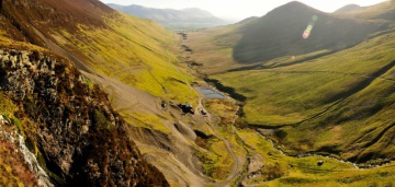
Case study:Force Crag Mine Remediation
Project overview
| Status | In progress |
|---|---|
| Project web site | |
| Themes | Habitat and biodiversity, Water quality |
| Country | England |
| Main contact forename | Hugh |
| Main contact surname | Potter |
| Main contact user ID | User:HPotter |
| Contact organisation | Environment Agency |
| Contact organisation web site | |
| Partner organisations | The Coal Authority (UK), Defra, National Trust, Newcastle University |
| Parent multi-site project | |
| This is a parent project encompassing the following projects |
No |
Project summary
Force Crag mine, worked for zinc, lead and barytes until 1991, was famously the last working mine in the Lake District. Mine water discharges and diffuse pollution from waste heaps mean it's a major source of cadmium, zinc and lead, depositing around 3 tonnes each year into the watercourse. The metals pollute the Coledale Beck and the Newlands Beck as far as Bassenthwaite Lake, and prevent these water bodies achieving good Chemical and Ecological status for the Water Framework Directive.
The site is now owned by the National Trust and run as a visitor attraction. It's within the Lake District High Fells SAC and two SSSI’s; Force Crag mine itself and Buttermere High Fells. It is also a Scheduled Monument.
We've been working in partnership with the Coal Authority, the National Trust and Newcastle University to develop a remediation scheme for this site with funding from Defra. The ‘vertical flow pond’ designed by Newcastle University is the first of its kind in the UK and uses compost, limestone and woodchips to remove metals from the water without the need for added energy or chemicals. This passive system works by passing the mine water down through the compost mixture where microbial activity binds the metals as sulphides, before discharging through a small wetland and into the Coledale Beck.
In September 2013, the Coal Authority began building the treatment scheme within the existing bunding of the former tailings lagoon. The National Trust and English Heritage supported the scheme as the next stage in the life cycle of this historic industrial site. On 31 March 2014, the valves were opened and mine water started filling up the ponds...
The system has now been operating for a year, and has removed over half a tonne of zinc. Although we're only treating some of the mine water flow (6 l/s), it's already making a significant difference to the water quality in the Coledale Beck since the scheme is removing >95% of the zinc, and >90% of the cadmium and lead. This is not yet enough for the river to achieve good status but we hope Bassenthwaite Lake will no longer fail the EQS for metals. Over the next couple of years we will see if the treatment system can cope with more of the flow without harming performance, and investigate how to deal with diffuse sources of metals in the catchment.
The benefits of cleaning up the Force Crag mine water are estimated to be up to £4.9m over 25 years, at a cost of~£1.5m.
Monitoring surveys and results
Lessons learnt
Image gallery
|
Catchment and subcatchmentSelect a catchment/subcatchment
Catchment
Subcatchment
Site
Project background
Cost for project phases
Reasons for river restoration
Measures
MonitoringHydromorphological quality elements
Biological quality elements
Physico-chemical quality elements
Any other monitoring, e.g. social, economic
Monitoring documents
Additional documents and videos
Additional links and references
Supplementary InformationEdit Supplementary Information
| ||||||||||||||||||||||||||||||||||||||||||||||||||||||||||||||||||||||||||||||||||||||||||||||||||||||||||||||||||||||||||||||||||||||||||||||||||||||||||||||||||||||||||||||||||||||||||||||||||||||||


