Case study:Cudworth dyke restoration project
Project overview
| Status | Planned |
|---|---|
| Project web site | http://http://www.yorkshirewater.com/our-environment/biodiversity/river-restoration-programme/cudworth-dyke-restoration-project.aspx |
| Themes | Environmental flows and water resources, Flood risk management, Habitat and biodiversity, Hydromorphology, Monitoring, Social benefits, Water quality, Urban |
| Country | England |
| Main contact forename | Kathryn |
| Main contact surname | Turner |
| Main contact user ID | User:Dr Turner |
| Contact organisation | Yorkshire Water |
| Contact organisation web site | http://http://www.yorkshirewater.com/our-environment/biodiversity/river-restoration-programme/cudworth-dyke-restoration-project.aspx |
| Partner organisations | |
| This is a parent project encompassing the following projects |
Project summary
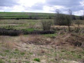
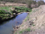
Sandybridge dyke is a small stream in the upper segment of Cudworth dyke, near Royston in South Yorkshire where we're trialling an innovative project to see whether habitat restoration can improve river water quality.
The stream runs between Rabbit Ings nature reserve, which was previously a colliery spoil heap, and a closed municipal land fill site and on through an industrial estate to reach it confluence with the River Dearne. As a result of its historical neighbours, the dyke is mostly man made, and in poor condition.
Yorkshire Water are undertaking research at this site, looking at natural ways to improve the quality of the water body. Due to its history and poor state, Cudworth Dyke makes the perfect case study for this research.
In 2013 we carried out an initial project to look at the pressures acting on this water way, including our own, and what could be done to improve water quality. We did this in conjunction with the Cudworth Dyke stakeholder group, our design specialists ARUP and government agencies such as the Environment Agency.
Following this research several practical habitat restoration actions were suggested. We will be trailing these in the upper section of the stream called Sandybridge dyke.
The Restoration of Sandybridge Dyke
Existing research published by the Journal of Applied Ecology suggests that restoration of rivers will deliver benefits to water quality. However due to the long term nature of the data sets required this has only rarely been demonstrated.
The restoration of Sandybridge Dyke will provide much needed data on whether river restoration can improve water quality.
With the kind permission and help of the landowners, The Land Trust and Barnsley Council, and with the support of Groundwork Dearne Valley who manage Rabbit Ings, we will be carrying out this restoration work from February 2014.
This will involve creating a new double meander in the dyke, altering a weir and digging out a dried reed bed, to bring faster flows and more oxygen to the waters. The new river route has been designed to take key detours, so that we don't damage the existing water vole population or the favourite roosting trees of key owl species who take up residence in the winter.
We are investiating how to best tend this type of work to reach key specialist contractors and partners to provide us with high quility outputs and the lowest cost. We have two year post monioring of key water quality metrics chemistry, macroinvertebrates, macrophytes and fish and aim to publish our findings good or bad to share this important test of river restoration to improve water quality.
Environmental Science in Action.
A key component of this project is monitoring of the water quality and the number and type of residents living in the river.
For two years before and two after our habitat restoration work on Sandybridge dyke, we have been and will continue to undertake detailed monitoring to be able to assess the impact of habitat restoration on water quality.
The data will contribute key evidence to support river restoration as a means to improve our post-industrial Yorkshire streams.
Monitoring surveys and results
We now have two years pre work monitoring chemistry, macroinvertebrates, macrophytes and fish which demonstrates that this section of the dyke is in poor condition . These will form a baseline for comparisons with two years post works assessment.
Lessons learnt
Origional cost estimates for the feasisbility and design of this work (180k) were too low, cost are now alomst double this value using our framework of providers. The use of tendering is now being investigated to allow us to procure directly to smaller more specialist providers and will provide a comparison for our future investment in approx 20 fish passage projects, when compared with other river restorations such as our projects at Ingbirchworth and Swinsty reservoirs that are being delivered down our corporate framwork.
Image gallery
|
Catchment and subcatchmentSelect a catchment/subcatchment
Catchment
Subcatchment
Site
Project background
Cost for project phases
Supplementary funding informationFunding has come from Yorkshire Waters National Environment Programme. Which investigates solutions to address reasons for failure under the water framework directive.
Reasons for river restoration
Measures
MonitoringHydromorphological quality elements
Biological quality elements
Physico-chemical quality elements
Any other monitoring, e.g. social, economic
Monitoring documents
Additional documents and videos
Additional links and references
Supplementary InformationEdit Supplementary Information
| |||||||||||||||||||||||||||||||||||||||||||||||||||||||||||||||||||||||||||||||||||||||||||||||||||||||||||||||||||||||||||||||||||||||||||||||||||||||||||||||||||||||||||||||||||||||||||||||||||||||||||||||||||||||||||||||||


