Case study:Bourne End Recreation Ground River Enhancement Project
Project overview
| Status | Complete |
|---|---|
| Project web site | http://http://www.chilternsaonb.org/news/261/19/River-Wye-Rebourne.html |
| Themes | Environmental flows and water resources, Fisheries, Habitat and biodiversity, Hydromorphology, Social benefits, Urban |
| Country | England |
| Main contact forename | Allen |
| Main contact surname | Beechey |
| Main contact user ID | User:ChilternChalkStreams |
| Contact organisation | Chilterns Chalk Streams Project |
| Contact organisation web site | http://www.chilternsaonb.org/chalk-streams |
| Partner organisations | Chiltern Rangers, Environment Agency, Foundation for Water Research, Revive the Wye, Wooburn Gree & Bourne End Parish Council |
| Parent multi-site project | |
| This is a parent project encompassing the following projects |
No |
Project summary
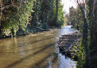
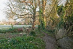
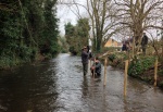
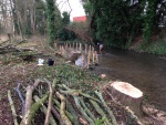
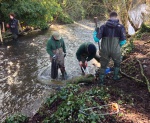
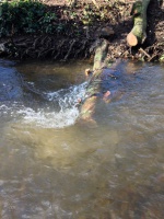
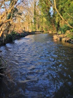
The purpose of the Project was to enhance river habitat along a 150m stretch of the R. Wye that borders Bourne End Recreation Ground in Buckinghamshire. Through a combination of tree management work and the installation of Woody Habitat structures, the scheme narrowed the previously over-wide channel and increased heterogeneity of flow and habitat. The scheme was designed to directly contribute to the R. Wye achieving Good Ecological Status under the Water Framework Directive. This project was one of three habitat enhancement Projects completed on the river in 2016 supported by the Catchment Partnership Action Fund. The Project was managed by the Chilterns Chalk Streams Project (CCSP) working in partnership with the Chiltern Rangers CIC, Environment Agency, Wooburn Green & Bourne End Parish Council under the banner of Revive the Wye a local community initiative. The work as carried out using a combination of specialist contractors (tree work) and volunteers. The project was funded by the CCSP, the Catchment Partnership Action Fund and the Chiltern Rangers CIC.
Monitoring surveys and results
Fixed point photography before, during & after the works.
Monthly riverfly monitoring - Anglers Riverfly Monitoring Initiative (commenced September 2015)
Lessons learnt
Site
| Name | Bourne End Recreation Ground |
|---|---|
| WFD water body codes | GB106039023880 |
| WFD (national) typology | Calcareous |
| WFD water body name | Wye (High Wycombe fire station to Thames) |
| Pre-project morphology | Over-widened, Straightened |
| Reference morphology | Chalk stream |
| Desired post project morphology | |
| Heavily modified water body | No |
| National/international site designation | |
| Local/regional site designations | |
| Protected species present | Yes |
| Invasive species present | Yes |
| Species of interest | Brown Trout, stone loach, bullhead (Cottus gobio), Otter (Lutra lutra) |
| Dominant hydrology | Chalk derived baseflow |
| Dominant substrate | Gravel |
| River corridor land use | Parklands garden, Urban |
| Average bankfull channel width category | 5 - 10 m |
| Average bankfull channel width (m) | |
| Average bankfull channel depth category | Less than 0.5 m |
| Average bankfull channel depth (m) | |
| Mean discharge category | |
| Mean annual discharge (m3/s) | |
| Average channel gradient category | |
| Average channel gradient | |
| Average unit stream power (W/m2) |
Image gallery
|
Catchment and subcatchmentSelect a catchment/subcatchment
Catchment
Subcatchment
Project background
Cost for project phases
Supplementary funding informationFunding contributions: £4,500 Chilterns Chalk Streams Project (incl. officer time) £2,300 Catchment Partnership Action Fund £1,250 Chiltern Rangers CIC (staff time) £150 River Chess Association (1 day at skilled volunteer day rate) £2,250 Volunteer time (30 volunteer days at unskilled day rate)
Reasons for river restoration
Measures
MonitoringHydromorphological quality elements
Biological quality elements
Physico-chemical quality elements
Any other monitoring, e.g. social, economic
Monitoring documents
Additional documents and videos
Additional links and references
Supplementary InformationEdit Supplementary Information
| ||||||||||||||||||||||||||||||||||||||||||||||||||||||||||||||||||||||||||||||||||||||||||||||||||||||||||||||||||||||||||||||||||||||||||||
