Case study:Washwalk Wetland

From RESTORE
Revision as of 17:59, 22 October 2024 by Stabilize7399 (talk | contribs)
Jump to navigation Jump to search


Project overview

Edit project overview
Status In progress
Project web site
Themes Habitat and biodiversity, Land use management - agriculture, Land use management - forestry, Social benefits, Water quality
Country England
Main contact forename Patrick
Main contact surname Hadow
Main contact user ID User:Stabilize7399
Contact organisation
Contact organisation web site
Partner organisations
Parent multi-site project
This is a parent project
encompassing the following
projects
No
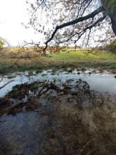
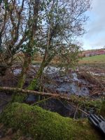
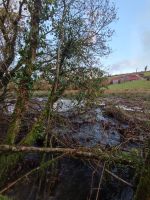
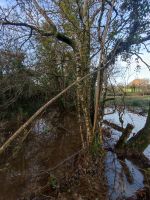
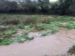
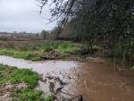
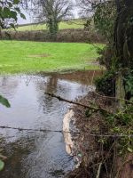
December 2023, photo of slow moving water during flash flooding

Project summary

Edit project overview to modify the project summary.


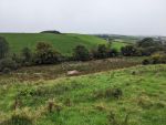
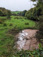
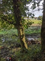
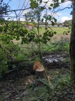
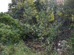
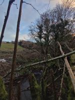
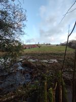
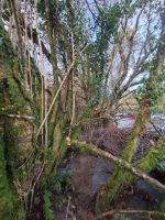
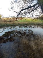
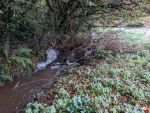
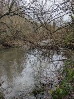
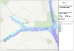
Beginning in 2022, the Washwalk Wetland project focuses on rewetting a 906m stretch of floodplain along the River Gara. The aim is to enhance the local environment by slowing water flow and reconnecting the channelised river to its floodplain through the felling of trees across and into the channel.

Monitoring surveys and results

Edit project overview to modify the Monitoring survey and results.


Monitoring has been primarily based on personal observations. Family and friends involved in the project have reported positive changes, such as increased water variability and enhanced vegetation growth along the banks. The presence of indicator bird species is used to track the project's success, with hopes of attracting more wader species. So far, kingfishers, mallards, herons, and little egrets have been observed.

Lessons learnt

Edit project overview to modify the lessons learnt.


This is an ongoing project still in its early stages. One key lesson learned is the importance of patience and continual observation. While initial signs of success, such as increased vegetation and bird sightings, are encouraging, long-term outcomes will require sustained monitoring and adaptive management. Engaging family and friends has also proven valuable, offering diverse perspectives and shared commitment to the project’s goals.


Image gallery


20241019 04816.jpg
20241019 104834.jpg
20241019 105046.jpg
20241019 105047.jpg
20241019 105713.jpg
PXL 20241016 091816213.MP.jpg
PXL 20241016 092624501.jpg
PXL 20241010 090057117.MP.jpg
PXL 20241010 091918205.MP.jpg
PXL 20241010 092102074.MP.jpg
IMG 20231208 082231.jpg
IMG 20231208 082321.jpg
IMG 20231208 082326.jpg
IMG 20231208 082329.jpg
IMG 20231208 082332.jpg
IMG 20231208 085345.jpg
IMG 20231208 085339.jpg
PXL 20231114 112758419.MP.jpg
PXL 20221231 141758900.MP.jpg
PXL 20221231 141733142.jpg
PXL 20230110 110853308.jpg
PXL 20230110 110848462.jpg
Screenshot 2024-10-21 at 16.33.13.png
ShowHideAdditionalImage.png


Catchment and subcatchment


Measures

Structural measures
Bank/bed modifications Introducing large woody debris, Re-introducing stones, Re-introducing gravel
Floodplain / River corridor Increases the interaction between land and water and the heterogeneity of the substrate; vegetation and shore structure
Planform / Channel pattern
Other
Non-structural measures
Management interventions
Social measures (incl. engagement)
Other


Site

Name
WFD water body codes
WFD (national) typology
WFD water body name
Pre-project morphology
Reference morphology
Desired post project morphology
Heavily modified water body No
National/international site designation
Local/regional site designations
Protected species present Yes
Invasive species present Yes
Species of interest otter (Lutra lutra), Brown trout (Salmo trutta), Water Vole, kingfisher
Dominant hydrology
Dominant substrate
River corridor land use
Average bankfull channel width category
Average bankfull channel width (m)
Average bankfull channel depth category
Average bankfull channel depth (m)
Mean discharge category
Mean annual discharge (m3/s)
Average channel gradient category
Average channel gradient
Average unit stream power (W/m2)
This case study is pending approval by a RiverWiki administrator.


0.00
(0 votes)


To discuss or comment on this case study, please use the discussion page.


Location: 50° 20' 29.04" N, 3° 41' 51.18" W
Loading map...
Left click to look around in the map, and use the wheel of your mouse to zoom in and out.


Project background

Reach length directly affected (m)
Project started
Works started
Works completed
Project completed
Total cost category
Total cost (k€)
Benefit to cost ratio
Funding sources

Cost for project phases

Phase cost category cost exact (k€) Lead organisation Contact forename Contact surname
Investigation and design
Stakeholder engagement and communication
Works and works supervision
Post-project management and maintenance
Monitoring


Reasons for river restoration

Mitigation of a pressure Abstraction, Invasive species, Agricultural Runoff and Pollution, Flood Protection Infrastructure
Hydromorphology Connection to groundwaters, Continuity for organisms, Flow velocities, Substrate conditions
Biology Fish, Fish: Abundance, Invertebrates: Diversity
Physico-chemical Nutrient concentrations
Other reasons for the project Bank erosion, Landscape enhancement, Recreation


Monitoring

Hydromorphological quality elements

Element When monitored Type of monitoring Control site used Result
Before measures After measures Qualitative Quantitative

Biological quality elements

Element When monitored Type of monitoring Control site used Result
Before measures After measures Qualitative Quantitative

Physico-chemical quality elements

Element When monitored Type of monitoring Control site used Result
Before measures After measures Qualitative Quantitative

Any other monitoring, e.g. social, economic

Element When monitored Type of monitoring Control site used Result
Before measures After measures Qualitative Quantitative


Monitoring documents


Additional documents and videos


Additional links and references

Link Description

Supplementary Information

Edit Supplementary Information