Case study:Rewilding the Rom
This case study is pending approval by a RiverWiki administrator.
Project overview
| Status | In progress |
|---|---|
| Project web site | http://www.thames21.org.uk/improving-rivers/rewilding-the-rom/ |
| Themes | Flood risk management, Habitat and biodiversity, Monitoring, Social benefits, Water quality, Urban |
| Country | England |
| Main contact forename | Carolina |
| Main contact surname | Pinto |
| Main contact user ID | User:TylerThames21 |
| Contact organisation | Thames 21 |
| Contact organisation web site | http://www.thames21.org.uk |
| Partner organisations | London Borough of Barking and Dagenham, Environment Agency, Essex and Suffolk Water (Northumbrian Water), Kusuma Trust, Land of the Fanns, Thames Chase, Mayor of London |
| Parent multi-site project | |
| This is a parent project encompassing the following projects |
No |
Project summary
The River Rom, south of Roneo Corner, is heavily degraded. Straightening has resulted in the river losing much of the natural flow and habitat diversity that is needed to support rich biodiversity. It has also resulted in the loss of much of the river’s connectivity to its floodplain. This means the Rom lacks many of the associated wetland habitats that would slow the speed of destructive floodwaters and support the area's biodiversity.
The Rewilding the Rom project presented a rare opportunity to restore natural functioning to an urban river in London and in doing so, increase the rivers resilience to the compounding effects of climate change. Project aims are broadly fourfold; providing both offline and online flood storage, increasing resilience of downstream communities; diversifying the Chase Local Nature Reserves (LNR) habitat to support biodiversity; improving water quality of the Rom; and connecting communities to their river and environment. By providing these multiple benefits, this project demonstrates measures to address the biodiversity crisis are often closely intertwined with improving local communities' resilience to climate change.
In 2021, Land of the Fanns Partnership Scheme funding facilitated the excavation of two seasonal wetlands (scrapes) on the Havering Side of the River Rom, in Grenfell Park to protect flood-prone properties downstream of the site. While the primary purpose of the scrapes is flood protection, they also provide habitats for flora and fauna. Flood modelling has been completed, showing that the scrapes, along with the other interventions, contribute to a reduction in flood risk to several downstream properties and the locally important Maylands Health Centre which currently serves 10% of Havering’s population.
Subsequently, eleven large wood deflectors have been installed in the River Rom, and a tributary has been realigned with the goal of diversifying the flow within the channel. By restoring sedimentary processes, different habitats are created to support fish spawning, invertebrates and other riverine species. Visual inspections of the deflectors indicate that they are generating new erosional and depositional features.
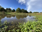
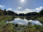
In 2022, Thames21 began work on the opposite bank at the Chase LNR. These works involved breaching a large flood embankment in three locations, behind which three interconnected wetland scrapes have been excavated. In high flows, the river now floods into this newly connected area of floodplain, creating an area of species-rich seasonal wetland. BEPERP, who are monitoring the Rom as part of their project, have found improvements in biological indicators already.
Monitoring surveys and results
Project progress has been monitored in a number of ways:
Through fixed point photography (FPP);
Aerial drone footage;
MoRPh surveys;
Macroinvertebrate (RMI);
Wildlife surveys to assess the reinstatement of native species.
As most of the major restoration works were completed by Thames21 in the spring of 2023, BEPREP research at ‘time zero’ in a rewilded wetland started (report attached as supporting file). Sampling began in April 2023, with a second session in August of the same year; sampling will continue with two sessions in 2024.
In addition, Thames21 are measuring the impact of the project on the local community by the number of participants in volunteering and other nature-related activities (e.g. nature walks, discussions, nature/art workshops). The aim is to achieve meaningful points of direct contact with at least 600 people including those from underrepresented communities (ethnic minorities and low-income groups).
The effort to restore natural processes on the Rom is demonstrated by several indicators that are tracked and evaluated via surveys, anecdotal evidence, and media coverage.
The Horizon funded BEPREP project, researches the effects of rewilding on improving health resilience. At the project site, biological indicators were measured both immediately after excavation and for five years post- restoration. The first few data points demonstrate that, especially the new wetland scrapes, have shown improved biological outcomes and shown which flora and fauna are settling at the site.
Specific indicators include microbiota (bacteria and fungi) changes in the water (e.g. amphibians), on the land (e.g. soil, arthropods, vegetation, micromammals, canids) and in the air (e.g. bats, birds). This research will provide crucial information on which flora, fauna and microorganisms colonise and interact in newly excavated urban wetlands and is fundamental for the sustainable management of aquatic urban environments, and for understanding their importance to human health. The first few data points demonstrate that, especially the new wetland scrapes, have shown improved biological outcomes and shown which flora and fauna are settling at the site.
We are using data from citizen science and observational monitoring, as well as advanced molecular analysis techniques (using environmental DNA) to measure the changes in macro and micro biodiversity of the restored wetlands and nearby forests (Report provided in the ‘Supporting Documentation’ section F1). Preliminary results already show arthropods, amphibians and reptiles colonising the new wetlands. Particularly noteworthy discoveries include molecular identification of faecal pellets from water voles, a nationally rare species.
Records from Fixed Point Photography (FPP) provide a visual record of the changes that are taking place; comparison photos from before and after the restoration work effectively show how the Rom and its floodplain have changed. These images provide a good view of the project impacts through increased river-land interface connectivity and the instigation of natural processes.
To ensure that large wood structures are performing their intended purpose, periodic assessments took place. The maintenance assessment included the characterisation of the structures in terms of stability and an assessment of material integrity and deterioration. After the large wood installation period, in December 2021, we carried out monthly visits for the first 6 months, and then bimonthly visits for the remainder of the first years. After this, we assessed the large wood every six months.
Anecdotal feedback from local communities and stakeholders further reinforces the success of our restoration project. Through our regular volunteering events we gathered valuable insights from the community, from appreciation of improvements to habitat quality to new recreational opportunities, such as the use of the new bridge for bird watching. In addition, the dissemination of information about our project through news articles, videos, and interviews emphasised the beneficial effects of our restoration efforts on the RBI catchment area.
Lessons learnt
Image gallery
|
Catchment and subcatchment
Site
Project background
Cost for project phases
Reasons for river restoration
Measures
MonitoringHydromorphological quality elements
Biological quality elements
Physico-chemical quality elements
Any other monitoring, e.g. social, economic
Monitoring documents
Additional documents and videos
Additional links and references
Supplementary InformationEdit Supplementary Information
| ||||||||||||||||||||||||||||||||||||||||||||||||||||||||||||||||||||||||||||||||||||||||||||||||||||||||||||||||||||||||||||||||||||||||||||||||||||||||||||||||||||||||


