Case study:The Middle Ouse Restoration of Physical Habitats (MORPH)
Project overview
| Status | Complete |
|---|---|
| Project web site | |
| Themes | Environmental flows and water resources, Flood risk management, Habitat and biodiversity |
| Country | England |
| Main contact forename | Mark |
| Main contact surname | Bennett |
| Main contact user ID | |
| Contact organisation | Environment Agency |
| Contact organisation web site | |
| Partner organisations | Ouse and Adur Rivers Trust, Royal HaskoningDHV |
| This is a parent project encompassing the following projects |
River Ouse at Sharpsbridge Rock Ramp Fish Easement Project, Spring Meadow Meander Restoration |
Project summary
The Middle Ouse Restoration of Physical Habitats (MORPH) project is an ambitious and visionary project which aims to transform the River Ouse in Sussex led by the partnership of the Environment Agency and the Ouse & Adur Rivers Trust (OART) and supported by Royal HaskoningDHV (providing design, engineering and environmental consultancy services) and C A Blackwell (contractor for the implementation works).
The river was historically enlarged and straightened to allow navigation and drain the floodplain, and a large number of weirs and sluices were installed to support milling. As a result, the rivers do not provide the full range of habitats expected and fish populations are not as good as they could be. Two hundred years on, the River Ouse and Adur catchment was selected as one of 10 Environment Agency-led pilot catchments in which to test different approaches for partnership working under the new Catchment Based Approach (CaBA) to collaborative Water Framework Directive (WFD) implementation.
The £1 million MORPH project, which was funded through the Catchment Restoration Fund, was established to deliver significant improvements to the ecology of the catchment by renaturalising the watercourse and reversing the impact that historical modifications have had on the catchment. The project had two main aims:
- To implement the objectives of the WFD by improving fish passage and the hydromorphology of the river.
- To implement natural flood management actions identified within the River Ouse Catchment Flood Management Plan, by increasing floodplain water storage to alleviate flooding downstream.
In order to deliver these aims, the project has so far:
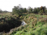
- Removed a redundant weir at Buxted Park, seeded gravel in the channel and allowed natural processes to operate on the river bed and banks in a controlled way.
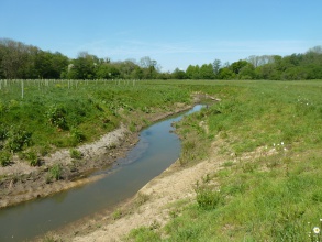
- Bypassed a second structure at Spring Meadow, creating a nature-like channel with a diverse range of habitats that is well connected to its floodplain.
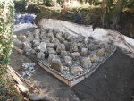
- Installed a rock ramp (the first of its kind in the UK) to allow fish to pass upstream of a culvert beneath a historic road bridge.
The river restoration works have renaturalised the river and delivered significant benefits for the ecology of the river and floodplain. Improving fish passage has helped priority fish species listed in the UK Biodiversity Action Plan as needing conservation action, and more natural in-channel and floodplain habitats have contributed towards delivering WFD requirements. The Buxted Park and Sheffield Park schemes have also helped to reconnect the river to its floodplain and encourage more frequent flooding, contributing to a reduction in flood risk to sensitive areas downstream.
In addition to these tangible on-the-ground achievements, the project has demonstrated that catchment partnerships can be extremely successful in delivering considerable results in a short period of time. This has galvanised local support, resulting in volunteers planting a wet woodland and other landowners actively exploring river restoration opportunities.
Monitoring surveys and results
The project is regarded by the partnership and other organisations as being extremely successful. Key evidence of this success includes:
- alongside fisheries surveys, botanical and invertebrate surveys, the partnership is U. The geomorphological surveys have highlighted minor adjustments that demonstrate that natural processes are operating as intended. H, it is provide of the ecological
- The project has enabled a sustainable partnership to be established between the different organisations that have been involved. The partnership continues to be very strong, with an established group of volunteers and several landowners (including the National Trust) expressing a strong interest in undertaking river restoration with the wider partnership on their land. The project team consider this to be an important indicator of a successful project.
- The MORPH project was the winner of the Professional Category in the prestigious Wild Trout Trust Conservation Awards 2013. In addition, the project was Highly Commended in the Sustainability and Environment Category of the Institution of Civil Engineers South East Engineering Excellence Awards 2013. This recognition by two leading independent bodies clearly demonstrates the success of the project in delivering real environmental benefits on the ground, successfully restoring natural processes, and raising the local profile of river restoration.
- This recognition is also reflected in the selection of the project to be showcased at the 2013 European River Restoration Conference and the 2013 River Restoration Centre Annual Networking Conference.
- Furthermore, the project has received coverage in the national press, being featured heavily in an article in the February 2014 The Environment Magazine entitled “Partnership Pays” published by the Chartered Institution of Water and Environmental Management.
- The project has been a high profile project in the Sussex area, receiving coverage in the local press, local blogs and websites along with being featured on the BBC News. Articles have also been published in the Mid Sussex Times and The Sunny Times for Buxted Park.
- The BBC South East Today news programme covered the project in November 2012 and held interviews with project team members at Spring Meadow, focussing on river restoration and ecology. The segment also included flyovers of the site pre-works.
- The Environment Agency and Royal HaskoningDHV have been presenting elements of the project to other areas of the Environment Agency South East region promoting the team’s achievements and promoting the good design, construction and programme management achievements.
- Tand project implementation, .
Lessons learnt
One of the key challenges of working at a catchment scale was rationalising catchment-wide WFD pressures and prioritising actions so that the greatest environmental and social benefits could be progressed. As in any catchment with a wide range of stakeholders, it has also been a great challenge to ensure that environmental requirements are balanced with the needs of local stakeholders. We have been able to overcome these challenges by working closely with stakeholders and developing a strategic plan which determines priorities and identifies “quick win sites” where limited constraints can allow construction to be progressed within a limited funding window.
keyfor OARTthe The key lessons learned while addressing these challenges and delivering the project include:
- The most important lesson is that pre project work in getting public and focused stakeholder support is vital in achieving the objectives. By working closely with landowners and other stakeholders at the beginning, listening to their concerns and incorporating these into initial designs, the projects run smoothly and at a faster pace as there is agreement right from the start.
Effective partnership working can enable delivery in a short time when funding is secure. On the ground input from the OART catchment officer has greatly assisted the Environment Agency in building and maintaining partnerships.
- The phased approach to design and construction allows lessons and best practice to be shared across sites. This ensures that the projects successfully deliver maximum benefits in an efficient and effective way.
- Ensuring that the projects deliver wider environmental and social objectives has helped to guarantee the success of the project and maintain widespread support.
- There is a clear requirement to manage stakeholder expectations through the project implementation stage so they are not surprised when sites get temporarily messy during construction.
- Investment at the quick win sites has acted as a catalyst to encourage other groups to undertake improvement works at different sites in the catchment.
The lessons learnt from these projects will be used by the Environment Agency and OART to guide their future catchment restoration activities in the Ouse and Adur catchments. The lessons can also be applied to other catchments as part of the Environment Agency’s Catchment Based Approach to WFD implementation.
Image gallery
|
Catchment and subcatchmentSelect a catchment/subcatchment
Catchment
Subcatchment
Site
Project background
Cost for project phases
Reasons for river restoration
Measures
MonitoringHydromorphological quality elements
Biological quality elements
Physico-chemical quality elements
Any other monitoring, e.g. social, economic
Monitoring documents
Additional documents and videos
Additional links and references
Supplementary InformationEdit Supplementary Information
| ||||||||||||||||||||||||||||||||||||||||||||||||||||||||||||||||||||||||||||||||||||||||||||||||||||||||||||||||||||||||||||||||||||||||||||||||||||||||||||||||||||||||||||||||||||||||||||||


