Case study:Bristol Frome Diffuse Pollution Project
Project overview
| Status | Complete |
|---|---|
| Project web site | |
| Themes | Habitat and biodiversity, Land use management - agriculture, Water quality |
| Country | England |
| Main contact forename | Harriet |
| Main contact surname | Alvis |
| Main contact user ID | User:H.alv |
| Contact organisation | Bristol Avon Rivers Trust |
| Contact organisation web site | http://www.bristolavonriverstrust.org |
| Partner organisations | |
| Parent multi-site project | |
| This is a parent project encompassing the following projects |
No |
Project summary
The Bristol Frome Diffuse Pollution Project is a project led by Bristol Avon Rivers Trust (BART) from June 2015 – March 2016, as part of the Bristol Avon Catchment Partnership. The project has been conducted in partnership with the Farming and Wildlife Advisory Group (FWAG) South West and the farmers and landowners along the Ladden Brook and Bradley Brook which form the headwaters of the Bristol Frome. It has been driven by Water Framework Directive classifications that have shown a need to identify issues and take actions to contribute towards a reduction in the levels of sediment and nutrients entering the Bristol Frome and its tributaries.
Reports commissioned by the Environment Agency suggested that a focus on agricultural practices within the streams of the upper Bristol Frome catchment should be carried out as a priority and pre-requisite to further improvement works. Therefore, the Bristol Frome Diffuse Pollution Project chose to focus on two agriculture dominated brooks, The Ladden and Bradley Brooks in order to achieve the overall aim of reducing nutrient and sediment inputs from diffuse agricultural sources.
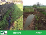
Baseline and wet weather monitoring, farmer engagement and advisory visits, walkover surveys and past Environment Agency data was used to assess areas for capital improvements to be made that would have the greatest impact for the timescale and funding available. These were decided upon as fencing to reduce bank erosion and an in-ditch wetland to separate clean water from dirty yard run-off that was previously entering the brook.
Monitoring surveys and results
Baseline and wet weather phosphate, turbidity and dissolved oxygen monitoring and invertebrate monitoring.
Main findings:
-Phosphate concentrations measured during this study were high enough to cause WFD failure at every site, suggesting high levels of diffuse pollution throughout the catchment.
-Particularly high phosphate concentrations recorded during during dry-weather conditions in the lower reaches of the Ladden Brook, were accompanied by low dissolved oxygen and elevated turbidity. This requires further investigation as a high priority.
-Historic DO concentration in the Bradley Brook has steadily increased over the last 35 years, suggesting an improvement in water quality over time.
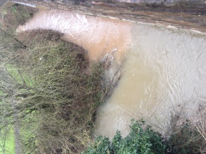
-The flood defence impoundment at Three Brooks Nature Reserve appears to be causing significant issues for turbidity and dissolved oxygen upstream in the Bradley Brook.
-There is a need for a future regular monitoring scheme on the brooks, including during wet weather events, if pollution sources are to be identified and resolved.
Lessons learnt
Both the Ladden and the Bradley Brooks are suffering biologically and physico-chemically due to agricultural run-off. Whilst the improvements made during the course of this project will help to reduce these issues to some extent, the catchment requires a much larger programme of improvements in order to make a measurable difference.
Image gallery
|
Catchment and subcatchmentSelect a catchment/subcatchment
Catchment
Subcatchment
Site
Project background
Cost for project phases
Reasons for river restoration
Measures
MonitoringHydromorphological quality elements
Biological quality elements
Physico-chemical quality elements
Any other monitoring, e.g. social, economic
Monitoring documents
Additional documents and videos
Additional links and references
Supplementary InformationEdit Supplementary Information
| ||||||||||||||||||||||||||||||||||||||||||||||||||||||||||||||||||||||||||||||||||||||||||||||||||||||||||||||||||||||||||||||||||||||||||||||||||||||||||||||||||||||||||||||||||||||||||||||||||||||||


