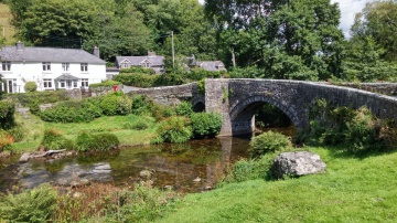
Case study:3Rivers - Lumburn:Walkham:Tavy
This case study is pending approval by a RiverWiki administrator.
Project overview
| Status | In progress |
|---|---|
| Project web site | http://http://wrt.org.uk/project/3rivers-project/ |
| Themes | Water quality |
| Country | England |
| Main contact forename | Hazel |
| Main contact surname | Kendall |
| Main contact user ID | User:David chapman |
| Contact organisation | Westcountry Rivers Trust |
| Contact organisation web site | http://wrt.org.iluk |
| Partner organisations | Devon Wildlife Trust, South West Water, Tamar Valley AONB, Tavy Walkham and Plym Fishing Club |
| Parent multi-site project | |
| This is a parent project encompassing the following projects |
No |
Project summary
The project focused on Water Framework Directive Failures on these three rivers which largely related to phosphate inputs. There are a range of diffuse and point source phosphate inputs into these rivers from both rural and urban sources. We worked with partners to contact farmers who were likely to be having impacts through their land based activities and households who may have impacts through the use of non-mains foul drainage systems.
26 farm visits and associated integrated farm plans were undertaken, three agricultural events were attended and three agricultural demonstrations were delivered (soil decompaction, cross compliance, efficient slurry spreading). Three farm grants (surface water management x 2, streamside fencing) were also completed.
With regard to urban drainage, over 100 of the most vulnerable properties on non-mains drainage were visited to disseminate information on the recently introduced General Binding Rules. Local estate agents were also contacted to help disseminate information on the General Binding Rules as were the caravan/ campsites in this area (8).
Other actions included the completion of 15km of river walkover surveys, engaging and training 14 volunteers, and half a hectare of native broadleaf woodland was planted.
Monitoring surveys and results
Water chemistry testing was regularly undertaken as part of the project to help identify phosphate sources. This testing was undertaken by Westcountry Rivers Trust and Students from Plymouth University. A more detailed study of metals in these rivers was also undertaken to help to understand more fully the historical issue with regard to heavy metals in the catchments.
Lessons learnt
Relatively short term projects (12 months or less) such as this make it difficult to build moment to any degree and identify and contact the most relevant land/ home owners with regard to impact on the rivers. Higher impact farms, such as the larger dairy units are particularly difficult to engage. Householders on non-mains drainage are also difficult to engage with through the normal methods such as attendance at events and markets etc.; the most effective way of engaging with non-mains drainage householders was through cold calling.
Good numbers of volunteers were available for tasks such as the undertaking of walkover surveys.
Landowners were reticent to plant trees, generally because land is being used for agricultural and the grants available for tree planting aren't significant.
Further water quality monitoring is required to provide greater details of phosphate and other pollution inputs.
Image gallery
|
Catchment and subcatchmentSelect a catchment/subcatchment
Catchment
Subcatchment
Site
Project background
Cost for project phases
Reasons for river restoration
Measures
MonitoringHydromorphological quality elements
Biological quality elements
Physico-chemical quality elements
Any other monitoring, e.g. social, economic
Monitoring documents
Additional documents and videos
Additional links and references
Supplementary InformationEdit Supplementary Information
| ||||||||||||||||||||||||||||||||||||||||||||||||||||||||||||||||||||||||||||||||||||||||||||||||||||||||||||||||||||||||||||||||||||||||||||||||||||||||||||||||||||||||||||||||||||||||||||||||||||||||


