Case study:Saving Chiswick Eyot
Project overview
| Status | In progress |
|---|---|
| Project web site | http://www.savingchiswickeyot.com |
| Themes | Economic aspects, Environmental flows and water resources, Fisheries, Flood risk management, Habitat and biodiversity, Hydromorphology, Land use management - forestry, Monitoring, Social benefits, Water quality, Urban |
| Country | England |
| Main contact forename | Martin |
| Main contact surname | Richardson |
| Main contact user ID | User:Mobilitydream |
| Contact organisation | Natural History Museum |
| Contact organisation web site | http://www.nhm.ac.uk |
| Partner organisations | Royal Holloway University of London, MoLA, Fullers Brewery, University of Leicester, Thames21, Port of London Authority, DHI, Thames Tideway, The British Geological Survey |
| This is a parent project encompassing the following projects |
Project summary
Project team
Dr. Dave Morritt, Royal Holloway University of London. Dr. Paul Clark, Natural History Museum, London. Martin Richardson, PhD student RHUL & NHM.
Project
Chiswick Eyot is a small, historically important island in the Thames near Chiswick Mall that is subject to erosion. We are working with an ‘ecosystem’ of partners to address the problem of maintaining the island employing best practice techniques. An initial 3D scan of almost the entire island was conducted in 2016 in association with the University of Leicester and Leica Geosystems. The scan was repeated in 2017. Analysis of the scans will provide greater understanding of the processes at work and enable visualisation of any changes occurring as well as determination of the rate of erosion. In addition, several hundred digital photographs were taken of areas of particular interest over a 3 year period to provide a visual record, these will also be used to develop point clouds as supplementary data.
Bi-monthly conventional topographic surveys of part of one bank were undertaken by MoLA in 1999 and 2000 allowing for decadal scale assessment of the erosion rate. High resolution aerial photographs and digitized historical Ordnance Survey maps are available dating back to at least the 1930s and these will be used to assess changes in surface area and any migration of the banks generally. We have engaged with the local community and formed partnerships with other organisations including Thames 21, the River Restoration Centre, Leica Geosystems, DHI, MoLA, and Royal Holloway University of London.
Monitoring surveys and results
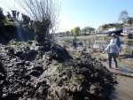
Very accurate baseline surveys have been completed.Preliminary assessment indicates a current rate of retreat of the banks at around 1m per decade, or approximately 10cm annually.A large amount of material has accumulated behind the facines which are being well maintained.
Lessons learnt
Restoration work using traditional willow withes has resulted in improved overall appearance and accretion to some areas of the bank. Vegetation is not growing in the silt perhaps because of a lack of oxygen. Seepage from the bank toe area is keeping the silt mobile in some areas. The current approach employed by Thames21 of incremental maintenance appears to be successful and demonstrates a very good cost vs. benefit ratio, especially since partners have started to make contributions towards costs. Withies planted on the flat surface of the island by the Old Chiswick Preservation Society are growing well and the willow holt, which is pollared annually, appears to be in very good condition. The withies produced by the pollarding are then bundled by the OCPS and volunteers and used to provide structure behind the fascines.
It might be useful at this point to consider additional techniques such as rolls of rocks (rocks bundled into mesh 'socks') at the areas of the bank toe with seepage but it is unknown currently if this is permitted in the area. Thames21 has also mentioned using different species of aquatic plants.
Image gallery
|
Catchment and subcatchmentSelect a catchment/subcatchment
Catchment
Subcatchment
Other case studies in this subcatchment: Barking Creek near A13, Barking Creekmouth, Chambers Wharf, Cuckolds Haven Nature Area, Greenwich Peninsula, Lower River Roding Regeneration Project, Mill Pool, Wandsworth Riverside Quarter
Site
Project background
Cost for project phases
Reasons for river restoration
Measures
MonitoringHydromorphological quality elements
Biological quality elements
Physico-chemical quality elements
Any other monitoring, e.g. social, economic
Monitoring documents
Additional documents and videos
Additional links and references
Supplementary InformationEdit Supplementary Information
| ||||||||||||||||||||||||||||||||||||||||||||||||||||||||||||||||||||||||||||||||||||||||||||||||||||||||||||||||||||||||||||||||||||||||||||||||||||||||||||||||||||||||||||||||||||||||||||||||||||||||


