Case study:River Adur - Shipley weir removal
Project overview
| Status | Complete |
|---|---|
| Project web site | |
| Themes | Fisheries, Flood risk management, Habitat and biodiversity, Hydromorphology |
| Country | England |
| Main contact forename | Gareth |
| Main contact surname | Williams |
| Main contact user ID | User:Glwilliams |
| Contact organisation | Environment Agency |
| Contact organisation web site | |
| Partner organisations | Ouse and Adur Rivers Trust, Royal HaskoningDHV |
| This is a parent project encompassing the following projects |
Project summary
The Adur Restoration of Physical Habitat Action plan (ARPHA) aims to improve riparian habitats, restore natural river and floodplain processes, reduce downstream flooding and improve biodiversity.
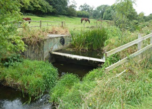
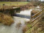
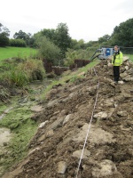
The latest success for this project is the removal of Shipley tilting gate. This Environment Agency owned and maintained structure on the Knepp estate on the Western arm of the Adur was preventing fish passage and impounding the river upstream. In partnership with the Ouse and Adur Rivers Trust (OART) the South Downs Fisheries and Biodiversity team led a project to remove the gate and stabilise the clay banks with brushwood terracing. This not only removed a significant barrier to fish passage but it has also helped restore natural river processes which will be beneficial to wider biodiversity as whole. The Arun and Adur operations field team with specialist help from the Ouse operations field team were the main contractors. Using their experience of the Knepp restoration project just downstream they carried out a very professional job and were praised by the designers, OART and everyone else involved with the project. The Arun and Adur Asset Performance Team helped with the engineering aspect as well as contractor management and finance.
This project has achieved Water Framework Directive (WFD) objectives for this waterbody and is an excellent example of another successful partnership project with OART.
Monitoring surveys and results
A fish survey was carried out before the structure was completely removed and this data will be used to compare future surveys and monitor the effects this project has had on the existing fish communities and whether the work has increased the diversity of species present in this stretch of the Adur.
Lessons learnt
Starting this project late in the year meant we had had to pull out when the weather turned. The welfare unit left on site was repeatedly flooded costing the project up to £40,000. Lesson learnt, try and secure funding as early as possible so you can programme the works to co-incide with the nice weather.
Image gallery
|
Catchment and subcatchmentSelect a catchment/subcatchment
Catchment
Subcatchment
Site
Project background
Cost for project phases
Supplementary funding information£37k was spent on replacing a welfare unit that was damaged in winter flooding. Cost of project would have been £40k otherwise
Reasons for river restoration
Measures
MonitoringHydromorphological quality elements
Biological quality elements
Physico-chemical quality elements
Any other monitoring, e.g. social, economic
Monitoring documents
Additional documents and videos
Additional links and references
Supplementary InformationEdit Supplementary Information
| ||||||||||||||||||||||||||||||||||||||||||||||||||||||||||||||||||||||||||||||||||||||||||||||||||||||||||||||||||||||||||||||||||||||||||||||||||||||||||||||||||||||||||||||||||||||||||||||||||||||||


