Case study:Arborfield nature like bypass and weirs project

From RESTORE
Revision as of 11:01, 5 June 2017 by Alexrrc (talk | contribs)
Jump to navigation Jump to search
4.50
(2 votes)


To discuss or comment on this case study, please use the discussion page.


Location: 51° 24' 28.95" N, 0° 55' 27.36" W
Loading map...
Left click to look around in the map, and use the wheel of your mouse to zoom in and out.


Project overview

Edit project overview
Status Complete
Project web site
Themes Fisheries, Flood risk management, Habitat and biodiversity
Country England
Main contact forename Dominic
Main contact surname Martyn
Main contact user ID
Contact organisation Environment Agency
Contact organisation web site http://www.environment-agency.gov.uk
Partner organisations
Parent multi-site project
This is a parent project
encompassing the following
projects
No
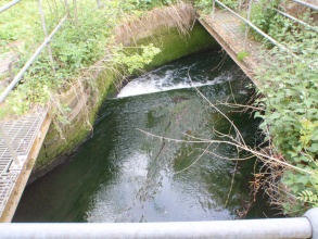
One of the five weir structures to be lowered during the project - pre-works. Courtesy of Wild Trout Trust and the Environment Agency.

Project summary

Edit project overview to modify the project summary.


In this reach, impassable flow control structures impounded the river by 1.4m, for over 4km upstream. WFD fisheries surveys determined moderate to poor ecological status upstream of the structures, with good ecological status downstream.

Project objectives to improve WFD status upstream of weir structures from 'moderate' to 'good', along with flood alleviation. Works involved lowering of 5 structures along an 800m section of river, construction of a 200m nature-like weir bypass channel to create free fish migration status, in addition to two backwaters created towards the end of the bypass channel and directly downstream of its exit; as well as creation of 80m of new riffle habitat for spawning.

After twenty years of work, a significant partnership project helping to deliver Water Framework Directive objectives has been completed on the River Loddon at Arborfield, near Reading.

The problem: Arborfield weirs were highlighted as the most significant barrier to fish migration in the Loddon catchment limiting natural habitat types upstream. Local access and flooding issues were raised.

The solution: Two hundred meters of complex channel and backwaters bypassing Arborfield weirs have been created. This will provide some 20km of free fish passage from the River Thames towards Basingstoke at certain times of year for a range of fish like sea trout, barbel and eels. The project delivers enhanced fish spawning and nursery grounds and restores impounded habitat.

The new river channel will help the Loddon towards meeting 'Good Ecological Status' required by the Water Framework Directive (WFD) and aims to be helpful as a case study for similar WFD-led projects around the country.

Project Objectives:

  • Working with communities: anglers and local people shaped objectives and gave practical input; University of Reading and Cranfield University are helping with monitoring.
  • Allow free fish passage to enable fish to complete lifecycles. We have seen fish entering the channel from top and bottom, confirming the bypass is passable for a variety of small fish.
  • Improve Water Framework Directive status from moderate to good: create new fish spawning and nursery areas and monitor effects.
  • Restore impounded habitat: lower weirs to restore flow and habitats. Chub have been observed spawning twice on restored riffles upstream since the weirs were lowered.
  • Restore Biodiversity Action Plan habitat; construct wet feeds to key areas.
  • Provide national case study: ‘before’ and ‘after’ studies to inform others.
  • Improve site health and safety: better, safer access around site.
  • Local flood risk: lower weirs have reduced breaching to adjacent land.

Works included: Thames Water weir lowering and repair work to four out of five structures - to lower upstream water levels and reduce overbank flow frequency.

Monitoring surveys and results

Edit project overview to modify the Monitoring survey and results.


Over 1 hectare of nationally important wetland habitats will be restored - benefiting wildlife such as otters, kingfishers and dragonflies. A key feature of the 400k project was the successful partnership with Thames Water, the University of Reading, Farley Estate and Arborleigh Angling Club. Over 60 volunteer days were given

Lessons learnt

This case study hasn’t got any lessons learnt, you can add some by editing the project overview.


Image gallery


Small fixed-crest weir prior to lowering. Courtesy of Wild Trout Trust and the Environment Agency.
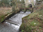
Small fixed-crest weir after lowering. Courtesy of Wild Trout Trust and the Environment Agency.
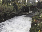
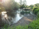
Backwater effect - 900m upstream of impounding weir structures. Courtesy of Wild Trout Trust and the Environment Agency.
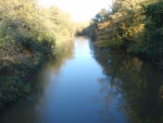
900m upstream of lowered impounding weir structures. Note significant reduction in backwater effect. Courtesy of Wild Trout Trust and the Environment Agency.
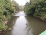
Channel 2900m upstream of impounding weir structures, prior to lowering. Courtesy of Wild Trout Trust and the Environment Agency.
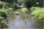
Channel 2900m upstream of lowered impounding weir structures. Note significant driop in water level and exposure of gravel riffle - now spawned on by chub. Courtesy of Wild Trout Trust and the Environment Agency.
plan
A mosaic of habitats was created in the new river channel, using many existing natural features
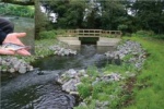
The completed bypass inlet in September 2011
ShowHideAdditionalImage.png


Catchment and subcatchment

Catchment

River basin district Thames
River basin Loddon

Subcatchment

River name Loddon (Swallowfield to River Thames confluence)
Area category 100 - 1000 km²
Area (km2)
Maximum altitude category Less than 100 m
Maximum altitude (m) 9999 m <br />0.099 km <br />9,900 cm <br />
Dominant geology Calcareous
Ecoregion Great Britain
Dominant land cover Suburban
Waterbody ID GB106039023160


Site

Name Loddon at Arborfield
WFD water body codes GB106039023160
WFD (national) typology Low, Medium, Calcareous
WFD water body name Loddon (Swallowfield to River Thames confluence)
Pre-project morphology
Reference morphology
Desired post project morphology
Heavily modified water body No
National/international site designation
Local/regional site designations
Protected species present No
Invasive species present No
Species of interest Target fish species: sea trout, eels, dace, barbel, chub, roach, bullhead, lamprey and pike.
Dominant hydrology
Dominant substrate
River corridor land use
Average bankfull channel width category
Average bankfull channel width (m)
Average bankfull channel depth category
Average bankfull channel depth (m)
Mean discharge category 1 - 10 m³/s
Mean annual discharge (m3/s) 2.162.16 m³/s <br />2,160 l/s <br />
Average channel gradient category
Average channel gradient
Average unit stream power (W/m2)


Project background

Reach length directly affected (m) 800800 m <br />0.8 km <br />80,000 cm <br />
Project started 2010/06/30
Works started
Works completed 2011/07/06
Project completed
Total cost category more than 10000 k€
Total cost (k€) 596596 k€ <br />596,000 € <br />
Benefit to cost ratio
Funding sources DEFRA, Environment Agency FCRM and Fisheries, Thames Water, Barbel Society

Cost for project phases

Phase cost category cost exact (k€) Lead organisation Contact forename Contact surname
Investigation and design 100 - 500 k€ 120120 k€ <br />120,000 € <br />
Stakeholder engagement and communication
Works and works supervision 100 - 500 k€ 450450 k€ <br />450,000 € <br />
Post-project management and maintenance
Monitoring 10 - 50 k€ 2424 k€ <br />24,000 € <br />


Reasons for river restoration

Mitigation of a pressure Barriers to fish migration, Flood risk management
Hydromorphology
Biology Fish
Physico-chemical
Other reasons for the project


Measures

Structural measures
Bank/bed modifications Introduction of spawning gravels, Riffle creation
Floodplain / River corridor
Planform / Channel pattern Bypass channel, Improving fish migration, Lowering of weir, Creation of backwater
Other
Non-structural measures
Management interventions
Social measures (incl. engagement)
Other Presentations and meetings with local citizens. Volunteers involved in construction and future management of project.


Monitoring

Hydromorphological quality elements

Element When monitored Type of monitoring Control site used Result
Before measures After measures Qualitative Quantitative
Channel pattern/planform Yes Yes No Yes No Awaiting results
Quantity & dynamics of flow Yes Yes No Yes No Awaiting results

Biological quality elements

Element When monitored Type of monitoring Control site used Result
Before measures After measures Qualitative Quantitative
Fish Yes Yes Yes Yes Yes Awaiting results
Invertebrates Yes Yes No Yes No Awaiting results
Macrophytes Yes Yes No Yes No Awaiting results

Physico-chemical quality elements

Element When monitored Type of monitoring Control site used Result
Before measures After measures Qualitative Quantitative

Any other monitoring, e.g. social, economic

Element When monitored Type of monitoring Control site used Result
Before measures After measures Qualitative Quantitative
Habitat mapping Yes Yes Yes Yes No Awaiting results


Monitoring documents


Additional documents and videos


Additional links and references

Link Description

Supplementary Information

Edit Supplementary Information

Post-project ecological/hydromorphological monitoring assessments during 2011/12. Data should be available during 2012.