Case study:Twineham Weir Removal & In-channel Enhancements
Project overview
| Status | Complete |
|---|---|
| Project web site | http://www.oart.org.uk/our-work/projects/restoration-projects/twineham-project |
| Themes | Environmental flows and water resources, Fisheries, Habitat and biodiversity |
| Country | England |
| Main contact forename | Peter |
| Main contact surname | King |
| Main contact user ID | User:Oartpk |
| Contact organisation | Ouse & Adur Rivers Trust |
| Contact organisation web site | http://www.oart.org.uk |
| Partner organisations | Environment Agency, Rampion Offshore Wind Ltd, Sussex Piscatorial Society |
| Parent multi-site project | |
| This is a parent project encompassing the following projects |
No |
Project summary
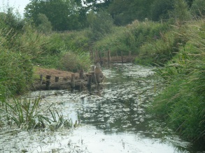
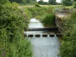
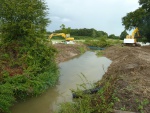
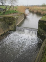
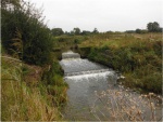
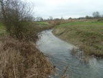
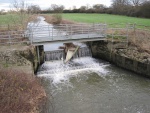
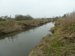
The Twineham Weir Removal and In-Channel Enhancement project has seen multiple benefits delivered to the upper Adur in West Sussex which has, over many years, been dredged and straightened with numerous impoundments present along its course. In 2014 the Ouse & Adur Rivers Trust (OART) led a project in collaboration with the Environment Agency to remove four weirs on the River Adur and Herrings Stream tributary. Due to the restricted availability of funding a novel approach was taken which saw OART employ the landowner as principle contractor to undertake the work resulting in a cost saving of over £160,000 and enabling work to be undertaken during suitable weather windows without incurring increased costs. The removal of these obstructions has restored river continuity, instigated a more natural dynamic flow regime and removed barriers to fish passage opening up 4.8km of unrestricted river.
Rather than developing a programme of in-channel enhancements prior to removing the weir structures, the partnership decided it would be better to wait to see how the site developed for six months to ensure that any further works were necessary and would be located in appropriate sections of the river. Throughout this period, along with fixed point photography to monitor changes to bank profiles, the local angling clubs were consulted to ensure their requirements were considered within the framework of the enhancement programme. It was clear from an early stage that the main constraint on anglers as a result of this project was reduced water levels limiting access to the river.
To fund the proposed in-channel works the local Environment Agency team negotiated a £15k contribution from Rampion Offshore Wind LTD, a joint venture between EON and the green investment bank, to enhance the upper Adur through the sections impacted by these weir removals on the Herrings Stream and River Adur. A number of previously unknown features had been uncovered through the reduced water levels and a number of the enhancements expected to be necessary could now be removed from the list. The project partnership, in consultation with the Wild Trout Trust, angling clubs and the landowner developed a programme of enhancements which has seen a dozen features created along 2.8km of channel combined with extensive tree planting on the banks and surrounding floodplain to provide natural recharge of woody debris to the channel. Again this work was undertaken by the landowner and his team, building on the relationships developed during the weir removals and allowing limited funding to maximise benefits.
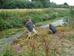
A number of volunteers, including members of the angling club, assisted in the creation of the in-channel features as well as providing essential manpower to plant a trees along the river bank and surrounding floodplain. The overall outcomes of this project are;
- Four weirs removed from the upper Adur, including the priority structure listed in the South East River Basin Management Plan for this catchment.
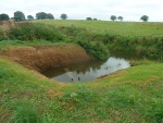
- Five backwaters have been dug to provide shelter for small fish in times of flood and warm conditions in the shallow backwaters will provide an ideal nursery for fish, invertebrates and amphibians.
- Six berms have been installed along a 1km straight section of river which has narrowed the channel, sped up flows and increased morphological diversity which will in turn improve the ecology.
- 10 tonnes of gravel placed in two sections of river to improve spawning opportunities for fish, habitat for invertebrates and replacing gravel lost over the centuries due to dredging of the river.
- 800 trees have been planted to provide shading, bank stabilisation and additional wildlife benefits such as habitat linkage.
Monitoring surveys and results
Prior to the weir removal fish surveys were conducted by the Environment Agency with the next surveys due in 2016. We continue to liaise with the angling clubs who have kept catch records at this site for a number of years. Currently we are seeing the expected dip in overall biomass of fish through this section as the resident Carp disperse away from the now flowing river and the overall species composition changes. We expect to see more natural, sustainable populations of river species develop over the coming years. The backwater habitats were immediately effective with over 300 fry counted in a single refuge within days of completion and larger individuals recorded during over-winter peak flows resting in the still waters these refuge areas have created.
In addition to the changes in fish species composition we have also recorded two kingfishers on site, the first time they have been observed here for over a decade. Through a separate project OART have been supporting the landowner in a programme of mink trapping which has not only captured 26 mink in its first year (in 2km of river) but has also recorded Polecat (known to have re-colonised Sussex approximately 8 years ago) and seen the number of wading and river birds rapidly increase.
We continue with our regime of fixed point photography to monitor change in bank profiles and the rate of vegetation establishment.
Lessons learnt
A number of valuable lessons have been learnt through the process of this project, one of the most important being that previous lessons learnt were implemented into this scheme, cutting down on the time it takes to develop and deliver projects. In addition the following form the additional lessons learnt from this project.
- It is not always necessary to engineer river restoration project or provide detailed construction designs, especially in the case of demolition of weir structures in areas of no perceived flood risk.
- Building relationships can lead to cost effective methods of undertaking a variety of river enhancement work, however, all partners must be willing to think a little “outside the box” when discussing delivery options.
- Angling club concerns remain centered around access to the river when water levels are reduced, the creation of berms which slope into the water not only constrict the channel and create flow diversity but also provide year round access to the water irrespective of the water levels.
Image gallery
|
Catchment and subcatchmentSelect a catchment/subcatchment
Catchment
Subcatchment
Other case studies in this subcatchment: Twineham Weir Removal & In-channel Enhancements
Site
Project background
Cost for project phases
Reasons for river restoration
Measures
MonitoringHydromorphological quality elements
Biological quality elements
Physico-chemical quality elements
Any other monitoring, e.g. social, economic
Monitoring documents
Additional documents and videos
Additional links and references
Supplementary InformationEdit Supplementary Information
| ||||||||||||||||||||||||||||||||||||||||||||||||||||||||||||||||||||||||||||||||||||||||||||||||||||||||||||||||||||||||||||||||||||||||||||||||||||||||||||||||||||||||||||||||||||||||||||||

