Case study:Highland Water at Warwickslade Lawn

From RESTORE
Revision as of 12:21, 1 June 2017 by Alexrrc (talk | contribs)
(diff) ← Older revision | Latest revision (diff) | Newer revision → (diff)
Jump to navigation Jump to search
0.00
(0 votes)


To discuss or comment on this case study, please use the discussion page.


Location: 50° 51' 28.12" N, 1° 36' 31.52" W
Loading map...
Left click to look around in the map, and use the wheel of your mouse to zoom in and out.


Project overview

Edit project overview
Status Complete
Project web site
Themes Flood risk management, Habitat and biodiversity
Country England
Main contact forename Sarah
Main contact surname Oakley
Main contact user ID
Contact organisation Forestry Commission
Contact organisation web site http://www.forestry.gov.uk/
Partner organisations Natural England, Environment Agency, Alaska Environmental Consulting
Parent multi-site project

Case_study:New Forest LIFE project

This is a parent project
encompassing the following
projects
No
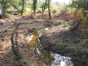
Re-meandered section of the restored river

Project summary

Edit project overview to modify the project summary.


As part of a EU Life project there was a programme of habitat restoration in SSSIs, into which the Highland Water at Warwickslade fell. The project looked to return the river to it's historical course (determined through the study of historical maps), including re-meandering. A number of work measures were undertaken to reduce the speed of the flow, subsequently reducing bank erosion, and to improve the habitat quality.

Highland Water is a small headwater sub-catchment (0.25m3) of the Lymington River. Prior to restoration the channel was up to 1.2m deep and 4m wide restricting the natural seasonal flooding of the surrounding forest. The previously wet woodland and mire habitat had dried out and the increased channel size presented a barrier to freely roaming animals across the forest due to channelization in the 1850’s. Construction was carried out using an innovative tramway system to import material to the site, removing the need to drive heavy machinery across the fragile forest environment, which helped to achieve rapid visual recovery once works were complete.

A variety of morphological features and in stream habitats have re-established and floodplain connection has been restored through more regular bank overtopping, which has helped to re-wet the surrounding woodland habitats. These enhancements have been quantified by a recorded improvement in SSSI condition scores for the area.

The work has been well received by the local communities with excellent media coverage. The success of the scheme has facilitated negotiations for future works at other locations across the New Forest.

Monitoring surveys and results

This case study hasn’t got any Monitoring survey and results, you can add some by editing the project overview.

Lessons learnt

This case study hasn’t got any lessons learnt, you can add some by editing the project overview.


Image gallery


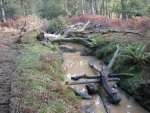
Addition of woody debris to the river to significantly reduce flow velocities, October 2009
To avoid damage to the site in construction, a minature railway track was created to transport materials and machinery. October 2009
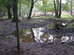
channel after restoration
drainage channel being filled with hoggin and clay mix as flow is transferred to restored channel close by
ShowHideAdditionalImage.png


Catchment and subcatchment

Catchment

River basin district South East
River basin New Forest

Subcatchment

River name Highland Water
Area category 10 - 100 km²
Area (km2)
Maximum altitude category 100 - 200 m
Maximum altitude (m) 121121 m <br />0.121 km <br />12,100 cm <br />
Dominant geology Siliceous
Ecoregion Great Britain
Dominant land cover Broadleaved Woodland
Waterbody ID GB107042016720


Other case studies in this subcatchment: New Forest LIFE project


Site

Name Highland Water
WFD water body codes GB107042016720
WFD (national) typology Low, Small, Siliceous
WFD water body name Highland Water
Pre-project morphology Artificial channel, Over deepened, Over-widened
Reference morphology Pool-riffle, Sinuous
Desired post project morphology
Heavily modified water body No
National/international site designation UK - Site of Special Scientific Interest
Local/regional site designations Special Area of Conservation, Ramsar, Special Protection Area, National Park
Protected species present No
Invasive species present No
Species of interest
Dominant hydrology
Dominant substrate Sand
River corridor land use Broadleaf/mixed woodland (semi natural), Moorland/heathland
Average bankfull channel width category
Average bankfull channel width (m)
Average bankfull channel depth category
Average bankfull channel depth (m)
Mean discharge category
Mean annual discharge (m3/s)
Average channel gradient category
Average channel gradient
Average unit stream power (W/m2)


Project background

Reach length directly affected (m) 3000 m3 km <br />300,000 cm <br />
Project started 2009/06/01
Works started
Works completed
Project completed 2009/11/01
Total cost category 1 - 10 k€
Total cost (k€) 4 k€4,000 € <br />
Benefit to cost ratio
Funding sources

Cost for project phases

Phase cost category cost exact (k€) Lead organisation Contact forename Contact surname
Investigation and design
Stakeholder engagement and communication
Works and works supervision
Post-project management and maintenance
Monitoring


Reasons for river restoration

Mitigation of a pressure Land drainage
Hydromorphology
Biology
Physico-chemical
Other reasons for the project Bank erosion, Recreation, Landscape enhancement in a heavily protected area


Measures

Structural measures
Bank/bed modifications Planting, Introduction of gravel
Floodplain / River corridor
Planform / Channel pattern Re-meandering
Other
Non-structural measures
Management interventions
Social measures (incl. engagement)
Other


Monitoring

Hydromorphological quality elements

Element When monitored Type of monitoring Control site used Result
Before measures After measures Qualitative Quantitative

Biological quality elements

Element When monitored Type of monitoring Control site used Result
Before measures After measures Qualitative Quantitative

Physico-chemical quality elements

Element When monitored Type of monitoring Control site used Result
Before measures After measures Qualitative Quantitative

Any other monitoring, e.g. social, economic

Element When monitored Type of monitoring Control site used Result
Before measures After measures Qualitative Quantitative


Monitoring documents


Additional documents and videos


Additional links and references

Link Description
http://www.therrc.co.uk/case studies/highland%20water%20at%20warwickslade%20lawn.pdf River Restoration Centre Case Study
http://www.therrc.co.uk/case studies/longwater%20lawn,%20new%20forest.pdf Other SSSI New Forest project - Longwater Lawn and Mallard Wood and Mead, New Forest

Supplementary Information

Edit Supplementary Information