Case study:River Alt and Croxteth Brook Restoration Project.
Project overview
| Status | In progress |
|---|---|
| Project web site | |
| Themes | Habitat and biodiversity, Hydromorphology, Monitoring, Social benefits, Urban |
| Country | England |
| Main contact forename | Helen |
| Main contact surname | Rawlinson |
| Main contact user ID | |
| Contact organisation | The Cass Foundation |
| Contact organisation web site | http://www.cassfoundation.org.uk |
| Partner organisations | Community Forests North West |
| Parent multi-site project | |
| This is a parent project encompassing the following projects |
No |
Project summary
In 2012, funding became available from DEFRA’s Catchment Restoration Fund, via the Environment Agency, for projects that could contribute to improving the water quality or biodiversity of rivers that were failing to meet EU Water Framework Directive standards for ‘Good’ ecological potential. The River Alt Restoration Project is a partnership between the Cass Foundation and the Community Forest Trust with support from the Environment Agency, Liverpool City Council and the local community in Stonebridge, Liverpool. The funding provided the opportunity to transform brownfield land that was blighting the area and attracting fly-tipping, by ‘daylighting’ the river and creating an attractive, publically accessible greenspace and setting for regeneration at Stonebridge Cross, in Croxteth.
The River Alt flows through an area of North Liverpool that experiences some of the most severe socio-economic problems in the UK and is one of Liverpool City Council’s highest priorities for regeneration. The River Alt Restoration Project supports several Liverpool and Environment Agency strategic priorities and plans including the River Basin Management Plan, the City’s Green Infrastructure Strategy and Flood Risk Management Plan and addresses issues including:
• Poor river morphology
• High flood risk within built-up areas and agricultural land
• Risk of blockage and failure of culverted sections due to fly-tipping
• Presence of invasive species including Japanese Knotweed and Himalayan Balsam
• Culverted river section creating a poor environment for biodiversity (e.g. status of ‘Bad’ for
invertebrates)
• Isolated green spaces and poor habitat connectivity • Neglected brownfield land blighting a deprived area of the city • The need for meaningful engagement with the community to encourage a sense of ownership, support
ultimately the long term success of the project
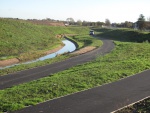
The River Alt flows through Merseyside from Huyton to Hightown, passing through West Derby, Croxteth and Maghull. Much of the 28km course has been affected by man-made intervention including canalisation and culverting. Over 8km of its length has been buried underground in concrete culverts including the 350m section that flowed through Stonebridge Cross in Croxteth. The River Alt Restoration Project has opened up the river to create a new public park alongside Stonebridge Lane, on a site that had been vacant and derelict for some time following demolition. The project has diverted a section of heavily engineered river from culvert into a new 900m meandering, naturalistic, open river channel with 1740m of newly vegetated river banks including flood plain ledges, an extensive riparian zone plus adjacent wildflower areas, semi natural grassland, willow scrub and wooded habitat. This section of river corridor has been transformed from brownfield land to 8.2ha of new public greenspace for the community to enjoy and experience biodiversity come alive on their doorstep.
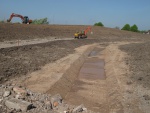
Physical works and channel excavation – A precise channel was excavated with a series of floodplain benches or ledges. The realignment extends the river by about 600m therefore the channel is designed to minimise siltation at low water while allowing the broader river channel to flood during peak flows. This means the channel will develop a mix of riparian (water’s edge) habitats. A gravel bed will help aerate the water and create micro habitat. There are sharp bends at the upstream entry and downstream exit points, constructed from reinforced earth and geotextile membranes to create a green wall. The design increases flood storage capacity within the river corridor, thereby reducing flood risk elsewhere in the catchment.
Habitat creation – A mosaic of habitats has been created by planting. The gravel bed, open channel and selective tree and scrub planting will improve conditions for river invertebrates by improving aeration and light penetration. The trees and semi-natural grassland of the steep eastern bank will eventually provide cover for nesting birds, small mammals and potential habitat for water voles and kingfisher known to be present locally along the river. 3ha of native grassland, including wildflower meadow, has been sown to enhance the species diversity above the western bank. Standard trees will create a more formal feature where the public have access.
Managing invasive weed species – A small area of Japanese Knotweed was eradicated prior to the channel excavation. Himalayan Balsam located upstream is monitored and managed by cutting before flowering in the late spring.
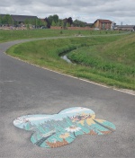
Providing access – A 4m-wide path network (DDA-compliant) runs the length of the site, close to the riverside within the upper floodplain. The path allows access for maintenance of the watercourse, including vegetation management, the removal of rubbish and other obstructions, thereby maintaining habitat quality and reducing the risk of flooding in the wider catchment. The river bank is steeper on the eastern side and public access is limited within this ecological zone.
Community activity – Community involvement has been integral to the project
Monitoring surveys and results
Lessons learnt
Image gallery
|
Catchment and subcatchmentSelect a catchment/subcatchment
Catchment
Subcatchment
Site
Project background
Cost for project phases
Reasons for river restoration
Measures
MonitoringHydromorphological quality elements
Biological quality elements
Physico-chemical quality elements
Any other monitoring, e.g. social, economic
Monitoring documents
Additional documents and videos
Additional links and references
Supplementary InformationEdit Supplementary Information
| ||||||||||||||||||||||||||||||||||||||||||||||||||||||||||||||||||||||||||||||||||||||||||||||||||||||||||||||||||||||||||||||||||||||||||||||||||||||||||||||||||||||||||||||||||||||||||||||||||||||||


