Case study:Habitat enhancement of the River Waveney through Bressingham

From RESTORE
Revision as of 14:39, 24 November 2014 by Tbond (talk | contribs)
Jump to navigation Jump to search

This case study is pending approval by a RiverWiki administrator.

Approve case study


0.00
(0 votes)


To discuss or comment on this case study, please use the discussion page.


Location: 52° 22' 45.29" N, 1° 2' 17.05" E
Loading map...
Left click to look around in the map, and use the wheel of your mouse to zoom in and out.


Project overview

Edit project overview
Status Complete
Project web site
Themes Fisheries, Habitat and biodiversity, Hydromorphology
Country England
Main contact forename Trevor
Main contact surname Bond
Main contact user ID User:Tbond
Contact organisation Environment Agency
Contact organisation web site http://www.gov.uk/government/organisations/environment-agency
Partner organisations Suffolk Wildlife Trust, Meryvn Lambert Plant Hire
Parent multi-site project
This is a parent project
encompassing the following
projects
No
Alternating berms on the River Waveney at Bressingham

Project summary

Edit project overview to modify the project summary.


The River Waveney through Bressingham has historically been diverted into what is colloquially referred to as the "New Cut". This linear, steep-sided channel was in much need of enhancement and following conversations with various local landowners, a scheme was put together to improve the river's form and function.

The lack of gradient through the site limits the effectiveness of restoration techniques aimed at increasing flow velocity. This is exacerbated by long-term maintenance that has seen the river routinely de-silted to a substantial depth, exceeding 1.5m in some places. Consequently the work that was undertaken aimed to increase habitat availability and diversity. Specifically, more shelter was created for fish and small in-stream organisms by constructing brushwood mattresses. Shallow berms were installed to soften the edge between the aquatic and terrestrial environment, providing an area of transitional plants to establish. In some locations a two-stage channel was formed using old spoil embankments, maintaining conveyance but increasing flow velocity at low flows.

Over the course of two weeks in October 2014 and with a budget of under £15,000, approximately 1.5km of river channel was enhanced.

Monitoring surveys and results

This case study hasn’t got any Monitoring survey and results, you can add some by editing the project overview.

Lessons learnt

This case study hasn’t got any lessons learnt, you can add some by editing the project overview.


Image gallery


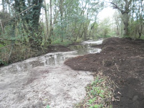
Looking downstream at a berm feature that was installed on the true left-hand bank of the River Waveney
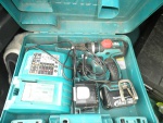
High-powered drills were necessary for us to screw some of the wooden features in place
Timber screws were used to connect the woody-debris to the vertical stakes. The screws are discrete but ensure the structure is solid
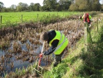
Prior to works the river banks were checked for water vole burrows
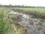
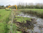
A long-reach excavator was the perfect tool for the job of working around a fence line. The weight of the machine did cause some minor tracking issues but ensured the required stability when working so close to the river bank
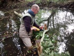
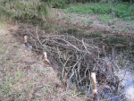
Brushwood mattresses were built largely by hand and create and excellent refuge for various species, particularly small fish
ShowHideAdditionalImage.png


Catchment and subcatchment


Site

Name
WFD water body codes
WFD (national) typology
WFD water body name
Pre-project morphology
Reference morphology
Desired post project morphology
Heavily modified water body
National/international site designation
Local/regional site designations
Protected species present
Invasive species present
Species of interest
Dominant hydrology
Dominant substrate
River corridor land use
Average bankfull channel width category
Average bankfull channel width (m)
Average bankfull channel depth category
Average bankfull channel depth (m)
Mean discharge category
Mean annual discharge (m3/s)
Average channel gradient category
Average channel gradient
Average unit stream power (W/m2)


Project background

Reach length directly affected (m)
Project started
Works started
Works completed
Project completed
Total cost category
Total cost (k€)
Benefit to cost ratio
Funding sources

Cost for project phases

Phase cost category cost exact (k€) Lead organisation Contact forename Contact surname
Investigation and design
Stakeholder engagement and communication
Works and works supervision
Post-project management and maintenance
Monitoring


Reasons for river restoration

Mitigation of a pressure
Hydromorphology
Biology
Physico-chemical
Other reasons for the project


Measures

Structural measures
Bank/bed modifications
Floodplain / River corridor
Planform / Channel pattern
Other
Non-structural measures
Management interventions
Social measures (incl. engagement)
Other


Monitoring

Hydromorphological quality elements

Element When monitored Type of monitoring Control site used Result
Before measures After measures Qualitative Quantitative

Biological quality elements

Element When monitored Type of monitoring Control site used Result
Before measures After measures Qualitative Quantitative

Physico-chemical quality elements

Element When monitored Type of monitoring Control site used Result
Before measures After measures Qualitative Quantitative

Any other monitoring, e.g. social, economic

Element When monitored Type of monitoring Control site used Result
Before measures After measures Qualitative Quantitative


Monitoring documents


Additional documents and videos


Additional links and references

Link Description

Supplementary Information

Edit Supplementary Information