Case study:Herefordshire Asset Restoration Project (HARP)
This case study is pending approval by a RiverWiki administrator.
Project overview
| Status | Complete |
|---|---|
| Project web site | http://www.wyeuskfoundation.org/projects/harp.php |
| Themes | Environmental flows and water resources, Fisheries, Habitat and biodiversity |
| Country | England |
| Main contact forename | Stephen |
| Main contact surname | Marsh-Smith |
| Main contact user ID | |
| Contact organisation | Wye & Usk Foundation |
| Contact organisation web site | http://www.wyeuskfoundation.org/ |
| Partner organisations | Advantage West Midlands, Natural England, Environment Agency |
| Parent multi-site project | |
| This is a parent project encompassing the following projects |
No |
Project summary
Herefordshire has the benefit of one of the most famous salmon rivers in the UK - the river Wye. It is also one of the UK's best coarse fishing rivers and its Herefordshire tributaries are fine trout and grayling streams. Yet its value to the local economy falls well short of its potential. Salmon stocks are improving following investment in the upper reaches but the infrastructure that ties in visitors to fishing, accommodation and other facilities and opportunities, requires restoration and further development.
Until the mid 1980's the Wye supported 70 direct full time jobs, and 5 times as many in associated businesses. The decrease in salmon stocks that reached its nadir in 2002 led to an exodus of anglers resulting in a decline in the rural economy. No specific thought was given to developing the Wye's coarse or trout fishery. This decline and prevailing attitudes of "wait and see" drove down investment, compounding the problem.
A promising start at developing this important natural resources was made in 2006 through our Defra funded RES project. 43 fishery infrastructure improvements were completed, enabling better access to riverbanks for visiting anglers. However, despite the project being concluded successfully, our efforts were not cast widely enough, nor of sufficient duration to reach sustainability. After a delayed start, our Natural Assets project HARP commenced in August 2011. Funded and supported by Advantage West Midlands, Natural England and the Environment Agency, it has 3 main areas of activity:
1. Restoring, improving and developing angling infrastructure + establishing new opportunities for salmon, trout and coarse fishing.
2. Securing the existing marketing vehicle, the 'Wye and Usk Passport', and significantly expanding it.
3. Helping to resolve increasing angler/canoeist conflict by developing, alongside EAW, alternative sites for canoe access, codes that work (as in Wales) and installing riverside signage at the known trouble spots. In recent years lack of coordination between the fishing and canoeing sectors has led to increasing conflict that can spoil both activities. This is a surmountable problem that can be ameliorated by zoning, education and facilitation for the benefit of all.
Achievements
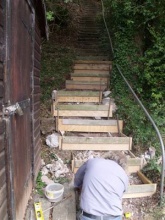
• 85 fishery infrastructure improvements
• A further 64 infrastructure improvements on 6 new beats
• 2.9 Full Time Equivalent jobs created
• 2 jobs safeguarded within WUF. 10.5 Full Time Equivalent jobs in the fishing guide/accommodation sector safeguarded.
• Assisted 1 graduate gain employment in land based sector via WUF
• Assist 1 non graduate full time and 1 part-time to gain employment in the land base sector via WUF
• Levered in £59,864 of private investment by December 2011
• 4 days support to fishing guides
• Attracted 768 extra fishing visitors (5,464 in total) during the lifetime of the project with many more expected to take advantage of the 23 Herefordshire fisheries that joined the scheme in 2011/12.
• Provided opportunities for 31 young people (14-19 age) to engage with the natural environment making them aware of future employment opportunities
• Engaged 9 businesses in new collaborations
• Levered in further public investment £155,000 by Dec 2011
• Assist with the development of one canoe access/egress point downstream of Hay
Monitoring surveys and results
Lessons learnt
Image gallery
|
Catchment and subcatchment
Site
Project background
Cost for project phases
Reasons for river restoration
Measures
MonitoringHydromorphological quality elements
Biological quality elements
Physico-chemical quality elements
Any other monitoring, e.g. social, economic
Monitoring documents
Additional documents and videos
Additional links and references
Supplementary InformationEdit Supplementary Information
| ||||||||||||||||||||||||||||||||||||||||||||||||||||||||||||||||||||||||||||||||||||||||||||||||||||||||||||||||||||||||||||||||||||||||||||||||||||||||||||||||||||||||||||||||||

