Case study:Wensum River Restoration Strategy
Project overview
| Status | In progress |
|---|---|
| Project web site | http://www.environment-agency.gov.uk/homeandleisure/wildlife/114676.aspx |
| Themes | Fisheries, Flood risk management, Habitat and biodiversity, Hydromorphology, Land use management - agriculture, Monitoring, Water quality |
| Country | England |
| Main contact forename | Adam |
| Main contact surname | Thurtle |
| Main contact user ID | |
| Contact organisation | Environment Agency |
| Contact organisation web site | http://www.environment-agency.gov.uk |
| Partner organisations | Natural England, Water Management Alliance, Riparian Landowners, Atkins |
| This is a parent project encompassing the following projects |
Great Ryburgh End Restoration Scheme, Meander reinstatement on the River Wensum at the Ryburgh Loop, River Tat Restoration Scheme, River Wensum Rehabilitation Project - Bintree, River Wensum Restoration, Reach 10 Lenwade, River Wensum Restoration, Reach 3a Costessey, River rehabilitation on the River Wensum at Swanton Morley, Sculthorpe Moor Restoration Scheme, Upper Wensum Restoration Project |
Project summary
The River Wensum Restoration Strategy is a long-term project with the vision to restore all 71km of the River Wensum SSSI/SAC. The project is lead by the Environment Agency, working in partnership with a range of organisations and individuals including Natural England, the Water Management Alliance, Atkins, riparian landowners and anglers. We intend to restore the river and floodplain to a more naturally functioning ecosystem so that it can support the wildlife and fisheries typical of a Norfolk chalk stream. We aim to ensure that the river is sustainably managed to meet the needs of all river users, providing ecosystem services to benefit wildlife, water quality, water resources, flood risk management, agriculture and leisure activities.
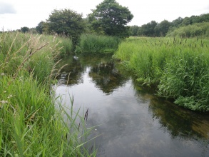
The Wensum is a chalk river of great importance for its wildlife, as well as being a notable landscape feature of rural Norfolk. Its conservation interest is recognised nationally and internationally through its notification as a Site of Special Scientific Interest (SSSI) and Special Area of Conservation (SAC). However, the river is in unfavourable ecological condition and failing its Water Framework Directive targets due to past physical modifications for land drainage and milling. In essence parts of the river are too wide, too deep and too straightened, as well as being heavily impounded by mill structures and disconnected from its floodplain by spoil banks resulting from historical dredging.
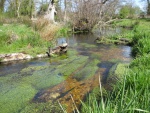
For the first time we have looked at a whole river scale to see what action needs to be taken to restore each section of the river. The main recommendations of the strategy include narrowing the channel, restoring the gravel bed, reducing impoundment, reconnecting the floodplain, improving channel sinuosity and increasing the amount of large woody material in the channel.
Our over-arching philosophy is to implement integrated schemes that deliver multiple benefits, including river restoration, floodplain biodiversity enhancements, reduced flood risk to people and property, and improved angling and water quality. We work closely with a wide range of other projects and initiatives within the Wensum catchment to achieve these objectives.
As of March 2014 we had completed 6 major restoration schemes on the river. A total of 12.46km of river has been restored.
Monitoring surveys and results
For each scheme we monitor the impacts of restoration on fish, invertebrates, aquatic macrophytes, and protected species (e.g. water vole). Fixed point photography is also undertaken.
Lessons learnt
Image gallery
|
Catchment and subcatchmentSelect a catchment/subcatchment
Catchment
Subcatchment
Other case studies in this subcatchment: River Wensum Rehabilitation Project - Bintree
Site
Project background
Cost for project phases
Reasons for river restoration
Measures
MonitoringHydromorphological quality elements
Biological quality elements
Physico-chemical quality elements
Any other monitoring, e.g. social, economic
Monitoring documents
Additional documents and videos
Additional links and references
Supplementary InformationEdit Supplementary Information
| ||||||||||||||||||||||||||||||||||||||||||||||||||||||||||||||||||||||||||||||||||||||||||||||||||||||||||||||||||||||||||||||||||||||||||||||||||||||||||||||||||||||||||||||||||||||||||||||||||||||||||||||||||||||||||||||


