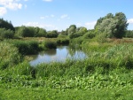
Case study:River Skerne- Life project
Project overview
| Status | Complete |
|---|---|
| Project web site | |
| Themes | Economic aspects, Habitat and biodiversity, Social benefits, Water quality, Urban |
| Country | England |
| Main contact forename | Ulrika |
| Main contact surname | Åberg |
| Main contact user ID | User:UlrikaRRC |
| Contact organisation | River Restoration Centre |
| Contact organisation web site | http://www.therrc.co.uk |
| Partner organisations | European Commission (LIFE funding), River Restoration Project (now River Restoration Centre), Darlington Borough Council, Environment Agency, Northumbrian Water, English Nature (now Natural England), Countryside Commission, Heritage Lottery Fund |
| Parent multi-site project |
Case_study:River restoration: Benefits for integrated catchment management |
| This is a parent project encompassing the following projects |
No |
Project summary
Background: The River Skerne is a tributary of the River Tees in North East England. The restored reach lies in a sub-urban area on the outskirts of Darlington, County Durham. During the last 150 years, the River Skerne has been heavily modified as a result of industrialisation and urbanisation. Between 1850 and 1945 the river was straightened and channelized, and the river corridor was markedly narrowed. Widening and deepening was undertaken in the 1950s and the 1970s, and new housing developments were built along the entire north side of the river. The area has a rich industrial heritage including the first railway company Stockton and Darlington. The Skerne (railway) Bridge, which can be found just downstream of the site, was pictured on the old five pound notes.
Restoration: The River Skerne was included in a joint initiative between England and Denmark to demonstrate best practice in urban and rural river rehabilitation and encourage river restoration in Europe. The wider aim was to promote further river restoration and demonstrate how river restoration could provide multiple benefits such as enhancement in wildlife, landscape, recreation, water quality, fisheries, amenities and other local interests.
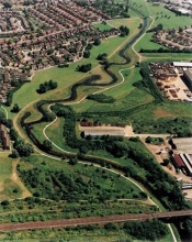
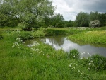
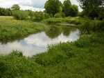
The restoration of 2 km of the Skerne was initiated in July 1995. Much of the floodplain had been raised by old industrial waste tipping, with gas and sewer pipes running alongside the river. As a result of these constraints, restoration opportunities were severely limited - typical of urban rivers elsewhere. At the upstream end, instream deflectors and a coarse sediment riffle were installed to enhance flow variability and habitat diversity. Further downstream four new meanders were cut across the old channel, which was used to create two backwaters. Soft revetments – such as willow mattress, willow spiling, underwater rock layer, fibre rolls, and geotextiles – were used on the outer meander bends to prevent erosion towards the gas main. As a flood water retention measure, about 25,000 m3 of spoil was removed from the river banks. This also aimed to increase the lateral connectivity between the river and the adjacent floodplain. The spoil was later used for landscaping purposes.
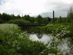
Thirteen ugly surface water outfalls were replaced with underground inspection /collection chambers that firstly intercept pollution and then discharge the water into the river below water level. New footpaths were constructed and a planting scheme engaging local residents carried out. At the downstream end of the restored section a new footbridge was constructed, designed to resemble a locomotive as a tribute to the historical significance of the Skerne Bridge.
Monitoring surveys and results
Pre-monitoring
Before restoration started, several indicators were monitored to see what the reference situation was for post-restoration monitoring.
Ecology
- Macrophytes - monitored qualitatively, number of species found per 500 meter channel length.
- Macro-invertebrates - species richness and abundance, and as an indicator for water quality/organic pollution (BMWP).
- Fish - biomass, fish density and species richness.
- Birds were monitored by assessing the assemblage of breeding birds and abundance.
Hydro-morphology
- Geomorphological - channel cross sections and physical habitat mapping.
- Water quality - suspended sediment concentration and concentration of nitrogen and phosphorus (measured at monthly intervals).
- Modelling of flood frequency.
Social-economic factors
- Economic benefits for six categories (water quality, amenity, fisheries, agriculture, flood defence and recreation) were calculated.
- Public perception was measured using a semi-structured questionnaire survey.
- 90% of the visitors to the River Skerne in Darlington were quite or very satisfied with the restoration of the river, 15 years on from the completion of the work. Revisiting the River Skerne: The long-term social benefits of river rehabilitation. Åberga and Tapsell. Landscape and Urban Planning 113 (2013) 94– 103
Post-monitoring
- Repetition of pre-monitoring was carried out 1 and 2 years after restoration. Due to its importance as a demonstration project, further monitoring been carried out by Master and PhD students.
- Revisiting the River Skerne: The long-term social benefits of river rehabilitation. Åberga and Tapsell. Landscape and Urban Planning 113 (2013) 94– 103
Expectations and Response:
- It was expected that the existing unpleasant park would improve in aesthetic quality and as a public recreation area. The river would feature more natural elements and dynamics.
Ecology
One year after restoration, macrophyte species richness increased above pre-restoration levels with 30%. The downstream control site did not seem to be affected by the restoration measures. No initial changes were found in the macro-invertebrate community, but long term surveys have shown an increase in niche specific macro-invertebrate families sensitive to siltation and/or organic pollution. The fish species richness increased with Roach (Rutilus rutilus) and Chub (Leuciscus cephalus), but the total number of caught individuals was small with only 16 fish of 4 species. The appearance of new fish species can be related to the new fish pass below Darlington. Unfortunately, several severe pollution incidents may have largely eliminated recolonizing fish populations.
Hydro-morphology
The river length was increased with 13%. Longitudinal and cross-section variability in meandered section was limited due to flood risk management requirements. However, macrophyte growth has provided some flow and habitat diversity. The constructed riffle at the upstream end has provided habitat for macro-invertebrates sensitive to fine sediments which were not found in the section prior to restoration (e.g. the freshwater limpet Ancylidae, the riffle beetle Elmidae, the net-spinning caddis fly Hydropsychidae and the blackfly larvae Simuliidae).
The new channel profile with lower banks increased the out of bank flow to a maximum of 4.5 days per year. The lowering of the floodplain itself created more water storage and the flood protection level has remained unchanged.
Social
Local residents were engaged in the project from the planning phase and post-restoration assessment showed that 52% of the local residents ‘mostly’ and 30% ‘strongly’ approved the restoration works. A majority of 64% felt that the restoration scheme had achieved its objectives and 70% of the residents thought more wildlife had been attracted to the area. Long term monitoring has shown an increased support for the restoration scheme, with increasing number of satisfied local residents.
Overall, the Skerne project was a big social success. People were engaged in the project and very positive about the outcomes. The ecological status has improved, but it is still limited by the urban environment, (e.g. fixation of the river to protect infrastructure, and pollution from industry upstream).
Lessons learnt
- Engaging the local community is critical.
- In these early days of river restoration the project showed what could be expected from a restoration project and how it develops (might be different from anticipated) – this needs to be built into decision making process
- It is important to do a formal long-term management plan, and have a cooperating (and stable) land owner
- The project showed a whole suite of demonstration techniques (included in the Manual of River Restoration Techniques http://www.therrc.co.uk/rrc_manual.php)
- The project clearly showed the complexity of a linear system (compared with pond), and that it's difficult to distinguish success between different components • The project gave a big boost to river restoration in the UK and showed that it is possible to do “large scale” (for that time) projects
- Long-term monitoring (>3 years, especially of biological indicators) is crusial for accurate evaluation of success.
Image gallery
|
Catchment and subcatchmentSelect a catchment/subcatchment
Catchment
Subcatchment
Site
Project background
Cost for project phases
Reasons for river restoration
Measures
MonitoringHydromorphological quality elements
Biological quality elements
Physico-chemical quality elements
Any other monitoring, e.g. social, economic
Monitoring documents
Additional documents and videos
Additional links and references
Supplementary InformationEdit Supplementary Information
| |||||||||||||||||||||||||||||||||||||||||||||||||||||||||||||||||||||||||||||||||||||||||||||||||||||||||||||||||||||||||||||||||||||||||||||||||||||||||||||||||||||||||||||||||||||||||||||||||||||||||||||||||||||||||||||||||||||||||||||||||||||||

