Case study:River Bure
This case study is pending approval by a RiverWiki administrator.
Project overview
| Status | Complete |
|---|---|
| Project web site | |
| Themes | Fisheries, Habitat and biodiversity |
| Country | England |
| Main contact forename | Nick |
| Main contact surname | Elbourne |
| Main contact user ID | User:NickRRC |
| Contact organisation | River Restoration Centre |
| Contact organisation web site | |
| Partner organisations | |
| Parent multi-site project | |
| This is a parent project encompassing the following projects |
No |
Project summary
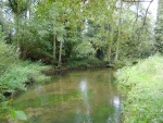
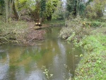
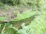
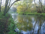
The National Trust in conjunction with the Blickling fishing club undertook a two-phase restoration project (in 2008 and 2010) at the River Bure, Norfolk. This involved installation of Large Woody Debris (LWD) with the overall aim of improving in-channel and marginal habitats, by re-establishing natural river processes interrupted by past management activities.
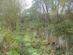
The stretch of the Bure flowing through the Blickling Estate had been severely over-widened due to historic dredging to increase channel and holding capacity for several mills in the area. Within the 7 km of river channel that border the Blickling Estate there are four mills and several bypassed meanders. Siltation added to the degraded state of the river, which was heavily wooded.
Felling trees to create in-channel LWD was identified as a good way to increase habitat and restore natural processes to the Bure (historically fallen trees had been removed by the Environment Agency and local fishing club). Riparian habitats were of high quality, comprising ancient woodland and alder and willow carr, therefore restoration works were restricted to options which would have a low impact on the site and surrounding habitats i.e. use of heavy machinery was not advised.
Objectives were:
- To improve river habitat by re-instating woody debris
- To increase the stock of wild brown trout
- To enhance biodiversity and conservation value of the reach
The project was completed in two phases. Phase 1 work was completed in November 2008 over four weeks. There was no allocated budget for the project, so works had to be economical and non-technical as access to the site was limited. Much of the work was therefore based on intuition and what was deemed to be aesthetically “right” for the location.
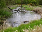
Trees were felled into the channel with some minor modifications made to their in-stream position to comply with EA by-laws and fishing requirements. Work was carried out by volunteers using chainsaws, a hand winch and plastic boat. This phase increased fish catch numbers (based on Blickling fishing club records).
Phase 2 of the project was completed in November 2010, encompassing a baseline survey and monitoring. In this phase the introduction of LWD was more adventurous. Consequently, the results of phase 2 were even more dramatic than phase 1. Effects of restoration appeared to be proportional to the amount of LWD introduced into the river.
The approach at both stages involved adhering to the following:
-selection of trees which were already likely to fall into the channel
-fell them so they remained attached to the root plate
-allow branches to penetrate the river bed to secure the tree
-only if necessary use a stake to prevent movement
-modify the position if necessary to maintain other channel functions e.g. fishing points
-felling more than one tree at each location allows a web of branches and twigs to form, diversifying habitats and anchoring the “structure”
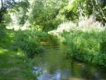
Since 2010 the river has continued to become more diverse in terms of the range of habitats. Sediment trapped by LWD has increase in channel and marginal vegetation. The redistribution of sediments has resulted in a naturally developing channel. Areas of faster flows have begun to clean gravels, with areas of reduced flow velocity causing deposition.
The National Trust has identified an increasing enthusiasm for retaining naturally occurring LWD as part of sustainable river management and restoration since the completion of this project. In the local area request to remove LWD have reduced dramatically. The potential reduction in management costs is likely to encourage LWD to be retained in its natural position or slightly modified as opposed to removed. The River Restoration Centre would like to thank Dave Brady from The National Trust for providing the case study content and photographs.
Monitoring surveys and results
Lessons learnt
Catchment and subcatchment
Edit the catchment and subcatchment details
(affects all case studies in this subcatchment)
Site
| Name | Bure at Blickling Estate |
|---|---|
| WFD water body codes | |
| WFD (national) typology | |
| WFD water body name | |
| Pre-project morphology | Over-widened, Over deepened, Straightened |
| Reference morphology | Sinuous, Pool-riffle |
| Desired post project morphology | |
| Heavily modified water body | No |
| National/international site designation | |
| Local/regional site designations | |
| Protected species present | No |
| Invasive species present | No |
| Species of interest | Brown trout |
| Dominant hydrology | |
| Dominant substrate | Gravel, Silt |
| River corridor land use | Intensive agriculture (arable), Broadleaf/mixed woodland (semi natural) |
| Average bankfull channel width category | |
| Average bankfull channel width (m) | |
| Average bankfull channel depth category | |
| Average bankfull channel depth (m) | |
| Mean discharge category | |
| Mean annual discharge (m3/s) | |
| Average channel gradient category | |
| Average channel gradient | |
| Average unit stream power (W/m2) |
Project background
| Reach length directly affected (m) | 300300 m <br />0.3 km <br />30,000 cm <br /> |
|---|---|
| Project started | 2008/11/01 |
| Works started | |
| Works completed | |
| Project completed | 2010/11/01 |
| Total cost category | 1 - 10 k€ |
| Total cost (k€) | 66 k€ <br />6,000 € <br /> |
| Benefit to cost ratio | |
| Funding sources | The National Trust |
Cost for project phases
| Phase | cost category | cost exact (k€) | Lead organisation | Contact forename | Contact surname |
|---|---|---|---|---|---|
| Investigation and design | |||||
| Stakeholder engagement and communication | |||||
| Works and works supervision | |||||
| Post-project management and maintenance | |||||
| Monitoring |
Reasons for river restoration
| Mitigation of a pressure | |
|---|---|
| Hydromorphology | |
| Biology | |
| Physico-chemical | |
| Other reasons for the project |
Measures
Structural measures
| |
|---|---|
| Bank/bed modifications | Introduction of naturally occuring LWD to encourage flow diversity and increase channel sinuosity |
| Floodplain / River corridor | |
| Planform / Channel pattern | Allow future natural channel changes to occur, Channel narrowing via the ntroduction of large woody debris |
| Other | |
Non-structural measures
| |
| Management interventions | no longer remove naturally occuring LWD |
| Social measures (incl. engagement) | |
| Other | |
Monitoring
Hydromorphological quality elements
| Element | When monitored | Type of monitoring | Control site used | Result | ||
|---|---|---|---|---|---|---|
| Before measures | After measures | Qualitative | Quantitative | |||
Biological quality elements
| Element | When monitored | Type of monitoring | Control site used | Result | ||
|---|---|---|---|---|---|---|
| Before measures | After measures | Qualitative | Quantitative | |||
Physico-chemical quality elements
| Element | When monitored | Type of monitoring | Control site used | Result | ||
|---|---|---|---|---|---|---|
| Before measures | After measures | Qualitative | Quantitative | |||
Any other monitoring, e.g. social, economic
| Element | When monitored | Type of monitoring | Control site used | Result | ||
|---|---|---|---|---|---|---|
| Before measures | After measures | Qualitative | Quantitative | |||
Monitoring documents
Image gallery
Additional documents and videos
Additional links and references
| Link | Description |
|---|
Supplementary Information
Edit Supplementary Information

