Case study:Wyndham Park, Grantham
This case study is pending approval by a RiverWiki administrator.
Project overview
| Status | Complete |
|---|---|
| Project web site | |
| Themes | Habitat and biodiversity, Spatial planning, Urban |
| Country | England |
| Main contact forename | Matt |
| Main contact surname | Parr |
| Main contact user ID | |
| Contact organisation | Environment Agency |
| Contact organisation web site | http://www.gov.uk/government/organisations/environment-agency |
| Partner organisations | South Kesteven District Council |
| Parent multi-site project | |
| This is a parent project encompassing the following projects |
No |
Project summary
The 2016 Grantham Urban Rivers and Wetlands Plan, launched in 2016, identified numerous opportunities for river
habitat improvements through the town, and Wyndham Park was selected as a pilot project to demonstrate the
benefits of urban river restoration to the people of Grantham and to show that projects like this, when carefully
designed, do not increase flood risk.
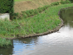
The overall objectives of the Wyndham scheme were to improve the flow, reduce sedimentation and create habitats for river life, including native brown trout and white-clawed crayfish, as wells as insect pollinators. A narrower, more sinuous, 2-stage channel would increase the flow and reduce the accumulation of fine sediment on the river bed.
Monitoring surveys and results
Trout Redd surveying of the gravels have been very positive with good numbers observed on the gravels installed.
Lessons learnt
In August 2017 the flood resilience of the project was immediately demonstrated when heavy overnight rain caused
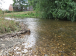
the river to rise and temporarily flood the berms. Soon after completion chub were observed on the fresh
gravel bed and in winter 2017/18 brown trout redds (spawning scrapes) were located. The access berm was an
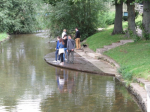
immediate success and provided the venue for river studies at the World Rivers Day event in September 2017.
Image gallery
|
Catchment and subcatchmentSelect a catchment/subcatchment
Catchment
Subcatchment
Other case studies in this subcatchment: Aubourn Rock Ramp and Habitat Works, Belton Floodplain Reconnection and River Restoration, Dysart Park, Grantham Habitat Improvement, Grantham Blue Green - Urban Reach, Little Ponton, Manthorpe Floodplain Reconnection, Papermill Weir Section in-channel restoration, River Witham Great Ponton, Stainby Road, Colsterworth, Syston and Barkston Restoration... further results
Site
Project background
Cost for project phases
Reasons for river restoration
Measures
MonitoringHydromorphological quality elements
Biological quality elements
Physico-chemical quality elements
Any other monitoring, e.g. social, economic
Monitoring documents
Additional documents and videos
Additional links and references
Supplementary InformationEdit Supplementary Information
| ||||||||||||||||||||||||||||||||||||||||||||||||||||||||||||||||||||||||||||||||||||||||||||||||||||||||||||||||||||||||||||||||||||||||||||||||||||||||||||||||||||||||||||||||||||||||||||||||||||||||


