Case study:Hills to Levels
This case study is pending approval by a RiverWiki administrator.
Project overview
| Status | In progress |
|---|---|
| Project web site | |
| Themes | Flood risk management, Habitat and biodiversity, Land use management - agriculture, Land use management - forestry, Monitoring, Water quality |
| Country | England |
| Main contact forename | Joanna |
| Main contact surname | Uglow |
| Main contact user ID | User:FWAGSW-H2L |
| Contact organisation | Farming & Wildlife Advisory Group SouthWest |
| Contact organisation web site | http://www.fwagsw.org.uk/ |
| Partner organisations | FWAG SW, Somerset Rivers Authority, Environment Agency, RSPB, Somerset Wildlife Trust |
| This is a parent project encompassing the following projects |
Project summary
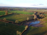
Hills to Levels is an holistic catchment management approach across catchments in Somerset, aiming to ‘slow the flow’ to reduce flood risk, reduce erosion, improve water quality, deliver wider environmental benefits and increase resilience on the floodplain. The idea is that a lot of small-scale interventions will have an effect at the large catchment scale with the motto that ‘every field, every farm, every stream has its part to play in flooding and water quality’.
The Hills to Levels approach started as a partnership between the RSPB, Royal Bath & West Society, Somerset Wildlife Trust and FWAG SW after the 2013/14 flooding of the Somerset Levels. The project aimed to reduce flood risk, increase farm resilience and to join up the communities in the upper and lower catchments in Somerset.
Monitoring surveys and results
Lessons learnt
Image gallery
|
Catchment and subcatchment
Site
Project background
Cost for project phases
Reasons for river restoration
Measures
MonitoringHydromorphological quality elements
Biological quality elements
Physico-chemical quality elements
Any other monitoring, e.g. social, economic
Monitoring documents
Additional documents and videos
Additional links and references
Supplementary InformationEdit Supplementary Information
| ||||||||||||||||||||||||||||||||||||||||||||||||||||||||||||||||||||||||||||||||||||||||||||||||||||||||||||||||||||||||||||||||||||||||||||||||||||||||||||||||||||||||||||||||||||||

