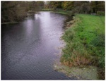
Case study:River Soar Floating Pennywort Eradication
This case study is pending approval by a RiverWiki administrator.
Project overview
| Status | In progress |
|---|---|
| Project web site | |
| Themes | Fisheries, Habitat and biodiversity, Water quality |
| Country | England |
| Main contact forename | Rebecca |
| Main contact surname | Brunt |
| Main contact user ID | |
| Contact organisation | Environment Agency |
| Contact organisation web site | http://https://www.gov.uk/government/organisations/environment-agency |
| Partner organisations | Leicester City Council, Canal and River Trust |
| Parent multi-site project | |
| This is a parent project encompassing the following projects |
No |
Project summary
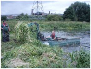
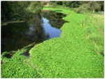
Around 96km of the River Soar and River Trent in Leicestershire and Nottinghamshire have in the past been choked by the non-native plant Floating Pennywort.
The plant was first identified in Leicestershire in 2004, thought to be an escapee from a private garden. It soon got a hold, growing fast in our waterways and out-competing our native plants. It can grow up to 20cm a day and spreads to block out light for other aquatic plants. The problem is so extensive that we have been carrying out annual herbicide spraying and some removal of the plant since 2007, with regular herbicide spraying from 2010.
The project will continue with spraying and undertake aerial surveys. It has been noticed that the weed has entered off line waterbodies after flooding events. Therefore we will also be contacting the owners of these waterbodies to highlight the presence of this invasive weed to see how these waterbodies can be tackled. Continue to spray on the Barrow Gravel Pits SSSI which will address one of its reasons for being in unfavourable condition.
Monitoring surveys and results
On a comparable length of watercourse that has been included in all surveys since 2007 (as the survey area has increased over the years) the approximate length of pennywort beds totalled 10.3km in 2009 and 1.6km in 2012, this is a significant decrease in the occurrence of this species.
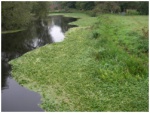
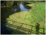
We are already seeing the impacts of our work. Huge areas are now clear of Pennywort and the river is visible again. We have seen water lilies return in Abbey Park and fish are able to migrate as the water column is clear of the plant. Clearing the Grand Union Canal has made it much more accessible for boats.
Lessons learnt
This is a constant battle, it is something that needs to be undertaken each year. There was no action in 2008 and this saw a huge increase in the presence of pennywort. As the occurrence of the plant becomes less the time and cost associated with the project also decreases.
Image gallery
|
Catchment and subcatchmentSelect a catchment/subcatchment
Catchment
Subcatchment
Site
Project background
Cost for project phases
Reasons for river restoration
Measures
MonitoringHydromorphological quality elements
Biological quality elements
Physico-chemical quality elements
Any other monitoring, e.g. social, economic
Monitoring documents
Additional documents and videos
Additional links and references
Supplementary InformationEdit Supplementary Information
| ||||||||||||||||||||||||||||||||||||||||||||||||||||||||||||||||||||||||||||||||||||||||||||||||||||||||||||||||||||||||||||||||||||||||||||||||||||||||||||||||||||||||||||||||||||||||||||||||||||||||

